وۆرسێستەر
وۆرسێستەر | |
|---|---|
شار | |
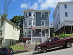
لەسەرەوە و بە پێچەوانەی میلی کاتژمێر: شاری وۆرسێستەر لە ئاسمانەوە; کۆمەڵەی دێرینناسی ئەمریکی; وێستگەی یۆنیەنی وۆرسێستەر; تاوەری بانکرۆفت; شەقامی پۆڵ ڕیڤەر; خانوویەکی سێ قات لە شەقامی کاترین; و هۆڵی شارەوانی | |
| ناسناو(ەکان): The City of the Seven Hills, The Heart of the Commonwealth, Wormtown, Woo-town, The Woo | |
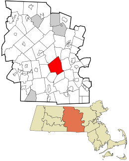
 Location within Worcester County | |
| پۆتانەکان: 42°16′17″N 71°47′56″W / 42.27139°N 71.79889°Wپۆتانەکان: 42°16′17″N 71°47′56″W / 42.27139°N 71.79889°W | |
| وڵات | ویلایەتە یەکگرتووەکانی ئەمریکا |
| ویلایەت | ماساچووسیتس |
| شارستان | وۆرسێستەر |
| ناوچە | ئینگلاندی نوێ |
| کۆڵۆنیای مێژوویی | Massachusetts Bay Colony Dominion of New England Province of Massachusetts Bay |
| دامەزران | ١٦٧٣ |
| Incorporated as a town | June 14, 1722 |
| دامەزران وەک شار | ٢٩ی شووباتی ١٨٤٨ |
| ھاوناو | وۆرسێستەر, وۆرسێستەرشایر |
| دەسەڵات | |
| • جۆر | بەڕێوەبەرایەتی ئەنجومەن |
| • Mayor | Joseph Petty (D) |
| ڕووبەر | |
| • شار | ٣٨٫٤٤ میلی چوارگۆشە (٩٩٫٥٧ کیلۆمەتری چوارگۆشە) |
| • وشکایی | ٣٧٫٣٦ میلی چوارگۆشە (٩٦٫٧٦ کیلۆمەتری چوارگۆشە) |
| • ئاو | ١٫٠٨ میلی چوارگۆشە (٢٫٨١ کیلۆمەتری چوارگۆشە) |
| بەرزایی | ٤٨٠ پێ (١٤٦ مەتر) |
| ژمارەی دانیشتووان (2020) | |
| • شار | ٢٠٦٬٥١٨ (US: ١١٤th) |
| • چڕی | ٥٬٥٢٧٫٧٨ کەس لە میلی چوارگۆشە (٢٬١٣٤٫٢٧ کەس لە کیلۆمەتری چوارگۆشە) |
| • شاری | ٤٨٢٬٠٨٥ (US: ٨٧th) |
| • چڕیی شاری | ١٬٨٥٢٫١ کەس لە میلی چوارگۆشە (٧١٥٫١ کەس لە کیلۆمەتری چوارگۆشە) |
| • گەورەشار | ٩٧٨٬٥٢٩ (US: US: ٥٧th) |
| ناوچەی کاتی | UTC−5 (Eastern) |
| • ھاوین (DST) | UTC−4 (Eastern) |
| ZIP Codes | 01601–01610, 01612–01615, 01653–01655 |
| کۆدی تەلەفۆن | 508 / 774 |
| FIPS code 0 | 25-82000 |
| GNIS feature ID | 0617867 |
| GDP | $45.393131 ملیار (لەوەتەی ٢٠١٨, بە دۆلاری ئەمریکی)[٢] |
| GDP per capita | $45,528 بۆ ھەر کەسێک[٢][٣] |
| وێبگە | www |
وۆرسێستەر[٤] دووەم چڕترین شاری ویلایەتی ماساچووسیتسە و ١١٤مین چڕترین شارە لە ویلایەتە یەکگرتووەکانی ئەمریکا.[ئ][٥] لەدوایی شاری وۆرسێستەری ئینگڵتەراوە ناوی لێنراو، و بەپێی سەرژمێری ٢٠٢٠ ژمارەی دانیشتووانی شارەکە بە ٢٠٦،٥١٨ کەس خەمڵێنراوە.[٦] بەمەش دەیکات بە دووەم چڕترین شار لەدوای بۆستن. وۆرسێستەر ٦٤ کیلۆمەتر بەرەو ڕۆژاوای بۆستن،[ا] و ٨٠ کیلۆمەتر بەرەو ڕۆژھەڵاتی سپرینیگفێڵد و ٦٤ کیلۆمەتر بەرەو باکووری-باکووری ڕۆژاوای پڕۆڤێدنز. لەبەر شوێنە جوگرافییەکەی کە دەکەوێتە سەنتەری ماساچووسیتس، وەک "دڵی کۆمۆنوێلت"[تێبینی ١] ناسراوە. و دڵ ھێمای فەرمی شارە. شاری وۆرسێستەر پایتەختێکی مێژوویی شارستانی وۆرسێستەرە لە ناوەڕاستی ماساچووسیتس.
لە سەدەی ١٩وە بەھۆی بەرھەمھێنان و گواستنەوەی کەلوپەل و بە شەمەندەفەر، و چەندین شتی تر وۆرسێستەر وەکوو شارێکی پیشەسازی گەشەی کردووە.
تێبینیەکان
[دەستکاری]- ^ بڕوانە گەلانی_کۆمۆنوێلت
- ^ Louisville's "balance" population is considered in determining rank among cities in the U.S.
- ^ The third largest city is Providence, Rhode Island, with a population of 178,042.[٧]
سەرچاوەکان
[دەستکاری]- بەشداربووانی ویکیپیدیا، «Worcester, Massachusetts»، ویکیپیدیای ئینگلیزی. سەردان لە ١٤ی کانوونی یەکەمی ٢٠٢٣.
- ^ «2020 U.S. Gazetteer Files». United States Census Bureau. لە ٢١ی ئایاری ٢٠٢٢ ھێنراوە.
- ^ ئ ا «Total Real Gross Domestic Product for Worcester, MA-CT (MSA)». Federal Reserve Bank of St. Louis. January 2001. لە ٢٧ی کانوونی یەکەمی ٢٠١٧ لە ڕەسەنەکەوە ئەرشیڤ کراوە. لە ٢٥ی تشرینی دووەمی ٢٠٢٠ ھێنراوە.
- ^ In 2012 chained US dollars. Calculated on the basis of the 2018 GDP figure, with the 2010 census-recorded population. Formula:
45.393131*10**9/181045. - ^ «How do you say 'Worcester?'». لە ڕەسەنەکە لە ٤ی ئایاری ٢٠١٥ ئەرشیڤ کراوە. لە ١ی ئابی ٢٠١٥ ھێنراوە.
- ^ «Annual Estimates of the Resident Population for Incorporated Places of 50,000 or More, Ranked by July 1, 2016 Population: April 1, 2010 to July 1, 2016—United States—Places of 50,000+ Population». 2016 Population Estimates. United States Census Bureau, Population Division. May 2017. لە ڕەسەنەکە لە ١٢ی ئەیلوولی ٢٠١٩ ئەرشیڤ کراوە. لە ١٢ی تەممووزی ٢٠١٧ ھێنراوە.
- ^ «Profile of General Population and Housing Characteristics: 2010 Demographic Profile Data (DP-1): Worcester city, Massachusetts». U.S. Census Bureau, American Factfinder. لە ڕەسەنەکە لە ١٢ی شوباتی ٢٠٢٠ ئەرشیڤ کراوە. لە ٦ی ئازاری ٢٠١٣ ھێنراوە.
- ^ «Geographic Identifiers: 2010 Demographic Profile Data (G001): Providence city, Rhode Island». U.S. Census Bureau, American Factfinder. لە ڕەسەنەکە لە ١٠ی شوباتی ٢٠٢٠ ئەرشیڤ کراوە. لە ٦ی ئازاری ٢٠١٣ ھێنراوە.
بەستەرە دەرەکییەکان
[دەستکاری]| کۆمنزی ویکیمیدیا، میدیای پەیوەندیدار بە وۆرسێستەر تێدایە. |
| ئەم وتارە کۆلکەیەکە. دەتوانیت بە فراوانکردنی یارمەتیی ویکیپیدیا بدەیت. |


