سانتا فێ
ڕواڵەت
| سانتا فێ | |
|---|---|
| بە ئیسپانی: La Villa Real de la Santa Fé de San Francisco de Asís | |
 | |
| دامەزران | ١ی کانوونی دووەمی ١٦١٠ |
| ناو بە زمانی فەرمی | Santa Fe |
| دامەزرێنەر | Pedro de Peralta |
| وڵات | ویلایەتە یەکگرتووەکانی ئەمریکا |
| پایتەختی | نیومەکسیکۆ، Santa Fe County، Santa Fe de Nuevo México |
| دابەشکاریی کارگێڕی | Santa Fe County |
| ناوچەی کاتی | Mountain Time Zone |
| خاکی ئاماری | Santa Fe metropolitan area |
| Associated electoral district | Santa Fe district 1، Santa Fe district 2، Santa Fe district 3، Santa Fe district 4 |
| Territory overlaps | Santa Fe urban area |
| پۆتانی شوێن | ٣٥°٤٠′٠″N ١٠٥°٥٨′٠″W |
| Coordinates of easternmost point | ٣٥°٣٩′٩″N ١٠٥°٥٣′٣٩″W |
| Coordinates of northernmost point | ٣٥°٤٥′١٦″N ١٠٥°٥٦′٣٦″W |
| Coordinates of southernmost point | ٣٥°٣٥′١٧″N ١٠٦°٣′٢٠″W |
| Coordinates of westernmost point | ٣٥°٣٦′٥٦″N ١٠٦°٦′٤٢″W |
| نووسینگەی بەڕێوەبردن | Alcalde-Mayor of Santa Fe |
| سەرۆک | Alan Webber |
| دەسەڵات | Santa Fe Municipal Government |
| ئەندامی | Creative Cities Network |
| دانیشتووان | ٨٧٬٥٠٥ |
| بەرزی لە ئاستی دەریا | ٢٬١٩٤±١ مەتر |
| ھاوسنوورە لەگەڵ | Santa Fe County |
| ڕووبەر | ١٣٥٫٥٧٩١٣٤ کیلۆمەتر چوارگۆشە، ١١٩٫٢٥٣١١٤ کیلۆمەتر چوارگۆشە |
| وێبگە | https://santafenm.gov/ |
| ھاشتاگ | SantaFe |
| وەسفی ئاڵا | flag of Santa Fe |
| وەسفی نیشان | coat of arms of Santa Fe |
| مۆر (نیشانە) | seal of Santa Fe |
| Official map URL | https://santafenm.gov/gis |
| کۆدی تەلەفۆن | 505 |
| کۆدی تابلۆی ئۆتۆمۆبیل | بێ نرخ |
 | |

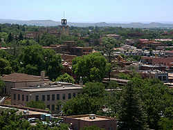
سانتا فێ شارێکە لە ویلایەتە یەکگرتووەکان.
| ئەم وتارە کۆلکەیەکە. دەتوانیت بە فراوانکردنی یارمەتیی ویکیپیدیا بدەیت. |
| کۆمنزی ویکیمیدیا، میدیای پەیوەندیدار بە سانتا فێ تێدایە. |
