
پەڕگە:Thailand Bueng Kan locator map.svg

Size of this PNG preview of this SVG file: ٣٤١ لە ٥٩٩ پیکسەڵ. ڕێزەلووشنەکانی تر: ١٣٦ لە ٢٤٠ پیکسەڵ | ٢٧٣ لە ٤٨٠ پیکسەڵ | ٤٣٧ لە ٧٦٨ پیکسەڵ | ٥٨٢ لە ١٬٠٢٤ پیکسەڵ | ١٬١٦٥ لە ٢٬٠٤٨ پیکسەڵ | ١٬٠٥٢ لە ١٬٨٤٩ پیکسەڵ.
پەڕگەی سەرەکی (پەڕگەی SVG، بە ناو ١٬٠٥٢ × ١٬٨٤٩ پیکسەڵ، قەبارەی پەڕگە: ١٫٨٤ مێگابایت)
| وەسف |
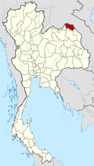
Deutsch: Lagekarte der Provinz Bueng Kan, Thailand English: Locator map of Bueng Kan Province, Thailand |
| ڕێکەوت | (UTC) |
| سەرچاوە | |
| بەرھەمھێنەر |
|
| This is a retouched picture, which means that it has been digitally altered from its original version. Modifications: Merged together to show Bueng Kan province. The original can be viewed here: Amphoe Nong Khai.svg:
|
ئەم پەڕگەیە لە ژێر مۆڵەتنامەی
Creative Commons Attribution-Share Alike 3.0 Unported دایە.
- تۆ ئازادی:
- بۆ بڵاکردنەوە – بۆ کۆپی کردن، دابەشکردن و دەستبەدەست ناردنی
- بۆ تێکەڵکردنەوە – بۆ سازاندنی کارەکە
- بەم مەرجانەی خوارەوە:
- دانەپاڵ – پێویستە باوەڕی گونجاو بدەیت، بەستەرێک بۆ مۆڵەتەکە دابین بکەیت و ئاماژە بەوە بکەیت کە ئایا گۆڕانکاری کراوە یان نا. دەتوانیت بە هەر شێوەیەکی گونجاو ئەوە بکەیت، بەڵام بە شێوەیەک نا کە وا دەربکەوێت کە مۆڵەتدەر پشتگیری تۆ یان بەکارهێنانەکەت بکات.
- بڵاوکردنەوەی گونجاو – ئەگەر لەسەر بنەمای ئەم کارە تێکەڵ، گۆڕان، یان ساز بکەی، پێویستە بەشدارییەکانت بە هەمان مۆڵەت یان هاوشێوەی مۆڵەتی ئەسڵی دابەش بکەی.
Original upload log
This image is a derivative work of the following images:
- File:Thailand_Nong_Khai_locator_map.svg licensed with Cc-by-3.0, GFDL
- 2009-04-21T17:01:48Z NordNordWest 1052x1849 (1525269 Bytes) {{Information |Description= {{de|Lagekarte der Provinz Nong Khai, Thailand}} {{en|Locator map of Nong Khai Province, Thailand}} |Source=self-made, using * [[:file:Thailand location map.svg|Thailand location map.svg]] |Date=2
- File:Amphoe_Nong_Khai.svg licensed with Cc-by-sa-3.0
Uploaded with derivativeFX
مێژووی پەڕگە
کرتە بکە لەسەر یەکێک لە ڕێکەوت/کاتەکان بۆ بینینی پەڕگەکە بەو شێوەی لەو کاتەدا بووە.
| ڕێکەوت/کات | ھێما | ئەندازە | بەکارھێنەر | تێبینی | |
|---|---|---|---|---|---|
| هەنووکە | ٢١:٢٧، ٦ی ئابی ٢٠١٠ | | ١٬٠٥٢ لە ١٬٨٤٩ (١٫٨٤ مێگابایت) | Ahoerstemeier | {{Information |Description={{de|Lagekarte der Provinz Nong Khai, Thailand}} {{en|Locator map of Nong Khai Province, Thailand}} {{en|1=Map of Nong Khai province, Thailand, with the districts (Amphoe) numbered. #Mueang Nong Khai (อำเภอเมื� |
بەکارھێنانی پەڕگە
ئەم پەڕەیە ئەم پەڕگەیە بەکار دەھێنێت:
بەکارھێنانی سەرانسەریی پەڕگە
ئەم ویکیانەی دیکەی خوارەوەش ئەم پەڕگە بەکاردێنن:
- بەکارھێنان لە ar.wikipedia.org
- بەکارھێنان لە be.wikipedia.org
- بەکارھێنان لە cdo.wikipedia.org
- بەکارھێنان لە de.wikipedia.org
- بەکارھێنان لە de.wikivoyage.org
- بەکارھێنان لە en.wikipedia.org
- Bueng Khong Long district
- Bung Khla district
- Pak Khat district
- Si Wilai district
- Seka district
- So Phisai district
- Bueng Kan province
- Seals of the provinces of Thailand
- Template:BuengKan-geo-stub
- Si Wilai subdistrict
- Chumphu Phon
- Phon Charoen
- Tha Kok Daeng
- Seka subdistrict
- Bueng Khong Long subdistrict
- Dong Bang, Bueng Kan
- Pho Mak Khaeng
- Tha Dok Kham
- Bung Khla subdistrict
- Khok Kwang
- Nong Doen
- Pak Khat subdistrict
- Nong Yong
- Na Kang
- Na Dong
- Non Sila, Bueng Kan
- Som Sanuk
- Don Ya Nang
- Nong Hua Chang
- Pa Faek, Bueng Kan
- Si Chomphu, Phon Charoen
- Si Samran
- Wang Chomphu
- Ban Tong
- Nam Chan
- Nong Thum
- Pong Hai
- Sang, Bueng Kan
- Sok Kam
- Tha Sa-at
- Na Sabaeng
- Na Saeng, Bueng Kan
- Na Sing
- Bua Tum
بینینی بەکارھێنانی گشتی زیاتری ئەم پەڕگەیە.