
پەڕگە:Relief Map of Brazil.jpg

قەبارەی ئەم پێشبینینە: ٦٠٧ لە ٦٠٠ پیکسەڵ. ڕێزەلووشنەکانی تر: ٢٤٣ لە ٢٤٠ پیکسەڵ | ٤٨٦ لە ٤٨٠ پیکسەڵ | ٧٧٧ لە ٧٦٨ پیکسەڵ | ١٬٢٠٠ لە ١٬١٨٦ پیکسەڵ.
پەڕگەی سەرەکی (١٬٢٠٠ × ١٬١٨٦ پیکسڵ، قەبارەی پەڕگە: ١٫٠٥ مێگابایت، جۆری ئێم ئای ئێم ئی: image/jpeg)
| وەسف |
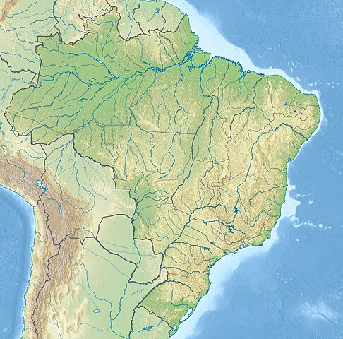
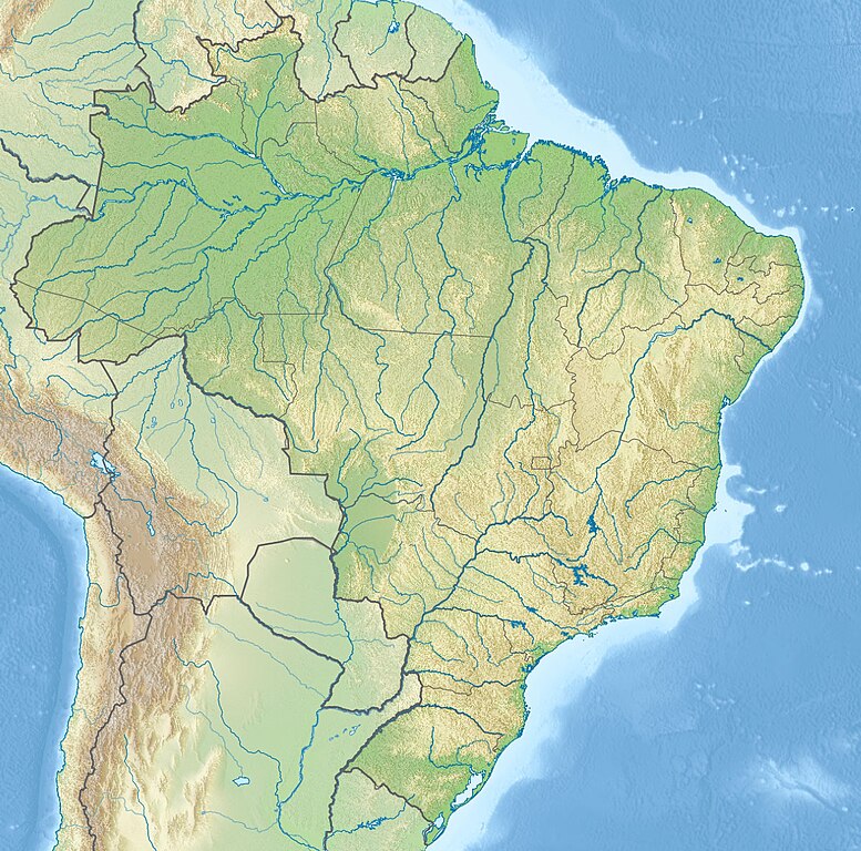
English: Location map of Brazil Equirectangular projection, N/S stretching 105 %. Geographic limits of the map:
|
|||
| ڕێکەوت | (UTC) | |||
| سەرچاوە |
|
|||
| بەرھەمھێنەر |
|
|||
| وەشانەکانی تر |
|


| This is a retouched picture, which means that it has been digitally altered from its original version. The original can be viewed here: Brazil location map.svg:
|
من، ھەڵگری مافی لەبەرگرتنەوەی ئەم بەرھەمە، لەژێر ئەم مۆڵەتنامەیەدا بڵاوی دەکەمەوە:
ئەم پەڕگەیە لە ژێر مۆڵەتنامەی
Creative Commons Attribution-Share Alike 3.0 Unported دایە.
- تۆ ئازادی:
- بۆ بڵاکردنەوە – بۆ کۆپی کردن، دابەشکردن و دەستبەدەست ناردنی
- بۆ تێکەڵکردنەوە – بۆ سازاندنی کارەکە
- بەم مەرجانەی خوارەوە:
- دانەپاڵ – پێویستە باوەڕی گونجاو بدەیت، بەستەرێک بۆ مۆڵەتەکە دابین بکەیت و ئاماژە بەوە بکەیت کە ئایا گۆڕانکاری کراوە یان نا. دەتوانیت بە هەر شێوەیەکی گونجاو ئەوە بکەیت، بەڵام بە شێوەیەک نا کە وا دەربکەوێت کە مۆڵەتدەر پشتگیری تۆ یان بەکارهێنانەکەت بکات.
- بڵاوکردنەوەی گونجاو – ئەگەر لەسەر بنەمای ئەم کارە تێکەڵ، گۆڕان، یان ساز بکەی، پێویستە بەشدارییەکانت بە هەمان مۆڵەت یان هاوشێوەی مۆڵەتی ئەسڵی دابەش بکەی.
Original upload log
This image is a derivative work of the following images:
- File:Brazil_location_map.svg licensed with Cc-by-sa-3.0
- 2009-08-05T19:53:55Z NordNordWest 2008x1984 (1674058 Bytes) {{int:filedesc}} {{Information |Description= {{de|Positionskarte von [[:de:Brasilien|Brasilien]]}} Quadratische Plattkarte, N-S-Streckung 105 %. Geographische Begrenzung der Karte: * N: 6.0° N * S: 34.0° S * W: 74.5° W * O
Uploaded with derivativeFX
مێژووی پەڕگە
کرتە بکە لەسەر یەکێک لە ڕێکەوت/کاتەکان بۆ بینینی پەڕگەکە بەو شێوەی لەو کاتەدا بووە.
| ڕێکەوت/کات | ھێما | ئەندازە | بەکارھێنەر | تێبینی | |
|---|---|---|---|---|---|
| هەنووکە | ٢١:٤٦، ١٤ی ئایاری ٢٠١٧ | | ١٬٢٠٠ لە ١٬١٨٦ (١٫٠٥ مێگابایت) | Janitoalevic | Added Rincón de Artigas disputed territory |
| ١٧:٥٥، ٢٧ی تشرینی دووەمی ٢٠١٠ |  | ١٬٢٠٠ لە ١٬١٨٦ (٤٩٢ کیلۆبایت) | Виктор В | {{Information |Description={{en|Location map of Brazil}} Equirectangular projection, N/S stretching 105 %. Geographic limits of the map: * N: 6.0° N * S: 34.0° S * W: 74.5° W * E: 32.0° W |Source=*File:Brazil_location_map.svg |
بەکارھێنانی پەڕگە
ئەم پەڕەیە ئەم پەڕگەیە بەکار دەھێنێت:
بەکارھێنانی سەرانسەریی پەڕگە
ئەم ویکیانەی دیکەی خوارەوەش ئەم پەڕگە بەکاردێنن:
- بەکارھێنان لە an.wikipedia.org
- بەکارھێنان لە ar.wikipedia.org
- بەکارھێنان لە ban.wikipedia.org
- بەکارھێنان لە bg.wikipedia.org
- Рио де Жанейро
- Итайпу
- Порто Алегри
- Сао Пауло
- Ирара
- Бауру
- Маже
- Айморес (Минаш Жерайс)
- Мост на дружбата (Парагвай - Бразилия)
- Бразилия (град)
- Петрополис
- Ресифи
- Флорианополис
- Анаполис
- Мадейра (река)
- Токантинс (река)
- Рио Негро (приток на Амазонка)
- Манаус
- Такуари
- Салвадор (Баия)
- Сантос
- Сао Бернардо до Кампо
- Розейра
- Ипатинга
- Трес Корасойнс
- Паулиста (Пернамбуко)
- Сао Висенти (Сао Пауло)
- Прадополис
- Белен (Пара)
- Бело Оризонти
- Масейо
- Форталеза
- Витория (Еспирито Санто)
- Гояния
- Кампо Гранди
- Кашоейра до Сул
- Итабуна
- Куритиба
- Арара (Параиба)
بینینی بەکارھێنانی گشتی زیاتری ئەم پەڕگەیە.