
پەڕگە:Iki-no-shima map.jpg

قەبارەی ئەم پێشبینینە: ٥٨٦ لە ٥٩٩ پیکسەڵ. ڕێزەلووشنەکانی تر: ٢٣٥ لە ٢٤٠ پیکسەڵ | ٤٦٩ لە ٤٨٠ پیکسەڵ | ٦٦٢ لە ٦٧٧ پیکسەڵ.
پەڕگەی سەرەکی (٦٦٢ × ٦٧٧ پیکسڵ، قەبارەی پەڕگە: ١٤٤ کیلۆبایت، جۆری ئێم ئای ئێم ئی: image/jpeg)
کورتە
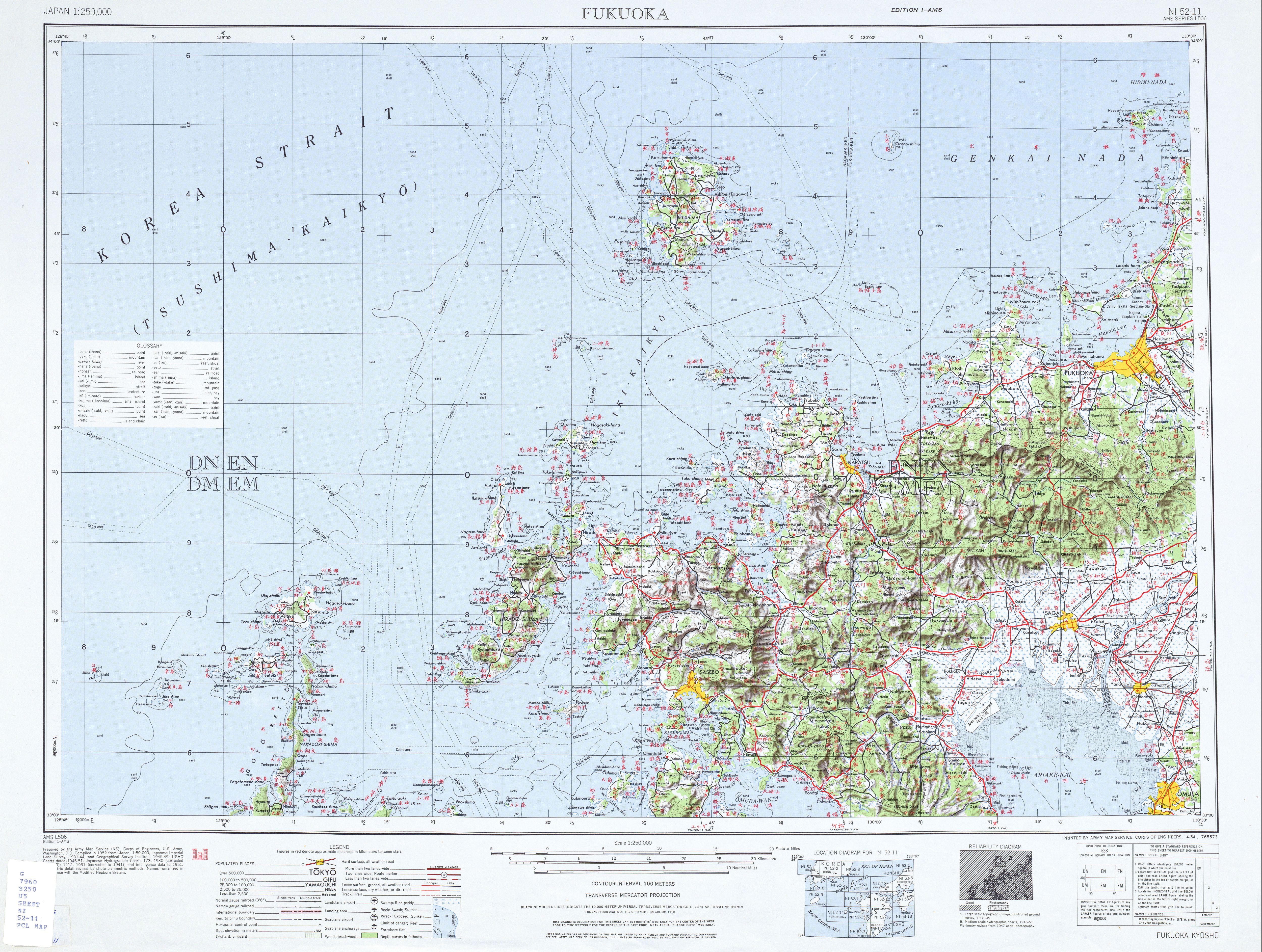
| وەسف | topographic map of Iki Island |
| ڕێکەوت | |
| سەرچاوە | http://www.lib.utexas.edu/maps/ams/japan/txu-oclc-6900707-ni52-11.jpg |
| بەرھەمھێنەر | Army Map Service, Corps of Engineers, U.S. Army |
مۆڵەتنامە
This file is a work of a U.S. Army soldier or employee, taken or made as part of that person's official duties. As a work of the U.S. federal government, it is in the public domain in the United States.
|
 |
مێژووی پەڕگە
کرتە بکە لەسەر یەکێک لە ڕێکەوت/کاتەکان بۆ بینینی پەڕگەکە بەو شێوەی لەو کاتەدا بووە.
| ڕێکەوت/کات | ھێما | ئەندازە | بەکارھێنەر | تێبینی | |
|---|---|---|---|---|---|
| هەنووکە | ٢٠:٢٠، ٨ی تشرینی دووەمی ٢٠١٢ | | ٦٦٢ لە ٦٧٧ (١٤٤ کیلۆبایت) | Mps2 | {{Information |Description=topographic map of Iki Island |Source=http://www.lib.utexas.edu/maps/ams/japan/txu-oclc-6900707-ni52-11.jpg |Date=1952 |Author=Army Map Service, Corps of Engineers, U.S. Army |Permission= |other_versions= }} [[Category:Topog... |
بەکارھێنانی پەڕگە
ئەم پەڕەیە ئەم پەڕگەیە بەکار دەھێنێت:
بەکارھێنانی سەرانسەریی پەڕگە
ئەم ویکیانەی دیکەی خوارەوەش ئەم پەڕگە بەکاردێنن:
- بەکارھێنان لە de.wikipedia.org
- بەکارھێنان لە en.wikipedia.org
- بەکارھێنان لە fr.wikipedia.org
- بەکارھێنان لە ja.wikipedia.org
- بەکارھێنان لە tr.wikipedia.org