
پەڕگە:GPS Block IIIA.jpg

قەبارەی ئەم پێشبینینە: ٦٠٠ لە ٦٠٠ پیکسەڵ. ڕێزەلووشنەکانی تر: ٢٤٠ لە ٢٤٠ پیکسەڵ | ٤٨٠ لە ٤٨٠ پیکسەڵ | ٧٦٨ لە ٧٦٨ پیکسەڵ | ١٬٠٢٤ لە ١٬٠٢٤ پیکسەڵ | ١٬٥٠٠ لە ١٬٥٠٠ پیکسەڵ.
پەڕگەی سەرەکی (١٬٥٠٠ × ١٬٥٠٠ پیکسڵ، قەبارەی پەڕگە: ٢٣٢ کیلۆبایت، جۆری ئێم ئای ئێم ئی: image/jpeg)
کورتە
| وەسف |
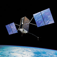
English: Artist's impression of a GPS Block IIIA satellite in orbit |
| ڕێکەوت | |
| سەرچاوە | http://www.losangeles.af.mil/shared/media/ggallery/hires/AFG-100825-006.jpg |
| بەرھەمھێنەر | USAF |
مۆڵەتنامە
This image or file is a work of a U.S. Air Force Airman or employee, taken or made as part of that person's official duties. As a work of the U.S. federal government, the image or file is in the public domain in the United States.
|
 |
مێژووی پەڕگە
کرتە بکە لەسەر یەکێک لە ڕێکەوت/کاتەکان بۆ بینینی پەڕگەکە بەو شێوەی لەو کاتەدا بووە.
| ڕێکەوت/کات | ھێما | ئەندازە | بەکارھێنەر | تێبینی | |
|---|---|---|---|---|---|
| هەنووکە | ٠٦:٠٣، ١١ی تەممووزی ٢٠١٢ | | ١٬٥٠٠ لە ١٬٥٠٠ (٢٣٢ کیلۆبایت) | Ng.j |
بەکارھێنانی پەڕگە
ئەم پەڕەیە ئەم پەڕگەیە بەکار دەھێنێت:
بەکارھێنانی سەرانسەریی پەڕگە
ئەم ویکیانەی دیکەی خوارەوەش ئەم پەڕگە بەکاردێنن:
- بەکارھێنان لە en.wikipedia.org
- بەکارھێنان لە es.wikipedia.org
- بەکارھێنان لە eu.wikipedia.org
- بەکارھێنان لە he.wikipedia.org
- بەکارھێنان لە it.wikipedia.org
- GPS
- Sistema di posizionamento Galileo
- EGNOS
- GLONASS
- Transit (satellite)
- Sistema di posizionamento BeiDou
- Sistema satellitare globale di navigazione
- Template:Sistema satellitare globale di navigazione
- Sistema di posizionamento satellitare regionale indiano
- Enhanced GPS
- Ciklon
- Cikada
- Sistema satellitare Quasi-Zenith
- GPS Aided Geo Augmented Navigation
- GPS differenziale
- Parus (satellite)
- Wide Area Augmentation System
- Multi-functional Satellite Augmentation System
- GNSS augmentation
- DORIS (sistema di posizionamento)
- Timation
- بەکارھێنان لە ja.wikipedia.org
- بەکارھێنان لە min.wikipedia.org
- بەکارھێنان لە pl.wikipedia.org
- بەکارھێنان لە pt.wikipedia.org
- بەکارھێنان لە zh.wikipedia.org