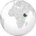
پەڕگە:Ethiopia (Africa orthographic projection).svg

Size of this PNG preview of this SVG file: ٥٥٠ لە ٥٥٠ پیکسەڵ. ڕێزەلووشنەکانی تر: ٢٤٠ لە ٢٤٠ پیکسەڵ | ٤٨٠ لە ٤٨٠ پیکسەڵ | ٧٦٨ لە ٧٦٨ پیکسەڵ | ١٬٠٢٤ لە ١٬٠٢٤ پیکسەڵ | ٢٬٠٤٨ لە ٢٬٠٤٨ پیکسەڵ.
پەڕگەی سەرەکی (پەڕگەی SVG، بە ناو ٥٥٠ × ٥٥٠ پیکسەڵ، قەبارەی پەڕگە: ١٤٣ کیلۆبایت)
مێژووی پەڕگە
کرتە بکە لەسەر یەکێک لە ڕێکەوت/کاتەکان بۆ بینینی پەڕگەکە بەو شێوەی لەو کاتەدا بووە.
| ڕێکەوت/کات | ھێما | ئەندازە | بەکارھێنەر | تێبینی | |
|---|---|---|---|---|---|
| هەنووکە | ٠٩:٤٢، ٣٠ی ئابی ٢٠١٢ |  | ٥٥٠ لە ٥٥٠ (١٤٣ کیلۆبایت) | Sémhur | Same with shadow |
| ٠٩:٤٠، ٣٠ی ئابی ٢٠١٢ |  | ٥٥٠ لە ٥٥٠ (١٤٣ کیلۆبایت) | Sémhur | Correcting few mistakes | |
| ١٠:٢٨، ١٥ی تەممووزی ٢٠١١ |  | ٥٥٠ لە ٥٥٠ (١٣٤ کیلۆبایت) | Mixx321 | Sudan Południowy | |
| ١١:٣٤، ٢٧ی کانوونی یەکەمی ٢٠٠٩ |  | ٥٥٠ لە ٥٥٠ (١٣٢ کیلۆبایت) | Sémhur | == {{int:filedesc}} == {{Information |Description={{en|1=Orthographic map of Africa, showing Ethiopia location.}} {{fr|1=Carte orthographique de l'Afrique, montrant l'emplacement de l'Éthiopie.}} |Source=*[[:File:Africa |
بەکارھێنانی پەڕگە
ئەم پەڕەیە ئەم پەڕگەیە بەکار دەھێنێت:
بەکارھێنانی سەرانسەریی پەڕگە
ئەم ویکیانەی دیکەی خوارەوەش ئەم پەڕگە بەکاردێنن:
- بەکارھێنان لە ady.wikipedia.org
- بەکارھێنان لە am.wikipedia.org
- بەکارھێنان لە am.wiktionary.org
- بەکارھێنان لە ang.wikipedia.org
- بەکارھێنان لە arc.wikipedia.org
- بەکارھێنان لە ar.wikipedia.org
- بەکارھێنان لە ar.wiktionary.org
- بەکارھێنان لە arz.wikipedia.org
- بەکارھێنان لە avk.wikipedia.org
- بەکارھێنان لە azb.wikipedia.org
- بەکارھێنان لە az.wiktionary.org
- بەکارھێنان لە ban.wikipedia.org
- بەکارھێنان لە bbc.wikipedia.org
- بەکارھێنان لە be-tarask.wikipedia.org
- بەکارھێنان لە be.wikipedia.org
- بەکارھێنان لە bg.wikipedia.org
- بەکارھێنان لە bh.wikipedia.org
- بەکارھێنان لە bi.wikipedia.org
- بەکارھێنان لە bm.wikipedia.org
- بەکارھێنان لە bxr.wikipedia.org
- بەکارھێنان لە cdo.wikipedia.org
- بەکارھێنان لە ceb.wikipedia.org
- بەکارھێنان لە chr.wikipedia.org
- بەکارھێنان لە cs.wikipedia.org
- بەکارھێنان لە cu.wikipedia.org
- بەکارھێنان لە dag.wikipedia.org
- بەکارھێنان لە da.wikipedia.org
- بەکارھێنان لە de.wikivoyage.org
- بەکارھێنان لە din.wikipedia.org
- بەکارھێنان لە el.wikipedia.org
- بەکارھێنان لە en.wikipedia.org
- Rastafari
- Ethiopia
- List of companies of Ethiopia
- LGBT rights in Ethiopia
- History of the Jews in Ethiopia
- List of conflicts in Ethiopia
- User:Pharaoh Amun
- Wikipedia talk:Manual of Style/Pronunciation/Archive 9
- User:PMK2000/sandbox/Ethiopia
- User:JosephMohan/sandbox
- Wikipedia:Wikipedia Signpost/2019-10-31/On the bright side
- Wikipedia:Wikipedia Signpost/Single/2019-10-31
- User:BushelCandle/Ethiopia - stable lede
- User:BushelCandle/Template:Ethiopia
- 2023 Ethiopian crackdown on the hospitality industry
- Portal:Ethiopia
- Portal:Ethiopia/Intro
- بەکارھێنان لە en.wikibooks.org
بینینی بەکارھێنانی گشتی زیاتری ئەم پەڕگەیە.
