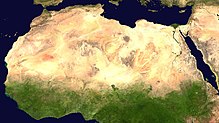
پەڕگە:Africa satellite plane.jpg

قەبارەی ئەم پێشبینینە: ٥٧٠ لە ٦٠٠ پیکسەڵ. ڕێزەلووشنەکانی تر: ٢٢٨ لە ٢٤٠ پیکسەڵ | ٤٥٦ لە ٤٨٠ پیکسەڵ | ٧٣٠ لە ٧٦٨ پیکسەڵ | ٩٧٣ لە ١٬٠٢٤ پیکسەڵ | ١٬٩٤٧ لە ٢٬٠٤٨ پیکسەڵ | ٨٬٤٦٠ لە ٨٬٩٠٠ پیکسەڵ.
پەڕگەی سەرەکی (٨٬٤٦٠ × ٨٬٩٠٠ پیکسڵ، قەبارەی پەڕگە: ٧٫٣٤ مێگابایت، جۆری ئێم ئای ئێم ئی: image/jpeg)
مێژووی پەڕگە
کرتە بکە لەسەر یەکێک لە ڕێکەوت/کاتەکان بۆ بینینی پەڕگەکە بەو شێوەی لەو کاتەدا بووە.
| ڕێکەوت/کات | ھێما | ئەندازە | بەکارھێنەر | تێبینی | |
|---|---|---|---|---|---|
| هەنووکە | ٠٠:٤٦، ٢٨ی ئازاری ٢٠٠٥ |  | ٨٬٤٦٠ لە ٨٬٩٠٠ (٧٫٣٤ مێگابایت) | Dbenbenn | original high-resolution version, cropped land_shallow_topo_west.tif at 8460x8900+19400+6200 |
| ٢١:٠٨، ١٣ی تشرینی دووەمی ٢٠٠٤ |  | ٧٤١ لە ٨٠٠ (١١٣ کیلۆبایت) | Bjarki S |
بەکارھێنانی پەڕگە
ھیچ پەڕەیەک نییە کە ئەم پەڕگەیە بەکاربھێنێت.
بەکارھێنانی سەرانسەریی پەڕگە
ئەم ویکیانەی دیکەی خوارەوەش ئەم پەڕگە بەکاردێنن:
- بەکارھێنان لە ace.wikipedia.org
- بەکارھێنان لە af.wikipedia.org
- بەکارھێنان لە als.wikipedia.org
- بەکارھێنان لە ar.wikipedia.org
- بەکارھێنان لە ar.wikinews.org
- بەکارھێنان لە ast.wikipedia.org
- بەکارھێنان لە azb.wikipedia.org
- بەکارھێنان لە az.wikipedia.org
- بەکارھێنان لە az.wikiquote.org
- بەکارھێنان لە ba.wikipedia.org
- بەکارھێنان لە be.wikipedia.org
- بەکارھێنان لە bm.wikipedia.org
- بەکارھێنان لە ca.wikiquote.org
- بەکارھێنان لە cdo.wikipedia.org
- بەکارھێنان لە co.wikipedia.org
- بەکارھێنان لە cv.wikipedia.org
- بەکارھێنان لە da.wikipedia.org
- بەکارھێنان لە de.wikipedia.org
- Oldowan
- CFA-Franc-Zone
- Fußball in Südafrika
- Portal:Afrika
- Wikipedia:Archiv/Qualitätsoffensive/Afrika
- Wikipedia:WikiProjekt Afrika
- Wikipedia Diskussion:WikiProjekt Afrika
- Uganda Olympic Committee
- Wikipedia:WikiProjekt Sudan
- Portal:Afrika/Unsere besten Artikel
- Wikipedia:WikiProjekt Äthiopien
- Portal:Gambia
- Fußball in Äthiopien
- Wikipedia:WikiProjekt Sudan/Verwandte
- Portal:Afrika/Register
- Benutzer:Vorlage/Herkunftsvorlagen
- Portal:Hip-Hop
- Portal:Hip-Hop/Hip-Hop nach Ländern
- Namibia National Olympic Committee
- Fußball
- Benutzer:Heiteck
- Benutzer:Vorlage/aus Afrika
- Gambia National Olympic Committee
- Portal:Nigeria
- Fußball in Lesotho
- Fußball in Burkina Faso
بینینی بەکارھێنانی گشتی زیاتری ئەم پەڕگەیە.


