
پەڕگە:1855 Colton Map of Turkey, Iraq, and Syria - Geographicus - TurkeyIraq-colton-1855.jpg
پەڕگەی سەرەکی (٣٬٥٠٠ × ٣٬٠٣٤ پیکسڵ، قەبارەی پەڕگە: ٣٫٢٢ مێگابایت، جۆری ئێم ئای ئێم ئی: image/jpeg)
| J. H. Colton: Turkey in Asia and the Caucasian Provinces of Russia
( |
|||||||||||||||||||||
|---|---|---|---|---|---|---|---|---|---|---|---|---|---|---|---|---|---|---|---|---|---|
| ھونەرمەند |
|
||||||||||||||||||||
| سەرناو |
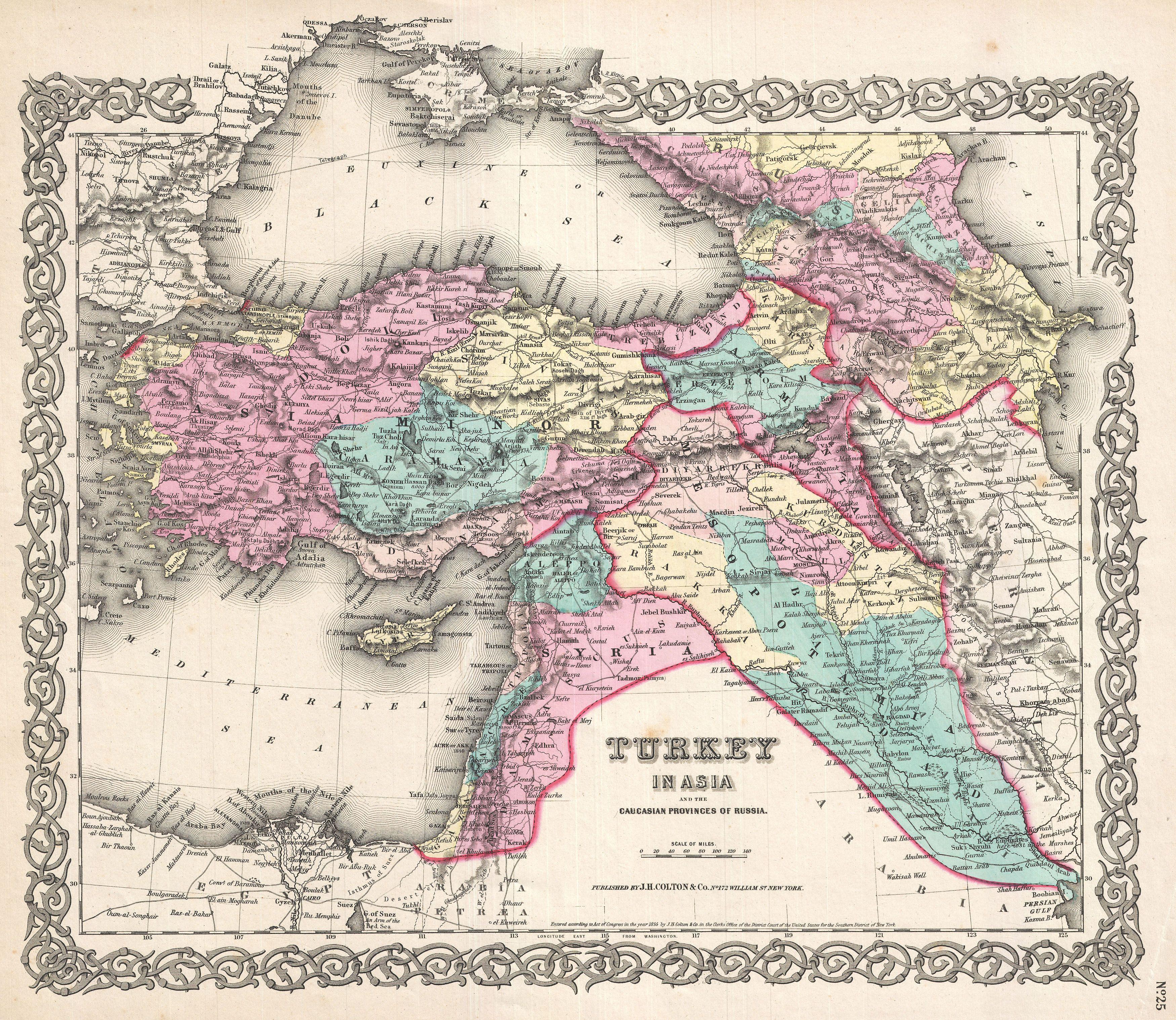
Turkey in Asia and the Caucasian Provinces of Russia |
||||||||||||||||||||
| وەسف |
العربية: خريطة جميلة لِإيالات الدولة العُثمانيَّة في آسيا وتظهر فيها المُقاطعات القوقازيَّة التي تُسيطر عليها روسيا. تعود هذه الخريطة لِلطبعة الأولى لِأطلس كولتون الصادر سنة 1855م.
English: A beautiful 1855 first edition example of Colton's map of the Ottoman Empire (Turkey) in Asia and the Caucuses.
|
||||||||||||||||||||
| ڕێکەوت | ١٨٥٥ (dated) | ||||||||||||||||||||
| Dimensions | بەرزایی: ١٣٫٠ in (٣٣٫٠ cm)؛ width: ١٦٫٥ in (٤١٫٩ cm) | ||||||||||||||||||||
| Accession number |
Geographicus link: TurkeyIraq-colton-1855 |
||||||||||||||||||||
| سەرچاوە/وێنەگر |
Colton, G. W., Colton's Atlas of the World Illustrating Physical and Political Geography, Vol 2, New York, 1855 (First Edition).
|
||||||||||||||||||||
| ڕێپێدان (بەکارھێنانەوەی ئەم پەڕگەیە) |
|
||||||||||||||||||||

|
مێژووی پەڕگە
کرتە بکە لەسەر یەکێک لە ڕێکەوت/کاتەکان بۆ بینینی پەڕگەکە بەو شێوەی لەو کاتەدا بووە.
| ڕێکەوت/کات | ھێما | ئەندازە | بەکارھێنەر | تێبینی | |
|---|---|---|---|---|---|
| هەنووکە | ١٥:٣٣، ٢٣ی ئازاری ٢٠١١ | | ٣٬٥٠٠ لە ٣٬٠٣٤ (٣٫٢٢ مێگابایت) | BotMultichillT | {{subst:User:Multichill/Geographicus |link=http://www.geographicus.com/P/AntiqueMap/TurkeyIraq-colton-1855 |product_name=1855 Colton Map of Turkey, Iraq, and Syria |map_title=Turkey in Asia and the Caucasian Provinces of Russia. |description=A beautiful 1 |
بەکارھێنانی پەڕگە
ئەم پەڕەیە ئەم پەڕگەیە بەکار دەھێنێت:
بەکارھێنانی سەرانسەریی پەڕگە
ئەم ویکیانەی دیکەی خوارەوەش ئەم پەڕگە بەکاردێنن:
- بەکارھێنان لە ar.wikipedia.org
- الأقاليم السورية الشمالية
- إيالة عثمانية
- العراق العثماني
- بوابة:الدولة العثمانية/صورة
- مستخدم:عمرو بن كلثوم/الأقاليم السورية الشمالية
- ويكيبيديا:صور مختارة/رسومات وجداول وخرائط/خرائط
- قائمة إيالات الدولة العثمانية
- ويكيبيديا:ترشيحات الصور المختارة/الإيالات العثمانية الآسيوية
- ويكيبيديا:صورة اليوم المختارة/أغسطس 2017
- قالب:صورة اليوم المختارة/2017-08-11
- بوابة:الدولة العثمانية/صورة مختارة/35
- ويكيبيديا:صورة اليوم المختارة/يناير 2020
- قالب:صورة اليوم المختارة/2020-01-14
- الحدود الإيرانية التركية
- ويكيبيديا:صورة اليوم المختارة/نوفمبر 2022
- قالب:صورة اليوم المختارة/2022-11-16
- بەکارھێنان لە arz.wikipedia.org
- بەکارھێنان لە az.wikipedia.org
- بەکارھێنان لە bn.wikipedia.org
- بەکارھێنان لە en.wikipedia.org
- بەکارھێنان لە et.wikipedia.org
- بەکارھێنان لە fa.wikipedia.org
- بەکارھێنان لە it.wikipedia.org
- بەکارھێنان لە ko.wikipedia.org
- بەکارھێنان لە ku.wikipedia.org
- بەکارھێنان لە pnb.wikipedia.org
- بەکارھێنان لە ro.wikipedia.org
- بەکارھێنان لە tr.wikipedia.org
- بەکارھێنان لە ur.wikipedia.org
- بەکارھێنان لە www.wikidata.org
- بەکارھێنان لە zh.wikipedia.org