
پەڕگە:Kotayk.svg

Size of this PNG preview of this SVG file: ٥٨٧ لە ٥٩٩ پیکسەڵ. ڕێزەلووشنەکانی تر: ٢٣٥ لە ٢٤٠ پیکسەڵ | ٤٧٠ لە ٤٨٠ پیکسەڵ | ٧٥٢ لە ٧٦٨ پیکسەڵ | ١٬٠٠٣ لە ١٬٠٢٤ پیکسەڵ | ٢٬٠٠٦ لە ٢٬٠٤٨ پیکسەڵ | ٧٢٥ لە ٧٤٠ پیکسەڵ.
پەڕگەی سەرەکی (پەڕگەی SVG، بە ناو ٧٢٥ × ٧٤٠ پیکسەڵ، قەبارەی پەڕگە: ٧٢ کیلۆبایت)
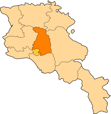
| وەسف | Image shows the eleven administrative subdivisions of Armenia: # Aragatsotn (Արագածոտնի) # Ararat (Արարատի) # Armavir (Արմավիրի) # Gegharkunik (Գեղարքունիքի) # Kotayk (Կոտայքի) # Lori (Լոռու) # Shirak (Շիրակի) # Syunik (Սյունիքի) # Tavush (Տավուշի) # Vayots Dzor (Վայոց Ձորի) # Yerevan (Երևան) - special administrative status Derived from a multiple of public sources and created using Inkscape. == |
| ڕێکەوت | (UTC) |
| سەرچاوە | |
| بەرھەمھێنەر |
|
| This is a retouched picture, which means that it has been digitally altered from its original version. Modifications: Creation d'une autre map. The original can be viewed here: Armenia map numbered.svg:
|
ئەم پەڕگەیە لە ژێر مۆڵەتنامەی
Creative Commons Attribution-Share Alike 3.0 Unported دایە.
- تۆ ئازادی:
- بۆ بڵاکردنەوە – بۆ کۆپی کردن، دابەشکردن و دەستبەدەست ناردنی
- بۆ تێکەڵکردنەوە – بۆ سازاندنی کارەکە
- بەم مەرجانەی خوارەوە:
- دانەپاڵ – پێویستە باوەڕی گونجاو بدەیت، بەستەرێک بۆ مۆڵەتەکە دابین بکەیت و ئاماژە بەوە بکەیت کە ئایا گۆڕانکاری کراوە یان نا. دەتوانیت بە هەر شێوەیەکی گونجاو ئەوە بکەیت، بەڵام بە شێوەیەک نا کە وا دەربکەوێت کە مۆڵەتدەر پشتگیری تۆ یان بەکارهێنانەکەت بکات.
- بڵاوکردنەوەی گونجاو – ئەگەر لەسەر بنەمای ئەم کارە تێکەڵ، گۆڕان، یان ساز بکەی، پێویستە بەشدارییەکانت بە هەمان مۆڵەت یان هاوشێوەی مۆڵەتی ئەسڵی دابەش بکەی.
Original upload log
This image is a derivative work of the following images:
- File:Armenia_map_numbered.svg licensed with Cc-by-sa-3.0-migrated, GFDL
- 2010-09-26T17:27:10Z 6AND5 725x740 (82221 Bytes) Reverted to version as of 17:31, 25 November 2006 (((Exclaves deleted according to official map at http://www.gov.am/en/regions/)))
- 2006-11-25T19:37:43Z Bastique 725x740 (87638 Bytes) Cleanup
- 2006-11-25T19:26:57Z Bastique 725x740 (86083 Bytes) Enclaves
- 2006-11-25T17:31:38Z Bastique 725x740 (82221 Bytes) Fixed canvas size
- 2006-11-25T17:27:59Z Bastique 744x1052 (79767 Bytes) Image shows the subdivisions of Armenia. Derived from a multiple of public sources and created using Inkscape. == Licensing == {{GFDL}} Image shows the eleven administrative subdivisions of Armenia: #[[Aragatsotn]] (Ար�
Uploaded with derivativeFX
مێژووی پەڕگە
کرتە بکە لەسەر یەکێک لە ڕێکەوت/کاتەکان بۆ بینینی پەڕگەکە بەو شێوەی لەو کاتەدا بووە.
| ڕێکەوت/کات | ھێما | ئەندازە | بەکارھێنەر | تێبینی | |
|---|---|---|---|---|---|
| هەنووکە | ١١:٢٠، ٣٠ی کانوونی یەکەمی ٢٠١٠ | | ٧٢٥ لە ٧٤٠ (٧٢ کیلۆبایت) | Varmin | {{Information |Description=Image shows the eleven administrative subdivisions of Armenia: # Aragatsotn (Արագածոտնի) # Ararat (Արարատի) # Armavir (Արմավիրի) # Gegharkunik (Գեղ |
بەکارھێنانی پەڕگە
ھیچ پەڕەیەک نییە کە ئەم پەڕگەیە بەکاربھێنێت.
بەکارھێنانی سەرانسەریی پەڕگە
ئەم ویکیانەی دیکەی خوارەوەش ئەم پەڕگە بەکاردێنن:
- بەکارھێنان لە ar.wikipedia.org
- بەکارھێنان لە be.wikipedia.org
- بەکارھێنان لە bg.wikipedia.org
- بەکارھێنان لە ceb.wikipedia.org
- بەکارھێنان لە ce.wikipedia.org
بینینی بەکارھێنانی گشتی زیاتری ئەم پەڕگەیە.