پەڕگە:Johor location map.svg
ڕواڵەت

Size of this PNG preview of this SVG file: ٦٢٩ لە ٥٩٩ پیکسەڵ. ڕێزەلووشنەکانی تر: ٢٥٢ لە ٢٤٠ پیکسەڵ | ٥٠٤ لە ٤٨٠ پیکسەڵ | ٨٠٦ لە ٧٦٨ پیکسەڵ | ١٬٠٧٥ لە ١٬٠٢٤ پیکسەڵ | ٢٬١٥٠ لە ٢٬٠٤٨ پیکسەڵ | ١٬٠٣٥ لە ٩٨٦ پیکسەڵ.
پەڕگەی سەرەکی (پەڕگەی SVG، بە ناو ١٬٠٣٥ × ٩٨٦ پیکسەڵ، قەبارەی پەڕگە: ٦٥ کیلۆبایت)
مێژووی پەڕگە
کرتە بکە لەسەر یەکێک لە ڕێکەوت/کاتەکان بۆ بینینی پەڕگەکە بەو شێوەی لەو کاتەدا بووە.
| ڕێکەوت/کات | ھێما | ئەندازە | بەکارھێنەر | تێبینی | |
|---|---|---|---|---|---|
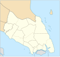
| هەنووکە | ١٣:١٢، ١٣ی کانوونی دووەمی ٢٠١٨ |  | ١٬٠٣٥ لە ٩٨٦ (٦٥ کیلۆبایت) | Goran tek-en | {{Information |description ={{en|1=A map showing districts and PBT (local authorities) of Johor (blank version)<br> Approximate geographic limits of the map: *N 3.108806 *W 102.365112 *S 1.270019 *E 104.61731}} |date =20180113 |source... |
بەکارھێنانی پەڕگە
ھیچ پەڕەیەک نییە کە ئەم پەڕگەیە بەکاربھێنێت.
بەکارھێنانی سەرانسەریی پەڕگە
ئەم ویکیانەی دیکەی خوارەوەش ئەم پەڕگە بەکاردێنن:
- بەکارھێنان لە en.wikipedia.org
- Johor Bahru
- Pasir Gudang
- Rawa Island
- Pemanggil Island
- Besar Island, Johor
- Kukup
- Mersing
- Labis
- Senai International Airport
- Iskandar Puteri
- Ayer Hitam
- Yong Peng
- Sultan Abu Bakar State Mosque
- Pasir Pelangi Royal Mosque
- Sultan Ibrahim Jamek Mosque
- Pasir Gudang Jamek Mosque
- Jementah
- Parit Raja
- Bandar Tenggara
- Tampoi, Johor
- Perling
- Bukit Kepong incident
- Air Panas
- Kempas
- Mengkibol
- Tenggaroh
- Sagil
- Sungai Mati
- Parit Bakar
- Semerah
- Sri Medan
- Sungai Balang
- Sultan Ismail Jamek Mosque
- Bandar Baru UDA Jamek Mosque
- Tanjung Kupang
- Gemas Baru
- Tongkang Pechah
- Ungku Tun Aminah Jamek Mosque
- Kolam Ayer Mosque
- Lima Kedai
- Senggarang, Johor
- Sri Gading
- Wikipedia:WikiProject Malaysia/Cartography
- Seelong
- Kangkar Pulai
- Tebrau
- Pulau Merambong
- Taman Sri Lambak
- Muar (town)
- Batu Pahat (town)
بینینی بەکارھێنانی گشتی زیاتری ئەم پەڕگەیە.
