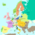
پەڕگە:Europa 1721.svg
ڕواڵەت

Size of this PNG preview of this SVG file: ٦٠٠ لە ٦٠٠ پیکسەڵ. ڕێزەلووشنەکانی تر: ٢٤٠ لە ٢٤٠ پیکسەڵ | ٤٨٠ لە ٤٨٠ پیکسەڵ | ٧٦٨ لە ٧٦٨ پیکسەڵ | ١٬٠٢٤ لە ١٬٠٢٤ پیکسەڵ | ٢٬٠٤٨ لە ٢٬٠٤٨ پیکسەڵ | ١٬٣٥٧ لە ١٬٣٥٧ پیکسەڵ.
پەڕگەی سەرەکی (پەڕگەی SVG، بە ناو ١٬٣٥٧ × ١٬٣٥٧ پیکسەڵ، قەبارەی پەڕگە: ٦٨٠ کیلۆبایت)
مێژووی پەڕگە
کرتە بکە لەسەر یەکێک لە ڕێکەوت/کاتەکان بۆ بینینی پەڕگەکە بەو شێوەی لەو کاتەدا بووە.
| ڕێکەوت/کات | ھێما | ئەندازە | بەکارھێنەر | تێبینی | |
|---|---|---|---|---|---|
| هەنووکە | ١٨:١٦، ١٧ی ئەیلوولی ٢٠٢٣ |  | ١٬٣٥٧ لە ١٬٣٥٧ (٦٨٠ کیلۆبایت) | Lalpino | File uploaded using svgtranslate tool (https://svgtranslate.toolforge.org/). Added translation for ca. |
| ١١:٥٠، ٢٠ی تشرینی یەکەمی ٢٠١٦ |  | ١٬٣٥٧ لە ١٬٣٥٧ (٦٦٧ کیلۆبایت) | Furfur | ... erneut | |
| ١١:٤٨، ٢٠ی تشرینی یەکەمی ٢٠١٦ |  | ١٬٣٥٧ لە ١٬٣٥٧ (٦٦٧ کیلۆبایت) | Furfur | rechte Bildgrenze, Grenze in Karelien | |
| ١١:٠٣، ٢٠ی تشرینی یەکەمی ٢٠١٦ |  | ١٬٣٨٧ لە ١٬٣٦٧ (٦٦٧ کیلۆبایت) | Furfur | Details | |
| ٢٢:٠٦، ١٦ی تشرینی یەکەمی ٢٠١٦ |  | ١٬٣٨٧ لە ١٬٣٦٧ (٦٦٦ کیلۆبایت) | Furfur | Details (Oldenburg, Toskana) | |
| ١٩:٥٣، ١ی تشرینی یەکەمی ٢٠١٦ |  | ١٬٣٨٧ لە ١٬٣٦٧ (٦٦٦ کیلۆبایت) | Furfur | hellere Meeresfarbe | |
| ١٩:١٢، ١ی تشرینی یەکەمی ٢٠١٦ |  | ١٬٣٨٧ لە ١٬٣٦٧ (٦٦٦ کیلۆبایت) | Furfur | nochmal Detail | |
| ١٩:١١، ١ی تشرینی یەکەمی ٢٠١٦ |  | ١٬٣٨٧ لە ١٬٣٦٧ (٦٦٦ کیلۆبایت) | Furfur | Details | |
| ١٩:٠٤، ١ی تشرینی یەکەمی ٢٠١٦ |  | ١٬٣٨٧ لە ١٬٣٦٧ (٦٦٦ کیلۆبایت) | Furfur | == {{int:filedesc}} == {{Information |Description={{User:Medium69/Traduction}} {{de|1=Eine einfache Karte von Europa am Ende des Großen Nordischen Krieges 1721.}} {{en|1=A simple map showing Europe at the end of the Great Nordic War, 1721}} |Source={{... |
بەکارھێنانی پەڕگە
ھیچ پەڕەیەک نییە کە ئەم پەڕگەیە بەکاربھێنێت.
بەکارھێنانی سەرانسەریی پەڕگە
ئەم ویکیانەی دیکەی خوارەوەش ئەم پەڕگە بەکاردێنن:
- بەکارھێنان لە af.wikipedia.org
- بەکارھێنان لە bg.wikipedia.org
- بەکارھێنان لە ca.wikipedia.org
- بەکارھێنان لە en.wikipedia.org
- بەکارھێنان لە sh.wikipedia.org
- بەکارھێنان لە zh-yue.wikipedia.org


