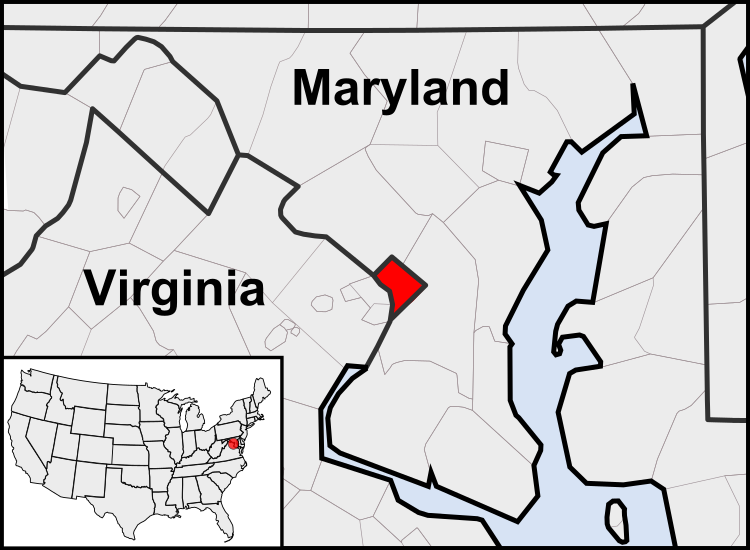
پەڕگە:Washington, D.C. locator map.svg

Size of this PNG preview of this SVG file: ٧٥٠ لە ٥٥٠ پیکسەڵ. ڕێزەلووشنەکانی تر: ٣٢٠ لە ٢٣٥ پیکسەڵ | ٦٤٠ لە ٤٦٩ پیکسەڵ | ١٬٠٢٤ لە ٧٥١ پیکسەڵ | ١٬٢٨٠ لە ٩٣٩ پیکسەڵ | ٢٬٥٦٠ لە ١٬٨٧٧ پیکسەڵ.
پەڕگەی سەرەکی (پەڕگەی SVG، بە ناو ٧٥٠ × ٥٥٠ پیکسەڵ، قەبارەی پەڕگە: ١٦٠ کیلۆبایت)
مێژووی پەڕگە
کرتە بکە لەسەر یەکێک لە ڕێکەوت/کاتەکان بۆ بینینی پەڕگەکە بەو شێوەی لەو کاتەدا بووە.
| ڕێکەوت/کات | ھێما | ئەندازە | بەکارھێنەر | تێبینی | |
|---|---|---|---|---|---|
| هەنووکە | ٠٣:٢٣، ٢٣ی تەممووزی ٢٠١١ |  | ٧٥٠ لە ٥٥٠ (١٦٠ کیلۆبایت) | Patrickneil | Reverted to version as of 03:04, 23 July 2011 |
| ٠٣:٢١، ٢٣ی تەممووزی ٢٠١١ |  | ٧٥٠ لە ٥٥٠ (١٦١ کیلۆبایت) | Patrickneil | Reverted to version as of 03:14, 23 July 2011 | |
| ٠٣:٢٠، ٢٣ی تەممووزی ٢٠١١ |  | ٧٥٠ لە ٥٥٠ (١٦١ کیلۆبایت) | Patrickneil | frame | |
| ٠٣:١٤، ٢٣ی تەممووزی ٢٠١١ |  | ٧٥٠ لە ٥٥٠ (١٦١ کیلۆبایت) | Patrickneil | thicker frame | |
| ٠٣:٠٤، ٢٣ی تەممووزی ٢٠١١ |  | ٧٥٠ لە ٥٥٠ (١٦٠ کیلۆبایت) | Patrickneil | straightening Maryland and Delaware borders | |
| ٠٢:٠٩، ١٥ی ئابی ٢٠١٠ |  | ٧٥٠ لە ٥٥٠ (٢٠٢ کیلۆبایت) | Patrickneil | Delaware River again | |
| ٠١:٥١، ١٥ی ئابی ٢٠١٠ |  | ٧٥٠ لە ٥٥٠ (٢٧٤ کیلۆبایت) | Patrickneil | Delaware River border | |
| ٠١:٤٢، ١٥ی ئابی ٢٠١٠ |  | ٧٥٠ لە ٥٥٠ (٢٧٣ کیلۆبایت) | Patrickneil | forgot border on Smith Island | |
| ٠١:٣٤، ١٥ی ئابی ٢٠١٠ |  | ٧٥٠ لە ٥٥٠ (٢٧٣ کیلۆبایت) | Patrickneil | county borders below state | |
| ٠١:٣٢، ١٥ی ئابی ٢٠١٠ |  | ٧٥٠ لە ٥٥٠ (٢٧٤ کیلۆبایت) | Patrickneil | changes by request |
بەکارھێنانی پەڕگە
ئەم پەڕەیە ئەم پەڕگەیە بەکار دەھێنێت:
بەکارھێنانی سەرانسەریی پەڕگە
ئەم ویکیانەی دیکەی خوارەوەش ئەم پەڕگە بەکاردێنن:
- بەکارھێنان لە af.wikipedia.org
- بەکارھێنان لە an.wikipedia.org
- بەکارھێنان لە ar.wikipedia.org
- بەکارھێنان لە arz.wikipedia.org
- بەکارھێنان لە as.wikipedia.org
- بەکارھێنان لە azb.wikipedia.org
- بەکارھێنان لە bh.wikipedia.org
- بەکارھێنان لە bs.wikipedia.org
- بەکارھێنان لە ceb.wikipedia.org
- بەکارھێنان لە en.wikipedia.org
- بەکارھێنان لە en.wikinews.org
- بەکارھێنان لە es.wikipedia.org
- بەکارھێنان لە es.wiktionary.org
- بەکارھێنان لە et.wikipedia.org
- بەکارھێنان لە fr.wikipedia.org
- بەکارھێنان لە fr.wiktionary.org
- بەکارھێنان لە fy.wikipedia.org
- بەکارھێنان لە gv.wikipedia.org
- بەکارھێنان لە hu.wikipedia.org
- بەکارھێنان لە ia.wikipedia.org
- بەکارھێنان لە id.wikipedia.org
- بەکارھێنان لە ilo.wikipedia.org
- Washington, D.C.
- Wikipedia:Ammom kadi/2013
- Plantilia:Ammom kadi/Agosto 3
- Plantilia:Ammom kadi/Septiembre 22
- Plantilia:Ammom kadi/Nobiembre 11
- Plantilia:Ammom kadi/Disiembre 31
- Plantilia:Ammom kadi/Enero 16
- Plantilia:Ammom kadi/Marso 6
- Plantilia:Ammom kadi/Abril 25
- Plantilia:Ammom kadi/Hunio 14
- Wikipedia:Umuna a Panid/Idi kalman
- Wikipedia:Nasalakniban-sariap a bambanag/Umuna a Panid/2
- Wikipedia:Nasalakniban-sariap a bambanag/Umuna a Panid/3
- بەکارھێنان لە incubator.wikimedia.org
- بەکارھێنان لە it.wikipedia.org
- بەکارھێنان لە jam.wikipedia.org
- بەکارھێنان لە ja.wikipedia.org
- بەکارھێنان لە jbo.wikipedia.org
- بەکارھێنان لە ko.wikipedia.org
- بەکارھێنان لە lb.wikipedia.org
- بەکارھێنان لە lfn.wikipedia.org
بینینی بەکارھێنانی گشتی زیاتری ئەم پەڕگەیە.
