
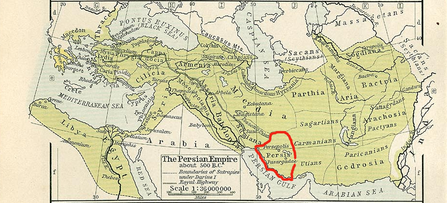
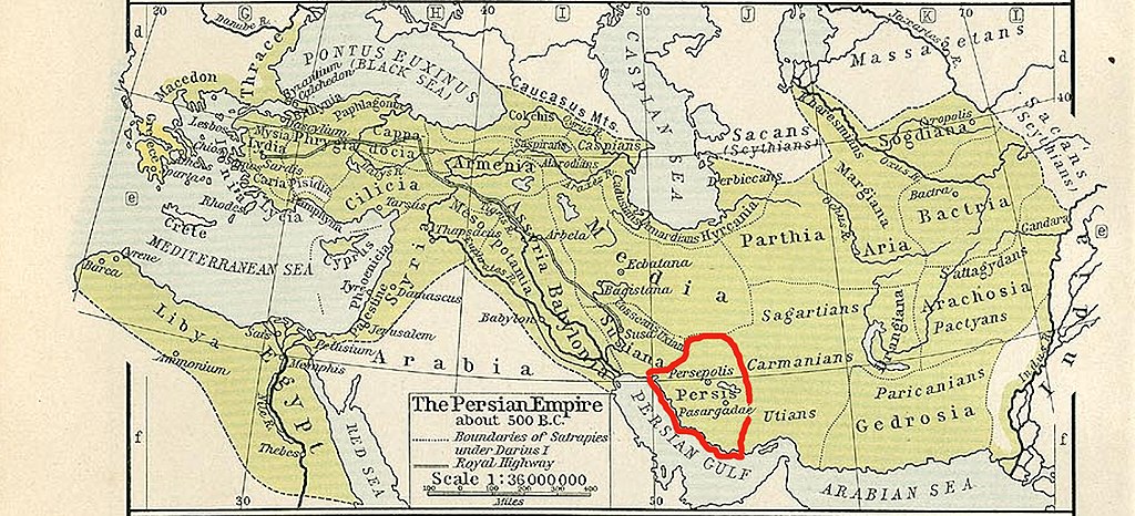
پەڕگە:Persis map.jpg
قەبارەی ئەم پێشبینینە: ٨٠٠ لە ٣٦٤ پیکسەڵ. ڕێزەلووشنەکانی تر: ٣٢٠ لە ١٤٦ پیکسەڵ | ٦٤٠ لە ٢٩١ پیکسەڵ | ١٬٠٢٤ لە ٤٦٦ پیکسەڵ | ١٬٨٤٦ لە ٨٤٠ پیکسەڵ.
پەڕگەی سەرەکی (١٬٨٤٦ × ٨٤٠ پیکسڵ، قەبارەی پەڕگە: ١٫٤٨ مێگابایت، جۆری ئێم ئای ئێم ئی: image/jpeg)
کورتە
| وەسف |
English: Persis map |
||||||||||||||||||||||
| ڕێکەوت | |||||||||||||||||||||||
| سەرچاوە |
This file was derived from: The Persian Empire, about 500 BC - Historical Athlas - William R. Shepherd - Henry Holt and Company, 1911.png |
||||||||||||||||||||||
| بەرھەمھێنەر |
|
||||||||||||||||||||||
مۆڵەتنامە
|
The author died in 1934, so this work is in the public domain in its country of origin and other countries and areas where the copyright term is the author's life plus 80 years or fewer. This work is in the public domain in the United States because it was published (or registered with the U.S. Copyright Office) before January 1, 1929. | |
| This file has been identified as being free of known restrictions under copyright law, including all related and neighboring rights. | |
مێژووی پەڕگە
کرتە بکە لەسەر یەکێک لە ڕێکەوت/کاتەکان بۆ بینینی پەڕگەکە بەو شێوەی لەو کاتەدا بووە.
| ڕێکەوت/کات | ھێما | ئەندازە | بەکارھێنەر | تێبینی | |
|---|---|---|---|---|---|
| هەنووکە | ٠٦:٥٧، ٢٨ی کانوونی یەکەمی ٢٠١٨ | | ١٬٨٤٦ لە ٨٤٠ (١٫٤٨ مێگابایت) | पाटलिपुत्र | User created page with UploadWizard |
بەکارھێنانی پەڕگە
ئەم پەڕەیە ئەم پەڕگەیە بەکار دەھێنێت:
بەکارھێنانی سەرانسەریی پەڕگە
ئەم ویکیانەی دیکەی خوارەوەش ئەم پەڕگە بەکاردێنن:
- بەکارھێنان لە bg.wikipedia.org
- بەکارھێنان لە cs.wikipedia.org
- بەکارھێنان لە en.wikipedia.org
- بەکارھێنان لە es.wikipedia.org
- بەکارھێنان لە fa.wikipedia.org
- بەکارھێنان لە id.wikipedia.org
- بەکارھێنان لە ru.wikipedia.org
- بەکارھێنان لە sk.wikipedia.org
- بەکارھێنان لە sl.wikipedia.org
- بەکارھێنان لە tr.wikipedia.org
- بەکارھێنان لە vi.wikipedia.org