
پەڕگە:Palestinian territories (West Bank and Gaza Strip) showing Israel's 1948 and 1967 borders.svg

Size of this PNG preview of this SVG file: ٤٢٤ لە ٦٠٠ پیکسەڵ. ڕێزەلووشنەکانی تر: ١٧٠ لە ٢٤٠ پیکسەڵ | ٣٣٩ لە ٤٨٠ پیکسەڵ | ٥٤٣ لە ٧٦٨ پیکسەڵ | ٧٢٤ لە ١٬٠٢٤ پیکسەڵ | ١٬٤٤٨ لە ٢٬٠٤٨ پیکسەڵ | ٧٤٤ لە ١٬٠٥٢ پیکسەڵ.
پەڕگەی سەرەکی (پەڕگەی SVG، بە ناو ٧٤٤ × ١٬٠٥٢ پیکسەڵ، قەبارەی پەڕگە: ٧٤ کیلۆبایت)
_showing_Israel%27s_1948_and_1967_borders.svg)
کورتە
| وەسف |
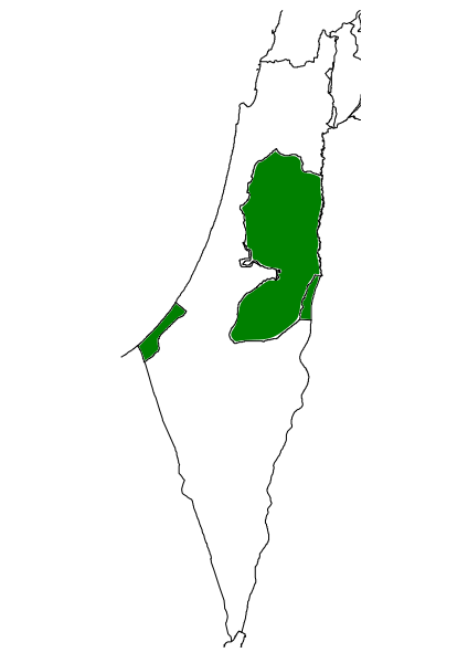
English: Palestinian territories (West Bank and Gaza Strip) showing Israel's 1948 and 1967 borders |
| ڕێکەوت | |
| سەرچاوە |
بەرھەمی خۆم. This file was derived from: |
| بەرھەمھێنەر | Oncenawhile |
| وەشانەکانی تر | File:Palestinian National Authority showing Israel's 1948 and 1967 borders.svg |
مۆڵەتنامە
من، ھەڵگری مافی لەبەرگرتنەوەی ئەم بەرھەمە، لەژێر ئەم مۆڵەتنامەیەدا بڵاوی دەکەمەوە:
| This file is made available under the Creative Commons CC0 1.0 Universal Public Domain Dedication. | |
| The person who associated a work with this deed has dedicated the work to the public domain by waiving all of their rights to the work worldwide under copyright law, including all related and neighboring rights, to the extent allowed by law. You can copy, modify, distribute and perform the work, even for commercial purposes, all without asking permission.
|
مێژووی پەڕگە
کرتە بکە لەسەر یەکێک لە ڕێکەوت/کاتەکان بۆ بینینی پەڕگەکە بەو شێوەی لەو کاتەدا بووە.
| ڕێکەوت/کات | ھێما | ئەندازە | بەکارھێنەر | تێبینی | |
|---|---|---|---|---|---|
| هەنووکە | ١٥:٣١، ٣٠ی ئازاری ٢٠١١ | | ٧٤٤ لە ١٬٠٥٢ (٧٤ کیلۆبایت) | Onceinawhile | {{Information |Description ={{en|1=Palestinian territories (West Bank and Gaza Strip) showing Israel's 1948 and 1967 borders}} |Source ={{own}} |Author =Oncenawhile |Date =2011-03-30 |Permission = |oth |
بەکارھێنانی پەڕگە
ئەم پەڕەیە ئەم پەڕگەیە بەکار دەھێنێت:
بەکارھێنانی سەرانسەریی پەڕگە
ئەم ویکیانەی دیکەی خوارەوەش ئەم پەڕگە بەکاردێنن:
- بەکارھێنان لە ar.wikipedia.org
- بەکارھێنان لە ast.wikipedia.org
- بەکارھێنان لە de.wikipedia.org
- بەکارھێنان لە en.wikipedia.org
- بەکارھێنان لە es.wikipedia.org
- بەکارھێنان لە gl.wikipedia.org
- بەکارھێنان لە ml.wikipedia.org
- بەکارھێنان لە pt.wikipedia.org
_showing_Israel%27s_1948_and_1967_borders.svg)