
پەڕگە:Meso2mil-English.JPG

Meso2mil-English.JPG (٥٧٧ × ٥٩٩ پیکسڵ، قەبارەی پەڕگە: ٥٥ کیلۆبایت، جۆری ئێم ئای ئێم ئی: image/jpeg)
کورتە
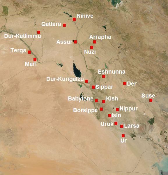
- La Mésopotamie au IIe millénaire av. J.-C.
- Mesopotamia in 2nd millennium BC

|
File:Mesopotamia in 2nd millennium BC.svg is a vector version of this file. It should be used in place of this JPG file when not inferior.
File:Meso2mil-English.JPG → File:Mesopotamia in 2nd millennium BC.svg
For more information, see Help:SVG. |
 |
Based on a recreation of Meso2mil.jpg as an SVG file (see Mesopotamia_in_2nd_millennium_BC.svg), translating names to English. This JPG is a rendering of the above-linked SVG file as displayed in Google Chrome 17 on Windows 7.
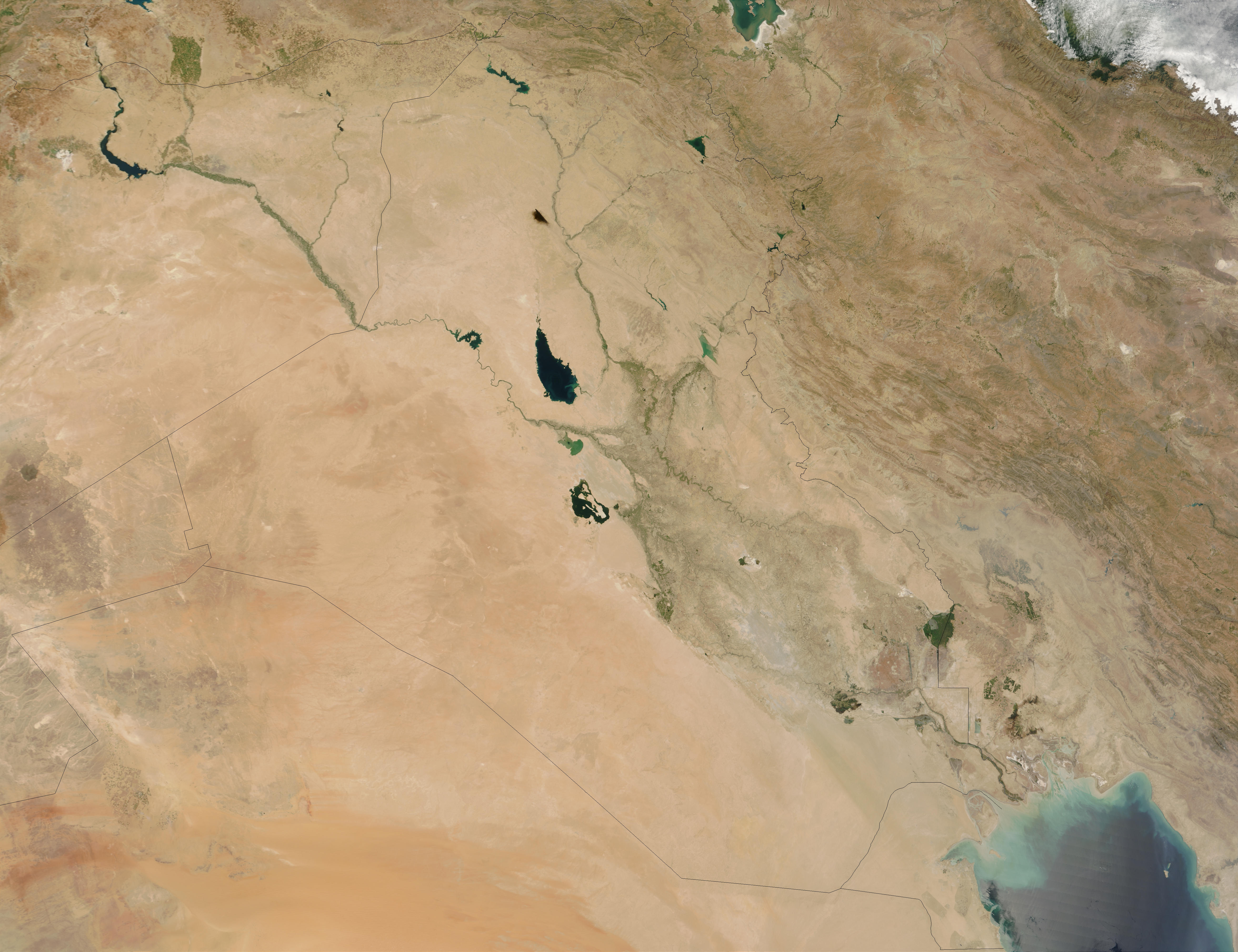
Derived from NASA Satellite imagery (2MB JPEG) (linking page), used under NASA's Terms of Use
Follows other published maps of Mesopotamian cities, such as the map by Kessler (2012) and the interactive map by Lendering (2004).
Landmarks
This map marks and captions the following cities, listed from top to bottom:
- Nineveh
- Qattara
- Dūr-Katlimmu
- Assur
- Arrapha
- Terqa
- Nuzi
- Mari
- Eshnunna
- Dur-Kurigalzu
- Der
- Sippar
- Babylon
- Kish
- Susa
- Borsippa
- Nippur
- Isin
- Uruk
- Larsa
- Ur
Notes
Map overlaps with Media:Meso2mil.JPG.

مۆڵەتنامە
- تۆ ئازادی:
- بۆ بڵاکردنەوە – بۆ کۆپی کردن، دابەشکردن و دەستبەدەست ناردنی
- بۆ تێکەڵکردنەوە – بۆ سازاندنی کارەکە
- بەم مەرجانەی خوارەوە:
- دانەپاڵ – پێویستە باوەڕی گونجاو بدەیت، بەستەرێک بۆ مۆڵەتەکە دابین بکەیت و ئاماژە بەوە بکەیت کە ئایا گۆڕانکاری کراوە یان نا. دەتوانیت بە هەر شێوەیەکی گونجاو ئەوە بکەیت، بەڵام بە شێوەیەک نا کە وا دەربکەوێت کە مۆڵەتدەر پشتگیری تۆ یان بەکارهێنانەکەت بکات.
- بڵاوکردنەوەی گونجاو – ئەگەر لەسەر بنەمای ئەم کارە تێکەڵ، گۆڕان، یان ساز بکەی، پێویستە بەشدارییەکانت بە هەمان مۆڵەت یان هاوشێوەی مۆڵەتی ئەسڵی دابەش بکەی.
مێژووی پەڕگە
کرتە بکە لەسەر یەکێک لە ڕێکەوت/کاتەکان بۆ بینینی پەڕگەکە بەو شێوەی لەو کاتەدا بووە.
| ڕێکەوت/کات | ھێما | ئەندازە | بەکارھێنەر | تێبینی | |
|---|---|---|---|---|---|
| هەنووکە | ٠٦:١٧، ٢٠ی شوباتی ٢٠١٢ | | ٥٧٧ لە ٥٩٩ (٥٥ کیلۆبایت) | Joeyhewitt | Recreated as an SVG file (see http://commons.wikimedia.org/wiki/File:Mesopotamia_in_2nd_millennium_BC.svg), translating names to English. Where the names from the original version differed, they are retained in the SVG as a French localization which is di |
بەکارھێنانی پەڕگە
ئەم پەڕەیە ئەم پەڕگەیە بەکار دەھێنێت:
بەکارھێنانی سەرانسەریی پەڕگە
ئەم ویکیانەی دیکەی خوارەوەش ئەم پەڕگە بەکاردێنن:
- بەکارھێنان لە am.wikipedia.org
- بەکارھێنان لە ar.wikipedia.org
- بەکارھێنان لە azb.wikipedia.org
- بەکارھێنان لە az.wikipedia.org
- بەکارھێنان لە ba.wikipedia.org
- بەکارھێنان لە bn.wikipedia.org
- بەکارھێنان لە ceb.wikipedia.org
- بەکارھێنان لە dag.wikipedia.org
- بەکارھێنان لە el.wikipedia.org
- بەکارھێنان لە en.wikipedia.org
- Uruk
- Karbala
- Nabopolassar
- Nabonidus
- Sinsharishkun
- Assur
- Šamaš-šuma-ukin
- Arrapha
- Neo-Babylonian Empire
- List of revolutions and rebellions
- List of cities of the ancient Near East
- Revolt of Babylon (626 BC)
- Terqa
- Kar-Tukulti-Ninurta
- List of conflicts in Iraq
- Ibal-pi-el II
- User:Falcaorib
- User:Northamerica1000/Topics
- Babylonian revolts (484 BC)
- User:A.X.Wiki.Editor/Uruk
- بەکارھێنان لە en.wikivoyage.org
- بەکارھێنان لە es.wikipedia.org
- بەکارھێنان لە fa.wikipedia.org
- بەکارھێنان لە fr.wikipedia.org
- بەکارھێنان لە fy.wikipedia.org
- بەکارھێنان لە ha.wikipedia.org
- بەکارھێنان لە id.wikipedia.org
- بەکارھێنان لە it.wikipedia.org
بینینی بەکارھێنانی گشتی زیاتری ئەم پەڕگەیە.