
پەڕگە:Map of Cyrenaica.png

قەبارەی ئەم پێشبینینە: ٨٠٠ لە ٥٤٣ پیکسەڵ. ڕێزەلووشنەکانی تر: ٣٢٠ لە ٢١٧ پیکسەڵ | ٦٤٠ لە ٤٣٤ پیکسەڵ | ٩١٨ لە ٦٢٣ پیکسەڵ.
پەڕگەی سەرەکی (٩١٨ × ٦٢٣ پیکسڵ، قەبارەی پەڕگە: ٩٢ کیلۆبایت، جۆری ئێم ئای ئێم ئی: image/png)
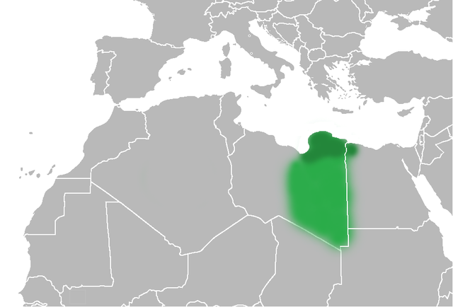
| وەسف | The Ottoman Turks conquered the country in the mid-16th century, and the three States or "Wilayat" of Tripolitania, Cyrenaica and Fezzan (which make up Libya) remained part of their empire with the exception of the virtual autonomy of the Karamanlis. The Karamanlis ruled from 1711 until 1835 mainly in Tripolitania, but had influence in Cyrenaica and Fezzan as well by the mid 18th century. |
| ڕێکەوت | (UTC) |
| سەرچاوە | |
| بەرھەمھێنەر |
|
| وەشانەکانی تر | File:Map of Cyrenaica.svg |
.png)
| This is a retouched picture, which means that it has been digitally altered from its original version. Modifications: changes of area Cyrenaica. The original can be viewed here: Ottoman Provinces Of Present day Libyapng.png:
|
| من، هەڵگری مافی لەبەرگرتنەوەی ئەم بەرھەمە، ئەم بەرھەمە بڵاودەکەمەوە بۆ پاوانی گشتی (public domain). ئەم مافە بۆ سەرانسەری جیھانە. لە ھەندێ وڵاتدا لەوانەیە یاسا، ڕێگە بەمە نەدات؛ لەو کاتەدا: من مافی بەکارھێنانی ئەم بەرھەمە بۆ ھەر مەبەستێک دەبەخشم بە ھەموو کەسێک، بێ ھیچ مەرجێک، مەگەر ئەو چەشنە مەرجانە کە یاسا ھەبوونیانی بە پێویستی بزانێت. |
Original upload log
This image is a derivative work of the following images:
- File:United_States_of_North_Africa_Locator.png licensed with PD-self
- 2010-03-26T13:53:08Z Roxanna 1160x1056 (29795 Bytes) {{Information |Description={{en|1="United States of North Africa" (proposal by President [[en:Habib Bourguiba]] for Tunisia, Algeria and Libya 1973) and "Arab Islamic Republic" (proposal by [[en:Muammar al-Gaddafi]] for a uni
- File:Ottoman_Provinces_Of_Present_day_Libyapng.png licensed with PD-self
Uploaded with derivativeFX
مێژووی پەڕگە
کرتە بکە لەسەر یەکێک لە ڕێکەوت/کاتەکان بۆ بینینی پەڕگەکە بەو شێوەی لەو کاتەدا بووە.
| ڕێکەوت/کات | ھێما | ئەندازە | بەکارھێنەر | تێبینی | |
|---|---|---|---|---|---|
| هەنووکە | ٢٠:٥١، ١ی تەممووزی ٢٠١٠ | | ٩١٨ لە ٦٢٣ (٩٢ کیلۆبایت) | Felitsata | change of border |
| ٢٠:٣٣، ١ی تەممووزی ٢٠١٠ |  | ٩١٨ لە ٦٢٣ (٩٣ کیلۆبایت) | Felitsata | {{Information |Description={{en|1="United States of North Africa" (proposal by President [http://en.wikipedia.org/wiki/Habib_Bourguiba Habib Bourguiba] for Tunisia, Algeria and Libya 1973) and "Arab Islamic Republic" (proposal by [http://en.wikipedia.org/ |
بەکارھێنانی پەڕگە
ھیچ پەڕەیەک نییە کە ئەم پەڕگەیە بەکاربھێنێت.
بەکارھێنانی سەرانسەریی پەڕگە
ئەم ویکیانەی دیکەی خوارەوەش ئەم پەڕگە بەکاردێنن:
- بەکارھێنان لە bg.wikipedia.org
- بەکارھێنان لە bn.wikipedia.org
- بەکارھێنان لە en.wikipedia.org
- بەکارھێنان لە es.wikipedia.org
- بەکارھێنان لە fa.wikipedia.org
- بەکارھێنان لە fi.wikipedia.org
- بەکارھێنان لە he.wikipedia.org
- بەکارھێنان لە hr.wikipedia.org
- بەکارھێنان لە hy.wikipedia.org
- بەکارھێنان لە inh.wikipedia.org
- بەکارھێنان لە it.wikipedia.org
- بەکارھێنان لە ja.wikipedia.org
- بەکارھێنان لە ko.wikipedia.org
- بەکارھێنان لە la.wiktionary.org
- بەکارھێنان لە nn.wikipedia.org
- بەکارھێنان لە pl.wiktionary.org
- بەکارھێنان لە ro.wikipedia.org
- بەکارھێنان لە ru.wikipedia.org
- بەکارھێنان لە sh.wikipedia.org
- بەکارھێنان لە sl.wikipedia.org
- بەکارھێنان لە sr.wikipedia.org
- بەکارھێنان لە th.wikipedia.org
- بەکارھێنان لە tr.wikipedia.org
- بەکارھێنان لە uk.wikipedia.org