
پەڕگە:Mali2 location map.svg

پەڕگەی سەرەکی (پەڕگەی SVG، بە ناو ١٬٦٤٤ × ١٬٥٦٨ پیکسەڵ، قەبارەی پەڕگە: ٢٩٧ کیلۆبایت)
کورتە
| وەسف |
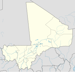
Deutsch: Positionskarte von Mali
Quadratische Plattkarte, N-S-Streckung 105 %. Geographische Begrenzung der Karte:
English: Location map of Mali
Equirectangular projection, N/S stretching 105 %. Geographic limits of the map:
|
||
| ڕێکەوت | |||
| سەرچاوە |
بەرھەمی خۆم, using
|
||
| بەرھەمھێنەر | NordNordWest | ||
| ڕێپێدان (بەکارھێنانەوەی ئەم پەڕگەیە) |
This file is licensed under the Creative Commons Attribution-Share Alike 3.0 Germany license.
 This file is licensed under the Creative Commons Attribution-Share Alike 3.0 Germany license.
|
||
| وەشانەکانی تر |
|
||
| SVG genesis | This map was created with Adobe Illustrator.
|


مێژووی پەڕگە
کرتە بکە لەسەر یەکێک لە ڕێکەوت/کاتەکان بۆ بینینی پەڕگەکە بەو شێوەی لەو کاتەدا بووە.
| ڕێکەوت/کات | ھێما | ئەندازە | بەکارھێنەر | تێبینی | |
|---|---|---|---|---|---|
| هەنووکە | ١٤:٥٢، ٢٢ی ئازاری ٢٠١٠ | | ١٬٦٤٤ لە ١٬٥٦٨ (٢٩٧ کیلۆبایت) | NordNordWest | c |
| ١٠:٥٧، ٢٢ی ئازاری ٢٠١٠ |  | ١٬٦٤٤ لە ١٬٥٦٨ (٢٩٦ کیلۆبایت) | NordNordWest | c | |
| ١٧:٤٣، ٢١ی ئازاری ٢٠١٠ |  | ١٬٦٤٤ لە ١٬٥٦٨ (٢٩٥ کیلۆبایت) | NordNordWest | =={{int:filedesc}}== {{Information |Description= {{de|Positionskarte von Mali}} Quadratische Plattkarte, N-S-Streckung 105 %. Geographische Begrenzung der Karte: * N: 25.5° N * S: 9.7° N * W: 12.6° W * O: 4.8° O {{en|Location map of [[:en |
بەکارھێنانی پەڕگە
ئەم پەڕەیە ئەم پەڕگەیە بەکار دەھێنێت:
بەکارھێنانی سەرانسەریی پەڕگە
ئەم ویکیانەی دیکەی خوارەوەش ئەم پەڕگە بەکاردێنن:
- بەکارھێنان لە ceb.wikipedia.org
- Plantilya:Location map Mali
- Tori
- Toyla
- Kaina
- Bala
- Tala
- Malala (pagklaro)
- Mbali
- Kombo
- Danga
- Leba
- Wango
- Koya
- Kifa
- Koroma
- Inis
- Loloro
- Garia
- Tarach
- Dogora
- Sola
- Bango
- Kita
- Bara (pagklaro)
- Koble
- Zina
- Agarak
- Tanda
- Mola (pagklaro)
- Teze
- Samba (pagklaro)
- Zombo
- Gamba
- Lenga
- Go
- Bondo
- Diadia
- Bamba
- Ba (pagklaro)
- Nena
- Gué
- Gue
- Bale
- Massa
- Tite
- Roy
- Bone
- Erna (pagklaro)
- Kobila
- Koba
بینینی بەکارھێنانی گشتی زیاتری ئەم پەڕگەیە.