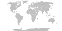
پەڕگە:Island nations.svg

Size of this PNG preview of this SVG file: ٨٠٠ لە ٤١١ پیکسەڵ. ڕێزەلووشنەکانی تر: ٣٢٠ لە ١٦٤ پیکسەڵ | ٦٤٠ لە ٣٢٩ پیکسەڵ | ١٬٠٢٤ لە ٥٢٦ پیکسەڵ | ١٬٢٨٠ لە ٦٥٧ پیکسەڵ | ٢٬٥٦٠ لە ١٬٣١٤ پیکسەڵ | ٨٦٣ لە ٤٤٣ پیکسەڵ.
پەڕگەی سەرەکی (پەڕگەی SVG، بە ناو ٨٦٣ × ٤٤٣ پیکسەڵ، قەبارەی پەڕگە: ١٫٥٥ مێگابایت)
مێژووی پەڕگە
کرتە بکە لەسەر یەکێک لە ڕێکەوت/کاتەکان بۆ بینینی پەڕگەکە بەو شێوەی لەو کاتەدا بووە.
| ڕێکەوت/کات | ھێما | ئەندازە | بەکارھێنەر | تێبینی | |
|---|---|---|---|---|---|
| هەنووکە | ١١:١٥، ٢٥ی ئەیلوولی ٢٠٢٣ |  | ٨٦٣ لە ٤٤٣ (١٫٥٥ مێگابایت) | Seabourn101 | Reverted to version as of 22:34, 31 May 2023 (UTC) |
| ١٨:٥٥، ١٢ی ئەیلوولی ٢٠٢٣ |  | ٨٦٣ لە ٤٤٣ (١٫٥٥ مێگابایت) | Taekhosong | Reverted to version as of 09:33, 1 August 2018 (UTC) | |
| ٢٢:٣٤، ٣١ی ئایاری ٢٠٢٣ |  | ٨٦٣ لە ٤٤٣ (١٫٥٥ مێگابایت) | Przemub | Reverted to version as of 16:20, 5 April 2023 (UTC). Another land border there is the one with Akrotiri and Dhekelia, which is internationally recognised. | |
| ٠٨:٢٧، ٧ی نیسانی ٢٠٢٣ |  | ٨٦٣ لە ٤٤٣ (١٫٥٩ مێگابایت) | Discombobulates | Cyprus shouldn't have a land border, the TRNC is recognised only by one country, its occupier | |
| ١٦:٢٠، ٥ی نیسانی ٢٠٢٣ |  | ٨٦٣ لە ٤٤٣ (١٫٥٥ مێگابایت) | Jeffhardyfan08 | wrong file | |
| ١٦:٢٠، ٥ی نیسانی ٢٠٢٣ |  | ١٬٠٠٠ لە ٥١٤ (٢٧ کیلۆبایت) | Jeffhardyfan08 | Added Greenland | |
| ٠٦:٣٨، ٢٥ی نیسانی ٢٠٢٢ |  | ٨٦٣ لە ٤٤٣ (١٫٥٥ مێگابایت) | Seabourn101 | Reverted to version as of 15:08, 1 September 2018 (UTC)- revert Unexplained reversion | |
| ٠٤:٢٦، ٢٠ی نیسانی ٢٠٢٢ |  | ٨٦٣ لە ٤٤٣ (١٫٥٥ مێگابایت) | Vodi.Dino.Eri | Reverted to version as of 20:31, 18 December 2015 (UTC) | |
| ١٥:٠٨، ١ی ئەیلوولی ٢٠١٨ |  | ٨٦٣ لە ٤٤٣ (١٫٥٥ مێگابایت) | 行到水穷处 | Reverted to version as of 16:05, 15 August 2018 (UTC) (as discussed) | |
| ١٤:٠٥، ١ی ئەیلوولی ٢٠١٨ |  | ٨٦٣ لە ٤٤٣ (١٫٥٥ مێگابایت) | 行到水穷处 | Reverted to version as of 09:33, 1 August 2018 (UTC) (No specific comment is provided for the last edit) |
بەکارھێنانی پەڕگە
ئەم پەڕەیە ئەم پەڕگەیە بەکار دەھێنێت:
بەکارھێنانی سەرانسەریی پەڕگە
ئەم ویکیانەی دیکەی خوارەوەش ئەم پەڕگە بەکاردێنن:
- بەکارھێنان لە af.wikipedia.org
- بەکارھێنان لە ar.wikipedia.org
- بەکارھێنان لە az.wikipedia.org
- بەکارھێنان لە bn.wikipedia.org
- بەکارھێنان لە bs.wikipedia.org
- بەکارھێنان لە ca.wikipedia.org
- بەکارھێنان لە da.wikipedia.org
- بەکارھێنان لە de.wikipedia.org
- بەکارھێنان لە en.wikipedia.org
- بەکارھێنان لە eo.wikipedia.org
- بەکارھێنان لە et.wikipedia.org
- بەکارھێنان لە eu.wikipedia.org
- بەکارھێنان لە fa.wikipedia.org
- بەکارھێنان لە fa.wikibooks.org
- بەکارھێنان لە fi.wikipedia.org
- بەکارھێنان لە fr.wikipedia.org
- بەکارھێنان لە fr.wiktionary.org
- بەکارھێنان لە gag.wikipedia.org
- بەکارھێنان لە gl.wikipedia.org
- بەکارھێنان لە he.wikipedia.org
- بەکارھێنان لە hi.wikipedia.org
- بەکارھێنان لە hu.wikipedia.org
- بەکارھێنان لە ia.wikipedia.org
- بەکارھێنان لە id.wikipedia.org
- بەکارھێنان لە ig.wikipedia.org
- بەکارھێنان لە ilo.wikipedia.org
- بەکارھێنان لە inh.wikipedia.org
- بەکارھێنان لە is.wiktionary.org
- بەکارھێنان لە it.wikipedia.org
- بەکارھێنان لە ja.wikipedia.org
- بەکارھێنان لە ko.wikipedia.org
- بەکارھێنان لە la.wikipedia.org
- بەکارھێنان لە lld.wikipedia.org
بینینی بەکارھێنانی گشتی زیاتری ئەم پەڕگەیە.


