
پەڕگە:Ecuador Galápagos Islands location map.svg

Size of this PNG preview of this SVG file: ٥٢٩ لە ٦٠٠ پیکسەڵ. ڕێزەلووشنەکانی تر: ٢١٢ لە ٢٤٠ پیکسەڵ | ٤٢٣ لە ٤٨٠ پیکسەڵ | ٦٧٧ لە ٧٦٨ پیکسەڵ | ٩٠٣ لە ١٬٠٢٤ پیکسەڵ | ١٬٨٠٦ لە ٢٬٠٤٨ پیکسەڵ | ٨٥٠ لە ٩٦٤ پیکسەڵ.
پەڕگەی سەرەکی (پەڕگەی SVG، بە ناو ٨٥٠ × ٩٦٤ پیکسەڵ، قەبارەی پەڕگە: ٤٥ کیلۆبایت)
کورتە
| وەسف |
Quadratische Plattkarte. Geographische Begrenzung der Karte:
Equirectangular projection. Geographic limits of the map:
|
| ڕێکەوت | ٢ی ئازاری ٢٠٠٩ (upload date) |
| سەرچاوە |
own work, using
|
| بەرھەمھێنەر | NordNordWest |
| وەشانەکانی تر | Derivative works of this file: Galapagos Simple Map.png |

|
This map has been made or improved in the German Kartenwerkstatt (Map Lab). You can propose maps to improve as well.
|
مۆڵەتنامە
من، ھەڵگری مافی لەبەرگرتنەوەی ئەم بەرھەمە، لەژێر ئەم مۆڵەتنامەیانەدا بڵاوی دەکەمەوە:

|
ڕێگەدراوە بە لەبەرگرتنەوە، دابەشکردن ھەروەھا/یان سازاندنی ئەم بەڵگەنامەیە لەژێر مەرجی مۆڵەتی GNU بۆ بەڵگەنامەی ئازاد، وەشانی ١.٢ یان ھەر وەشانێکی تری دواتر کە بڵاوکراوەتەوە لەلایەن دامەزراوەی بەرنامەی ئازاد، بەبێ ھیچ بەشێکی جیاواز، بەبێ نووسین لەسەر بەرگی پێشەوە و دواوەی. وێنەیەک لەمۆڵەتەکە لە بەشێکدا ھەیە کە ناوی مۆڵەتی GNU بۆ بەڵگەنامەی ئازادە. |
This file is licensed under the Creative Commons Attribution 3.0 Unported license.
- تۆ ئازادی:
- بۆ بڵاکردنەوە – بۆ کۆپی کردن، دابەشکردن و دەستبەدەست ناردنی
- بۆ تێکەڵکردنەوە – بۆ سازاندنی کارەکە
- بەم مەرجانەی خوارەوە:
- دانەپاڵ – پێویستە باوەڕی گونجاو بدەیت، بەستەرێک بۆ مۆڵەتەکە دابین بکەیت و ئاماژە بەوە بکەیت کە ئایا گۆڕانکاری کراوە یان نا. دەتوانیت بە هەر شێوەیەکی گونجاو ئەوە بکەیت، بەڵام بە شێوەیەک نا کە وا دەربکەوێت کە مۆڵەتدەر پشتگیری تۆ یان بەکارهێنانەکەت بکات.
دەتوانی مۆڵەتنامەی دڵخوازت ھەڵبژێریت.
مێژووی پەڕگە
کرتە بکە لەسەر یەکێک لە ڕێکەوت/کاتەکان بۆ بینینی پەڕگەکە بەو شێوەی لەو کاتەدا بووە.
| ڕێکەوت/کات | ھێما | ئەندازە | بەکارھێنەر | تێبینی | |
|---|---|---|---|---|---|
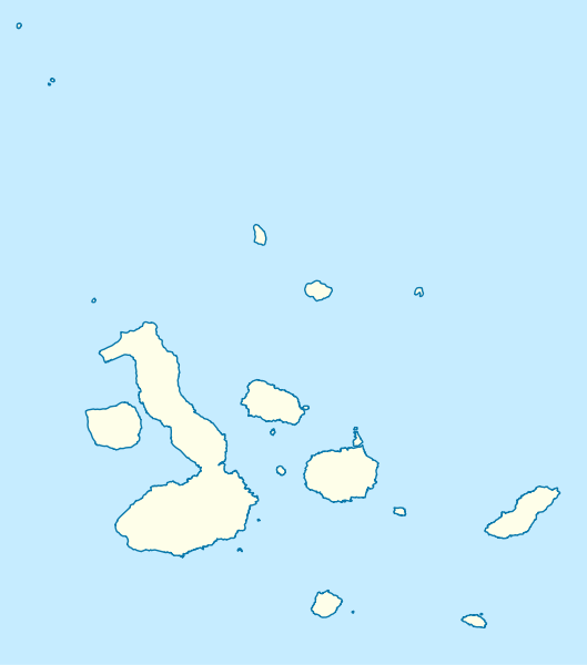
| هەنووکە | ١٤:٣٢، ٢ی ئازاری ٢٠٠٩ | | ٨٥٠ لە ٩٦٤ (٤٥ کیلۆبایت) | NordNordWest | {{Information |Description= {{de|Positionskarte der Galápagos-Inseln, Ecuador}} Quadratische Plattkarte. Geographische Begrenzung der Karte: * N: 1.8° N * S: 1.6° S * W: 92.1° W * O: 89.1° W {{en|Location map |
بەکارھێنانی پەڕگە
ئەم پەڕەیە ئەم پەڕگەیە بەکار دەھێنێت:
بەکارھێنانی سەرانسەریی پەڕگە
ئەم ویکیانەی دیکەی خوارەوەش ئەم پەڕگە بەکاردێنن:
- بەکارھێنان لە ar.wikipedia.org
- بەکارھێنان لە ast.wikipedia.org
- بەکارھێنان لە be.wikipedia.org
- بەکارھێنان لە bg.wikipedia.org
- بەکارھێنان لە bs.wikipedia.org
- بەکارھێنان لە ceb.wikipedia.org
- بەکارھێنان لە cs.wikipedia.org
- Šablona:LocMap Galapágy
- Wikipedie:WikiProjekt Česko-slovenská Wikipedie/Přeložené články/2014-02/Galerie
- Alcedo (sopka)
- Cerro Azul (Galapágy)
- Darwin (sopka)
- Ecuador (sopka)
- Fernandina
- Genovesa
- Marchena (ostrov)
- Pinta (ostrov)
- San Cristóbal (ostrov)
- Santiago (Galapágy)
- Sierra Negra (sopka)
- Wolf (sopka)
- Puerto Baquerizo Moreno
- Isabela (Galapágy)
- La Cumbre
- بەکارھێنان لە da.wikipedia.org
- بەکارھێنان لە de.wikipedia.org
- بەکارھێنان لە en.wikipedia.org
بینینی بەکارھێنانی گشتی زیاتری ئەم پەڕگەیە.