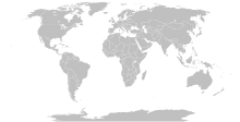
پەڕگە:BlankMap-World-Compact.svg

Size of this PNG preview of this SVG file: ٨٠٠ لە ٣٥٤ پیکسەڵ. ڕێزەلووشنەکانی تر: ٣٢٠ لە ١٤٢ پیکسەڵ | ٦٤٠ لە ٢٨٤ پیکسەڵ | ١٬٠٢٤ لە ٤٥٤ پیکسەڵ | ١٬٢٨٠ لە ٥٦٧ پیکسەڵ | ٢٬٥٦٠ لە ١٬١٣٤ پیکسەڵ.
پەڕگەی سەرەکی (پەڕگەی SVG، بە ناو ٢٬٥٦٠ × ١٬١٣٤ پیکسەڵ، قەبارەی پەڕگە: ١٫٠١ مێگابایت)
مێژووی پەڕگە
کرتە بکە لەسەر یەکێک لە ڕێکەوت/کاتەکان بۆ بینینی پەڕگەکە بەو شێوەی لەو کاتەدا بووە.
| ڕێکەوت/کات | ھێما | ئەندازە | بەکارھێنەر | تێبینی | |
|---|---|---|---|---|---|
| هەنووکە | ١٢:٥٦، ١١ی تشرینی یەکەمی ٢٠٢٣ |  | ٢٬٥٦٠ لە ١٬١٣٤ (١٫٠١ مێگابایت) | Yodin | Latest version is minified, and no longer easily text-editable; Reverted to version as of 14:50, 16 March 2019 (UTC) |
| ١٧:٠٧، ١٠ی تشرینی یەکەمی ٢٠٢٣ |  | ٥١٢ لە ٢٢٧ (٧٥٤ کیلۆبایت) | Ahmed0arafat | fix african countries count to 54 | |
| ١٤:٥٠، ١٦ی ئازاری ٢٠١٩ |  | ٢٬٥٦٠ لە ١٬١٣٤ (١٫٠١ مێگابایت) | Gomoloko | I corrected Transnistria tag showing in a larger area than it should, instead of Moldova | |
| ٠٧:٠٩، ١١ی ئازاری ٢٠١٩ |  | ٢٬٥٦٠ لە ١٬١٣٤ (١٫٠١ مێگابایت) | Gomoloko | I corrected West Bank (State of Palestine) name not showing when the mouse was over the area | |
| ٠٠:٥١، ١١ی ئازاری ٢٠١٩ |  | ٢٬٥٦٠ لە ١٬١٣٤ (١٫٠١ مێگابایت) | Gomoloko | last change :) Gambia, Republic of The | |
| ٠٠:٢٥، ١١ی ئازاری ٢٠١٩ |  | ٢٬٥٦٠ لە ١٬١٣٤ (١٫٠١ مێگابایت) | Gomoloko | I reverted all changes and made only the following according to www.un.org : North Macedonia, United States of America, Eswatini, United Kingdom of Great Britain and Northern Ireland, Cabo Verde | |
| ٢١:٠٢، ١٠ی ئازاری ٢٠١٩ |  | ٢٬٥٦٠ لە ١٬١٣٤ (١٫٠١ مێگابایت) | Gomoloko | North Macedonia, Republic of _ Congo, Democratic Republic of the _ Kyrgyz Republic _ Vietnam, Socialist Republic of _ China, People's Republic of _ United States of America _ Eswatini, Kingdom of _ Cabo Verde, Republic of | |
| ٢١:٥٥، ١٠ی شوباتی ٢٠١٨ |  | ٢٬٥٦٠ لە ١٬١٣٤ (١٫٠١ مێگابایت) | Fibonacci | Updated the map with land and water outlines from the original. | |
| ١٩:٣٢، ٢٥ی ئابی ٢٠١٢ |  | ٩٤٠ لە ٤١٥ (١٫٤٥ مێگابایت) | Kpengboy | Reverted to version as of 16:35, 13 February 2012 (there's a reason the code wasn't "optimised". re-add transparency if you think it's better) | |
| ٢٠:٥٧، ١٧ی نیسانی ٢٠١٢ |  | ٩٤٠ لە ٤١٥ (٨١٨ کیلۆبایت) | Fred the Oyster | Corrected my faux pas with the upper and lower margins |
بەکارھێنانی پەڕگە
ھیچ پەڕەیەک نییە کە ئەم پەڕگەیە بەکاربھێنێت.
بەکارھێنانی سەرانسەریی پەڕگە
ئەم ویکیانەی دیکەی خوارەوەش ئەم پەڕگە بەکاردێنن:
- بەکارھێنان لە de.wikipedia.org
- بەکارھێنان لە en.wikipedia.org
- بەکارھێنان لە fr.wikipedia.org
- بەکارھێنان لە zh.wikipedia.org


