
پەڕگە:Balkan-range-satellite.jpg

قەبارەی ئەم پێشبینینە: ٨٠٠ لە ٥٦٢ پیکسەڵ. ڕێزەلووشنەکانی تر: ٣٢٠ لە ٢٢٥ پیکسەڵ | ٦٤٠ لە ٤٥٠ پیکسەڵ | ١٬٠٢٤ لە ٧١٩ پیکسەڵ | ١٬٢٨٠ لە ٨٩٩ پیکسەڵ | ٢٬٣٧٩ لە ١٬٦٧١ پیکسەڵ.
پەڕگەی سەرەکی (٢٬٣٧٩ × ١٬٦٧١ پیکسڵ، قەبارەی پەڕگە: ٦٩١ کیلۆبایت، جۆری ئێم ئای ئێم ئی: image/jpeg)
کورتە
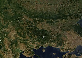
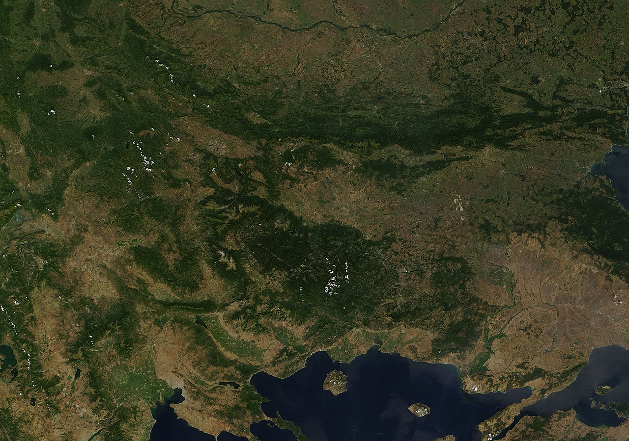
| وەسف | Satellite image of the Balkan mountains (Stara Planina). The mountain range is running across the territory of Bulgaria. |
| سەرچاوە | NASA, Image:Satellite image of Greece.jpg |
| بەرھەمھێنەر | User:Introvert |
| ڕێپێدان (بەکارھێنانەوەی ئەم پەڕگەیە) |
Original image from NASA, cropped Image:Satellite image of Greece.jpg |
مۆڵەتنامە
| This file is in the public domain in the United States because it was solely created by NASA. NASA copyright policy states that "NASA material is not protected by copyright unless noted". (See Template:PD-USGov, NASA copyright policy page or JPL Image Use Policy.) | ||
 |
Warnings:
|
مێژووی پەڕگە
کرتە بکە لەسەر یەکێک لە ڕێکەوت/کاتەکان بۆ بینینی پەڕگەکە بەو شێوەی لەو کاتەدا بووە.
| ڕێکەوت/کات | ھێما | ئەندازە | بەکارھێنەر | تێبینی | |
|---|---|---|---|---|---|
| هەنووکە | ٢٣:٣٨، ٢١ی کانوونی یەکەمی ٢٠٠٥ | | ٢٬٣٧٩ لە ١٬٦٧١ (٦٩١ کیلۆبایت) | Introvert | {{Information| |Description=Satellite image of the Balkan mountains (Stara Planina). The moutain range is running across the territory of Bulgaria. |Source=NASA |Date= |Author=User:Introvert |Permission=Original image from NASA, cropped |other |
بەکارھێنانی پەڕگە
ئەم پەڕەیە ئەم پەڕگەیە بەکار دەھێنێت:
بەکارھێنانی سەرانسەریی پەڕگە
ئەم ویکیانەی دیکەی خوارەوەش ئەم پەڕگە بەکاردێنن:
- بەکارھێنان لە arz.wikipedia.org
- بەکارھێنان لە ast.wikipedia.org
- بەکارھێنان لە az.wikipedia.org
- بەکارھێنان لە ba.wikipedia.org
- بەکارھێنان لە be.wikipedia.org
- بەکارھێنان لە br.wikipedia.org
- بەکارھێنان لە ca.wikipedia.org
- بەکارھێنان لە ceb.wikipedia.org
- بەکارھێنان لە da.wikipedia.org
- بەکارھێنان لە eo.wikipedia.org
- بەکارھێنان لە eo.wikiquote.org
- بەکارھێنان لە eu.wikipedia.org
- بەکارھێنان لە fr.wikinews.org
- بەکارھێنان لە fr.wikivoyage.org
- بەکارھێنان لە ga.wikipedia.org
- بەکارھێنان لە ia.wikipedia.org
- بەکارھێنان لە kab.wikipedia.org
- بەکارھێنان لە kcg.wikipedia.org
- بەکارھێنان لە ku.wikipedia.org
- بەکارھێنان لە sv.wikipedia.org
- بەکارھێنان لە tg.wikipedia.org
- بەکارھێنان لە tt.wikipedia.org
- بەکارھێنان لە vec.wikipedia.org
- بەکارھێنان لە www.wikidata.org