
پەڕگە:Wheatbelt panorama-2.JPG

قەبارەی ئەم پێشبینینە: ٨٠٠ لە ١٧٢ پیکسەڵ. ڕێزەلووشنەکانی تر: ٣٢٠ لە ٦٩ پیکسەڵ | ٦٤٠ لە ١٣٧ پیکسەڵ | ٢٬٩٩٥ لە ٦٤٣ پیکسەڵ.
پەڕگەی سەرەکی (٢٬٩٩٥ × ٦٤٣ پیکسڵ، قەبارەی پەڕگە: ٥٦٢ کیلۆبایت، جۆری ئێم ئای ئێم ئی: image/jpeg)
| وەسف |
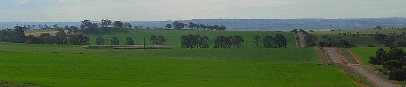
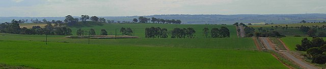
English: Scenery of the Wheatbelt region looking North from Centenary Hill, near the corner of Southern Brook & Habgood Roads, east of Northam, Western Australia. |
| ڕێکەوت | |
| سەرچاوە | uploaded by photographer |
| بەرھەمھێنەر | JarrahTree |
| وەشانەکانی تر |
|
| Camera location | | View this and other nearby images on: OpenStreetMap |
|---|
I User:JarrahTree hereby publish Wheatbelt panorama-2.JPG under Creative Commons Attribution 2.5 Australia License
Attribution requirement;
Photographs by JarrahTree...commons.wikimedia.org
| process functionality required template |
|---|
| process functionality requires a generic template that best reflected image licensing as prescribed above on the 13 September 2012, where there is any difference/conflict/decrepency between what is described above as the image license and this template the above license as indicated takes precedence
JarrahTree، ھەڵگری مافی لەبەرگرتنەوەی ئەم بەرھەمە، لەژێر ئەم مۆڵەتنامەیەدا بڵاوی دەکاتەوە: This file is licensed under the Creative Commons Attribution 2.5 Australia license. دانەپاڵ: Photographs by JarrahTree...commons.wikimedia.org
 |
مێژووی پەڕگە
کرتە بکە لەسەر یەکێک لە ڕێکەوت/کاتەکان بۆ بینینی پەڕگەکە بەو شێوەی لەو کاتەدا بووە.
| ڕێکەوت/کات | ھێما | ئەندازە | بەکارھێنەر | تێبینی | |
|---|---|---|---|---|---|
| هەنووکە | ٠٣:١٥، ٢٩ی ئابی ٢٠٠٨ | ٢٬٩٩٥ لە ٦٤٣ (٥٦٢ کیلۆبایت) | JarrahTree | {{Information |Description=Photo taken 28th August wheatbelt photo trip Scenery near Centenary Hill east of Northam, Western Australia |Source=uploaded by photographer |Date=28th August 2008 |Author=SatuSuro |Permission=Attribution ShareAlike 3.0 |other_v |
بەکارھێنانی پەڕگە
ئەم پەڕەیە ئەم پەڕگەیە بەکار دەھێنێت:
بەکارھێنانی سەرانسەریی پەڕگە
ئەم ویکیانەی دیکەی خوارەوەش ئەم پەڕگە بەکاردێنن:
- بەکارھێنان لە en.wikipedia.org
- بەکارھێنان لە fr.wikipedia.org
- بەکارھێنان لە it.wikipedia.org
- بەکارھێنان لە ka.wikipedia.org
- بەکارھێنان لە ru.wikipedia.org
- بەکارھێنان لە www.wikidata.org
- بەکارھێنان لە zh.wikipedia.org