
پەڕگە:Usa edcp (+HI +AK) location map.svg

Size of this PNG preview of this SVG file: ٨٠٠ لە ٤٩٥ پیکسەڵ. ڕێزەلووشنەکانی تر: ٣٢٠ لە ١٩٨ پیکسەڵ | ٦٤٠ لە ٣٩٦ پیکسەڵ | ١٬٠٢٤ لە ٦٣٤ پیکسەڵ | ١٬٢٨٠ لە ٧٩٢ پیکسەڵ | ٢٬٥٦٠ لە ١٬٥٨٥ پیکسەڵ | ١٬١٨١ لە ٧٣١ پیکسەڵ.
پەڕگەی سەرەکی (پەڕگەی SVG، بە ناو ١٬١٨١ × ٧٣١ پیکسەڵ، قەبارەی پەڕگە: ٣٫٦٨ مێگابایت)
کورتە
| وەسف |
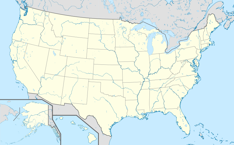
English: Location map of the USA (Hawaii and Alaska shown in sidemaps).
Main map: EquiDistantConicProjection : Central parallel : * N: 37.0° N Central meridian : * E: 96.0° W Standard parallels: * 1: 32.0° N * 2: 42.0° N Made with Natural Earth. Free vector and raster map data @ naturalearthdata.com. Formulas for x and y: x = 50.0 + 124.03149777329222 * ((1.9694462586094064-({{{2}}}* pi / 180))
* sin(0.6010514667026994 * ({{{3}}} + 96) * pi / 180))
y = 50.0 + 1.6155950752393982 * 124.03149777329222 * 0.02613325650382181
- 1.6155950752393982 * 124.03149777329222 *
(1.3236744353715044 - (1.9694462586094064-({{{2}}}* pi / 180))
* cos(0.6010514667026994 * ({{{3}}} + 96) * pi / 180))
Hawaii side map: Equirectangular projection, N/S stretching 107 %. Geographic limits of the map:
Alaska side map: Equirectangular projection, N/S stretching 210.0 %. Geographic limits of the map:
|
| ڕێکەوت | |
| سەرچاوە |
بەرھەمی خۆم This vector image includes elements that have been taken or adapted from this file: This vector image includes elements that have been taken or adapted from this file: This vector image includes elements that have been taken or adapted from this file: This vector image includes elements that have been taken or adapted from this file: This vector image includes elements that have been taken or adapted from this file: This vector image includes elements that have been taken or adapted from this file: |
| بەرھەمھێنەر |
TUBS |
| وەشانەکانی تر |
|
| SVG genesis |
_location_map.svg)
_relief_location_map.png)
_relief_location_map.svg)
_location_map.svg)
مۆڵەتنامە
من، ھەڵگری مافی لەبەرگرتنەوەی ئەم بەرھەمە، لەژێر ئەم مۆڵەتنامەیەدا بڵاوی دەکەمەوە:
ئەم پەڕگەیە لە ژێر مۆڵەتنامەی
Creative Commons Attribution-Share Alike 3.0 Unported دایە.
- تۆ ئازادی:
- بۆ بڵاکردنەوە – بۆ کۆپی کردن، دابەشکردن و دەستبەدەست ناردنی
- بۆ تێکەڵکردنەوە – بۆ سازاندنی کارەکە
- بەم مەرجانەی خوارەوە:
- دانەپاڵ – پێویستە باوەڕی گونجاو بدەیت، بەستەرێک بۆ مۆڵەتەکە دابین بکەیت و ئاماژە بەوە بکەیت کە ئایا گۆڕانکاری کراوە یان نا. دەتوانیت بە هەر شێوەیەکی گونجاو ئەوە بکەیت، بەڵام بە شێوەیەک نا کە وا دەربکەوێت کە مۆڵەتدەر پشتگیری تۆ یان بەکارهێنانەکەت بکات.
- بڵاوکردنەوەی گونجاو – ئەگەر لەسەر بنەمای ئەم کارە تێکەڵ، گۆڕان، یان ساز بکەی، پێویستە بەشدارییەکانت بە هەمان مۆڵەت یان هاوشێوەی مۆڵەتی ئەسڵی دابەش بکەی.
مێژووی پەڕگە
کرتە بکە لەسەر یەکێک لە ڕێکەوت/کاتەکان بۆ بینینی پەڕگەکە بەو شێوەی لەو کاتەدا بووە.
| ڕێکەوت/کات | ھێما | ئەندازە | بەکارھێنەر | تێبینی | |
|---|---|---|---|---|---|
| هەنووکە | ١٠:٣٢، ١٥ی ئازاری ٢٠١٩ | | ١٬١٨١ لە ٧٣١ (٣٫٦٨ مێگابایت) | Lasunncty | remove unused elements and fix SVG errors |
| ١٧:٠٣، ٢٤ی تشرینی یەکەمی ٢٠١٣ |  | ١٬١٨١ لە ٧٣١ (٦٫٩٣ مێگابایت) | TUBS | ||
| ١٦:٢٧، ٢٤ی تشرینی یەکەمی ٢٠١٣ |  | ١٬١٨١ لە ٧٣١ (٦٫٩٤ مێگابایت) | TUBS | ||
| ١٥:٥٢، ٢٤ی تشرینی یەکەمی ٢٠١٣ |  | ١٬١٨١ لە ٧٣١ (٣٫٧٣ مێگابایت) | TUBS | ||
| ١٥:٣٨، ٢٤ی تشرینی یەکەمی ٢٠١٣ |  | ١٬١٨١ لە ٧٣١ (٣٫٧٣ مێگابایت) | TUBS | ||
| ١٥:٢٥، ٢٤ی تشرینی یەکەمی ٢٠١٣ |  | ١٬١٨١ لە ٧٣١ (٣٫٧٣ مێگابایت) | TUBS | == Summary == {{Information |Description={{en|1=Location map of the USA (Hawaii and Alaska shown in sidemaps). ===Main Map Projection=== EquiDistantConicProjection : Central parallel : * N: 37.0° N Central meridian : * E: 96.0° W Standard parallel... |
بەکارھێنانی پەڕگە
ھیچ پەڕەیەک نییە کە ئەم پەڕگەیە بەکاربھێنێت.
بەکارھێنانی سەرانسەریی پەڕگە
ئەم ویکیانەی دیکەی خوارەوەش ئەم پەڕگە بەکاردێنن:
- بەکارھێنان لە als.wikipedia.org
- San Marino (Kalifornien)
- Modesto
- Karlsruhe (Nord Dakota)
- Fargo
- Vorlage:Positionskarte USA
- St. Louis
- Philadelphia
- Norwood (Missouri)
- Wind Gap (Pennsylvania)
- Park City (Kentucky)
- Berne (Indiana)
- Vorlage:Infobox NRHP
- Vorlage:Positionskarte USA Texas
- Vorlage:Positionskarte USA Wisconsin
- Vorlage:Positionskarte USA Maryland
- Vorlage:Positionskarte USA New York
- Vorlage:Positionskarte USA New York City
- Vorlage:Positionskarte USA New York City Manhattan
- بەکارھێنان لە de.wikipedia.org
- Hollywood
- Los Angeles
- San Francisco
- Wyoming
- Houston
- Boston
- Cape Canaveral (Küstenabschnitt)
- Seattle
- Grand Canyon
- Philadelphia
- Crazy Horse Memorial
- Phoenix (Arizona)
- Yellowstone-Nationalpark
- Arches-Nationalpark
- Badlands-Nationalpark
- Big-Bend-Nationalpark
- Biscayne-Nationalpark
- Bryce-Canyon-Nationalpark
- Canyonlands-Nationalpark
- Acadia-Nationalpark
- Black-Canyon-of-the-Gunnison-Nationalpark
- Carlsbad-Caverns-Nationalpark
- Channel-Islands-Nationalpark
- Miami
- Everglades-Nationalpark
- Glacier-Nationalpark (Vereinigte Staaten)
- Grand-Teton-Nationalpark
- Great-Basin-Nationalpark
- Isle-Royale-Nationalpark
- Joshua-Tree-Nationalpark
- Mount St. Helens
- Lassen-Volcanic-Nationalpark
بینینی بەکارھێنانی گشتی زیاتری ئەم پەڕگەیە.
_location_map.svg)
_location_map.svg)