
پەڕگە:Un-rwanda.png

پەڕگەی سەرەکی (٣٬٠٣٨ × ٢٬٢٥٨ پیکسڵ، قەبارەی پەڕگە: ١٫٤٣ مێگابایت، جۆری ئێم ئای ئێم ئی: image/png)
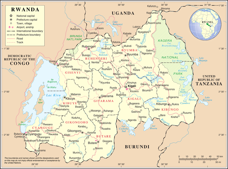
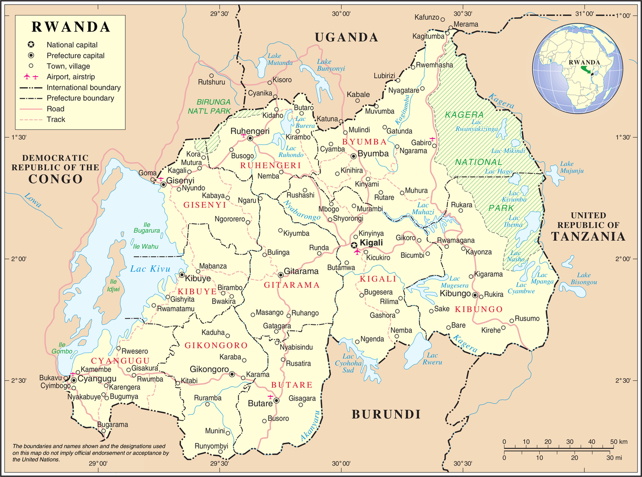
| وەسف | United Nations Map showing Rwanda prior to the reform of its subdivision in 2006 | |||
| سەرچاوە | ||||
| بەرھەمھێنەر | United Nations Cartographic Section | |||
| ڕێپێدان (بەکارھێنانەوەی ئەم پەڕگەیە) |
|

مێژووی پەڕگە
کرتە بکە لەسەر یەکێک لە ڕێکەوت/کاتەکان بۆ بینینی پەڕگەکە بەو شێوەی لەو کاتەدا بووە.
| ڕێکەوت/کات | ھێما | ئەندازە | بەکارھێنەر | تێبینی | |
|---|---|---|---|---|---|
| هەنووکە | ٠٢:١١، ٢٤ی تشرینی یەکەمی ٢٠٠٧ | | ٣٬٠٣٨ لە ٢٬٢٥٨ (١٫٤٣ مێگابایت) | Jeroen | {{UN map}} Category:Maps of Rwanda |
بەکارھێنانی پەڕگە
ئەم پەڕەیە ئەم پەڕگەیە بەکار دەھێنێت:
بەکارھێنانی سەرانسەریی پەڕگە
ئەم ویکیانەی دیکەی خوارەوەش ئەم پەڕگە بەکاردێنن:
- بەکارھێنان لە avk.wikipedia.org
- بەکارھێنان لە ca.wikipedia.org
- بەکارھێنان لە en.wikipedia.org
- بەکارھێنان لە fa.wikipedia.org
- بەکارھێنان لە fr.wikipedia.org
- بەکارھێنان لە id.wikipedia.org
- بەکارھێنان لە ja.wikipedia.org
- بەکارھێنان لە mg.wikipedia.org
- بەکارھێنان لە mzn.wikipedia.org
- بەکارھێنان لە nl.wikipedia.org
- بەکارھێنان لە no.wikipedia.org
- بەکارھێنان لە pl.wiktionary.org
- بەکارھێنان لە ru.wikipedia.org
- بەکارھێنان لە rw.wikipedia.org
- بەکارھێنان لە uk.wikipedia.org
- بەکارھێنان لە wa.wikipedia.org
- بەکارھێنان لە www.wikidata.org