
پەڕگە:Tanzania relief location map.svg

Size of this PNG preview of this SVG file: ٦٣٠ لە ٦٠٠ پیکسەڵ. ڕێزەلووشنەکانی تر: ٢٥٢ لە ٢٤٠ پیکسەڵ | ٥٠٤ لە ٤٨٠ پیکسەڵ | ٨٠٧ لە ٧٦٨ پیکسەڵ | ١٬٠٧٦ لە ١٬٠٢٤ پیکسەڵ | ٢٬١٥٢ لە ٢٬٠٤٨ پیکسەڵ | ٣٬٣٠٢ لە ٣٬١٤٣ پیکسەڵ.
پەڕگەی سەرەکی (پەڕگەی SVG، بە ناو ٣٬٣٠٢ × ٣٬١٤٣ پیکسەڵ، قەبارەی پەڕگە: ٣٫١ مێگابایت)
کورتە
| وەسف |
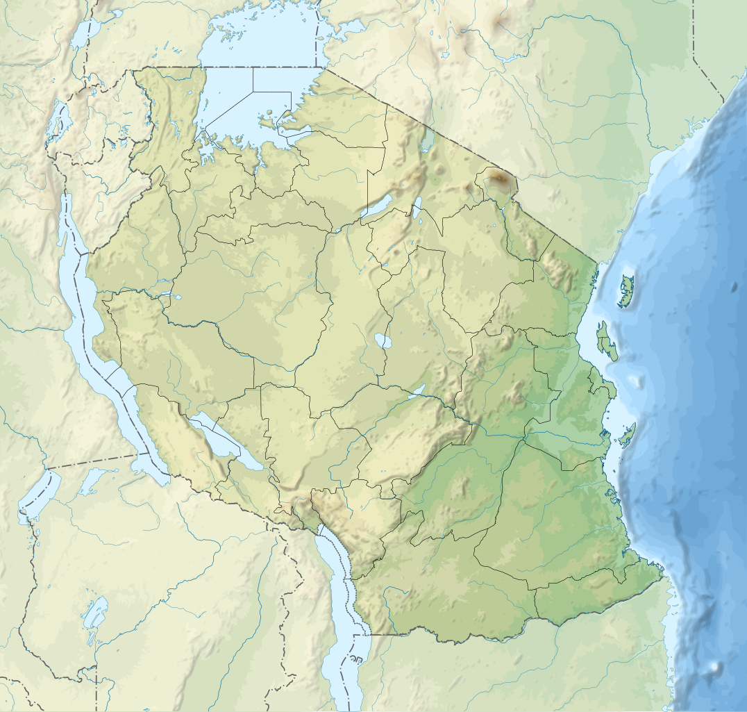
English: Relief location map of Tanzania.
Equirectangular projection. 1° N, 28° W, 42° E, -13° S. Center : -6.375, 35 Español: Mapa de georreferenciación de Tanzania. 1° N, 28° O, 42° E, -13° S. Centro : -6.375, 35
Français : Carte de géolocalisation du relief de la Tanzanie. Projection cylindrique équidistante. 1° N, 28° O, 42° E, -13° S. Centre : -6.375, 35 |
||
| ڕێکەوت | (UTC) | ||
| سەرچاوە | Derived from Tanzania_map-fr.svg | ||
| بەرھەمھێنەر | Sémhur | ||
| وەشانەکانی تر |
[]
| ||
| دانەپاڵ (required by the license) | © Sémhur / Wikimedia Commons / | ||
| SVG | W3C-validity not checked.
|
||
| Graphic Lab |


| Object location | | View this and other nearby images on: OpenStreetMap |
|---|
مۆڵەتنامە
من، ھەڵگری مافی لەبەرگرتنەوەی ئەم بەرھەمە، لەژێر ئەم مۆڵەتنامەیانەدا بڵاوی دەکەمەوە:
| Copyleft: This work of art is free; you can redistribute it and/or modify it according to terms of the Free Art License. You will find a specimen of this license on the Copyleft Attitude site as well as on other sites. |
This file is licensed under the Creative Commons Attribution-Share Alike 4.0 International, 3.0 Unported, 2.5 Generic, 2.0 Generic and 1.0 Generic license.
- تۆ ئازادی:
- بۆ بڵاکردنەوە – بۆ کۆپی کردن، دابەشکردن و دەستبەدەست ناردنی
- بۆ تێکەڵکردنەوە – بۆ سازاندنی کارەکە
- بەم مەرجانەی خوارەوە:
- دانەپاڵ – پێویستە باوەڕی گونجاو بدەیت، بەستەرێک بۆ مۆڵەتەکە دابین بکەیت و ئاماژە بەوە بکەیت کە ئایا گۆڕانکاری کراوە یان نا. دەتوانیت بە هەر شێوەیەکی گونجاو ئەوە بکەیت، بەڵام بە شێوەیەک نا کە وا دەربکەوێت کە مۆڵەتدەر پشتگیری تۆ یان بەکارهێنانەکەت بکات.
- بڵاوکردنەوەی گونجاو – ئەگەر لەسەر بنەمای ئەم کارە تێکەڵ، گۆڕان، یان ساز بکەی، پێویستە بەشدارییەکانت بە هەمان مۆڵەت یان هاوشێوەی مۆڵەتی ئەسڵی دابەش بکەی.
دەتوانی مۆڵەتنامەی دڵخوازت ھەڵبژێریت.
Original upload log
This image is a derivative work of the following images:
- File:Tanzania_map-fr.svg licensed with Cc-by-sa-3.0,2.5,2.0,1.0, GFDL
- 2009-03-20T13:30:18Z Sémhur 3096x3113 (3225659 Bytes) Ol Doinyo Lengaï was misplaced
- 2009-03-20T11:14:35Z Sémhur 3096x3113 (3224368 Bytes) Add location map and few summits.
- 2009-03-19T17:14:13Z Sémhur 3096x3113 (3099209 Bytes) grrr...
- 2009-03-19T17:08:18Z Sémhur 3096x3113 (3099244 Bytes) Oups ! It wasn't the valid one.
- 2009-03-19T17:05:02Z Sémhur 3096x3113 (3122421 Bytes) {{Information |Description={{en|1=Map of [[:en:Tanzania]].}} {{fr|1=Carte de la [[:fr:Tanzanie]].}} {{es|1=Mapa de [[:es:Tanzania]].}} |Source=travail personnel (own work). Sources of data: * Elevations : NASA SRTM3 (public d
Uploaded with derivativeFX
مێژووی پەڕگە
کرتە بکە لەسەر یەکێک لە ڕێکەوت/کاتەکان بۆ بینینی پەڕگەکە بەو شێوەی لەو کاتەدا بووە.
| ڕێکەوت/کات | ھێما | ئەندازە | بەکارھێنەر | تێبینی | |
|---|---|---|---|---|---|
| هەنووکە | ٢٠:٣٢، ٣ی ئازاری ٢٠٢٠ | | ٣٬٣٠٢ لە ٣٬١٤٣ (٣٫١ مێگابایت) | Sémhur | Modifying Tanzanian border claim (from https://www.nbs.go.tz/index.php/en/census-surveys/gis/385-2012-phc-shapefiles-level-one-and-two) |
| ٢٠:١٨، ٢٨ی حوزەیرانی ٢٠١٧ |  | ٣٬٣٠٢ لە ٣٬١٤٣ (٣٫٠٩ مێگابایت) | Sémhur | Update with Songwe region | |
| ١٤:١١، ٢٨ی کانوونی یەکەمی ٢٠١٣ |  | ٣٬٠٩٦ لە ٢٬٩٤٧ (٣٫١ مێگابایت) | Sémhur | Updated with the four new regions | |
| ١٥:١٧، ٣ی ئایاری ٢٠٠٩ |  | ٣٬٠٩٦ لە ٢٬٩٤٧ (٣٫٥٥ مێگابایت) | Sémhur | Adding border between Arusha and Manyara | |
| ١٨:٥٨، ١ی ئایاری ٢٠٠٩ |  | ٣٬٠٩٦ لە ٢٬٩٤٧ (٣٫٥٤ مێگابایت) | Sémhur | {{int:summary}} {{Information |Description={{en|1=Relief location map of en:Tanzania.}} {{fr|1=Carte de géolocalisation du relief de la fr:Tanzanie.}} {{es|1=Mapa de georreferenciación de es:Tanzania.}} Equirectangular projection. 0.25� |
بەکارھێنانی پەڕگە
ئەم پەڕەیە ئەم پەڕگەیە بەکار دەھێنێت:
بەکارھێنانی سەرانسەریی پەڕگە
ئەم ویکیانەی دیکەی خوارەوەش ئەم پەڕگە بەکاردێنن:
- بەکارھێنان لە af.wikipedia.org
- بەکارھێنان لە als.wikipedia.org
- بەکارھێنان لە ar.wikipedia.org
- بەکارھێنان لە ast.wikipedia.org
- بەکارھێنان لە as.wikipedia.org
- بەکارھێنان لە avk.wikipedia.org
- بەکارھێنان لە av.wikipedia.org
- بەکارھێنان لە azb.wikipedia.org
- بەکارھێنان لە az.wikipedia.org
- بەکارھێنان لە ban.wikipedia.org
- بەکارھێنان لە ba.wikipedia.org
بینینی بەکارھێنانی گشتی زیاتری ئەم پەڕگەیە.