
پەڕگە:South Sudan location map.svg

پەڕگەی سەرەکی (پەڕگەی SVG، بە ناو ١٬٥٦١ × ١٬١٣٣ پیکسەڵ، قەبارەی پەڕگە: ٢٠٥ کیلۆبایت)
کورتە
| وەسف |
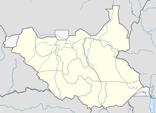
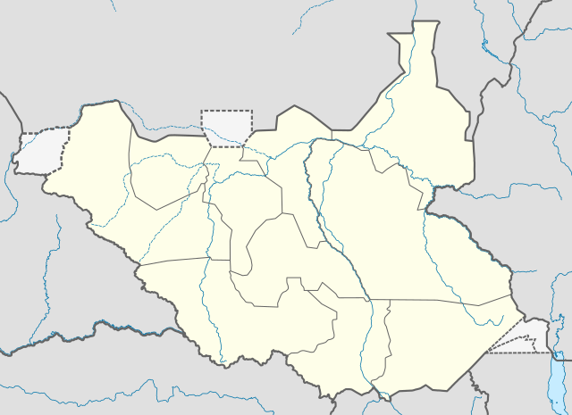
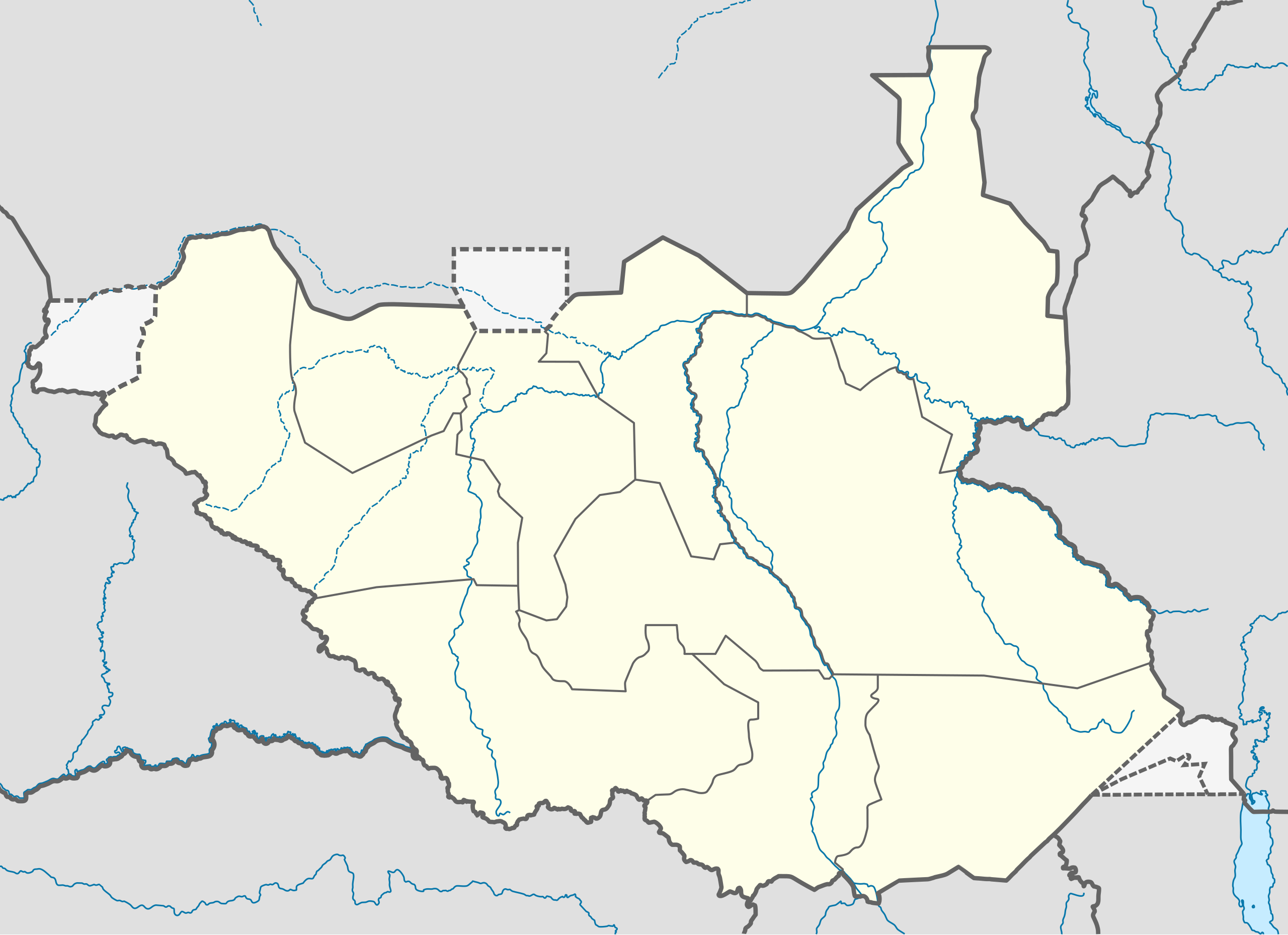
Deutsch: Positionskarte vom Südsudan
Quadratische Plattkarte, N-S-Streckung 101 %. Geographische Begrenzung der Karte:
English: Location map of South Sudan
Equirectangular projection, N/S stretching 101 %. Geographic limits of the map:
|
|
| ڕێکەوت | ||
| سەرچاوە |
بەرھەمی خۆم, using
|
|
| بەرھەمھێنەر | NordNordWest | |
| ڕێپێدان (بەکارھێنانەوەی ئەم پەڕگەیە) |
This file is licensed under the Creative Commons Attribution-Share Alike 3.0 Germany license.
 ئەم پەڕگەیە لە ژێر مۆڵەتنامەی
Creative Commons Attribution-Share Alike 3.0 Unported دایە.
|
|
| وەشانەکانی تر |
Derivative works of this file: File:South Sudan location green map.svg |


|
This map has been made or improved in the German Kartenwerkstatt (Map Lab). You can propose maps to improve as well.
|
مێژووی پەڕگە
کرتە بکە لەسەر یەکێک لە ڕێکەوت/کاتەکان بۆ بینینی پەڕگەکە بەو شێوەی لەو کاتەدا بووە.
| ڕێکەوت/کات | ھێما | ئەندازە | بەکارھێنەر | تێبینی | |
|---|---|---|---|---|---|
| هەنووکە | ٠٨:٢١، ١٨ی ئابی ٢٠١١ | | ١٬٥٦١ لە ١٬١٣٣ (٢٠٥ کیلۆبایت) | Spesh531 | I am reverting and fixing all of the templates ot the best of my ability, I can need some help |
| ٠٧:٥٣، ١٨ی ئابی ٢٠١١ |  | ١٬٥٠٠ لە ١٬١٣٣ (١٧١ کیلۆبایت) | NordNordWest | you cannot change the area that is shown without adjusting all templates in which this map is used | |
| ٢٣:٢٠، ١٧ی ئابی ٢٠١١ |  | ١٬٥٦١ لە ١٬١٣٣ (٢٠٥ کیلۆبایت) | Spesh531 | adding a disputed territory | |
| ١١:٤٢، ١٨ی تەممووزی ٢٠١١ |  | ١٬٥٠٠ لە ١٬١٣٣ (١٧١ کیلۆبایت) | NordNordWest | corr | |
| ١٢:٠٤، ٨ی تەممووزی ٢٠١١ |  | ١٬٥٠٠ لە ١٬١٣٣ (١٧٢ کیلۆبایت) | NordNordWest | upd | |
| ١٤:٢٣، ١٨ی شوباتی ٢٠١١ |  | ١٬٥٠٠ لە ١٬١٣٣ (١٧٨ کیلۆبایت) | NordNordWest | =={{int:filedesc}}== {{Information |Description= {{de|Positionskarte vom Südsudan}} Quadratische Plattkarte, N-S-Streckung 101 %. Geographische Begrenzung der Karte: * N: 12.7° N * S: 3.2° N * W: 23.7° O * O: 36.4° O {{en|Location m |
بەکارھێنانی پەڕگە
ئەم پەڕەیە ئەم پەڕگەیە بەکار دەھێنێت:
بەکارھێنانی سەرانسەریی پەڕگە
ئەم ویکیانەی دیکەی خوارەوەش ئەم پەڕگە بەکاردێنن:
- بەکارھێنان لە af.wikipedia.org
- بەکارھێنان لە ar.wikipedia.org
- بەکارھێنان لە bn.wikipedia.org
- بەکارھێنان لە da.wikipedia.org
- بەکارھێنان لە de.wikipedia.org
- بەکارھێنان لە en.wikipedia.org
- بەکارھێنان لە eo.wikipedia.org
- بەکارھێنان لە es.wikipedia.org
- بەکارھێنان لە eu.wikipedia.org
- بەکارھێنان لە fa.wikipedia.org
- بەکارھێنان لە frr.wikipedia.org
- بەکارھێنان لە gl.wikipedia.org
- بەکارھێنان لە hr.wikipedia.org
- بەکارھێنان لە hy.wikipedia.org
- بەکارھێنان لە id.wikipedia.org
- بەکارھێنان لە incubator.wikimedia.org
- بەکارھێنان لە it.wikipedia.org
بینینی بەکارھێنانی گشتی زیاتری ئەم پەڕگەیە.