
پەڕگە:Rhodes NLT Landsat7.png
قەبارەی ئەم پێشبینینە: ٦٠٥ لە ٦٠٠ پیکسەڵ. ڕێزەلووشنەکانی تر: ٢٤٢ لە ٢٤٠ پیکسەڵ | ٤٨٤ لە ٤٨٠ پیکسەڵ | ٧٧٥ لە ٧٦٨ پیکسەڵ | ١٬٠٣٣ لە ١٬٠٢٤ پیکسەڵ | ١٬٩٤٨ لە ١٬٩٣١ پیکسەڵ.
پەڕگەی سەرەکی (١٬٩٤٨ × ١٬٩٣١ پیکسڵ، قەبارەی پەڕگە: ٥٫٦٥ مێگابایت، جۆری ئێم ئای ئێم ئی: image/png)
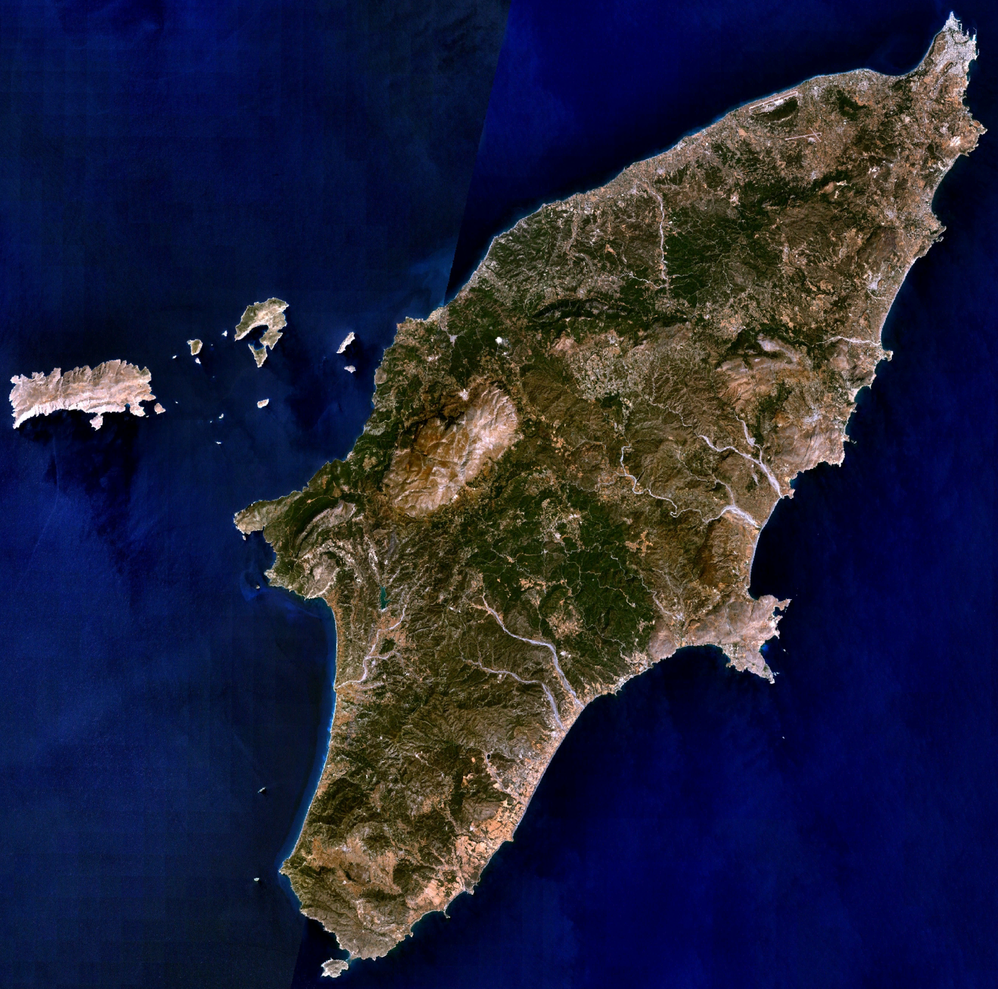
| وەسف | Visible colour satellite image of Rhodes. | |||
| سەرچاوە |
Screenshot from NASA World Wind, NLT Landsat7 layer. Coordinates: worldwind://goto/world=Earth&lat=36.16654&lon=27.93315&alt=80698 |
|||
| بەرھەمھێنەر | وێنە: NASA | |||
| ڕێپێدان (بەکارھێنانەوەی ئەم پەڕگەیە) |
|
|||
| وەشانەکانی تر | Image:Rodas.png |

مێژووی پەڕگە
کرتە بکە لەسەر یەکێک لە ڕێکەوت/کاتەکان بۆ بینینی پەڕگەکە بەو شێوەی لەو کاتەدا بووە.
| ڕێکەوت/کات | ھێما | ئەندازە | بەکارھێنەر | تێبینی | |
|---|---|---|---|---|---|
| هەنووکە | ٢٠:٢٩، ١٦ی نیسانی ٢٠٠٦ | | ١٬٩٤٨ لە ١٬٩٣١ (٥٫٦٥ مێگابایت) | Hautala | {{Information| |Description=Visible colour satellite image of Rhodes. |Source=Screenshot from NASA World Wind, NLT Landsat7 layer. |Date= |Author= |Permission={{PD-WorldWind}} |other_versions= }} |
بەکارھێنانی پەڕگە
ھیچ پەڕەیەک نییە کە ئەم پەڕگەیە بەکاربھێنێت.
بەکارھێنانی سەرانسەریی پەڕگە
ئەم ویکیانەی دیکەی خوارەوەش ئەم پەڕگە بەکاردێنن:
- بەکارھێنان لە ab.wikipedia.org
- بەکارھێنان لە als.wikipedia.org
- بەکارھێنان لە an.wikipedia.org
- بەکارھێنان لە ar.wikipedia.org
- بەکارھێنان لە az.wikipedia.org
- بەکارھێنان لە be-tarask.wikipedia.org
- بەکارھێنان لە be.wikipedia.org
- بەکارھێنان لە bg.wikipedia.org
- بەکارھێنان لە ca.wikipedia.org
- بەکارھێنان لە ceb.wikipedia.org
- بەکارھێنان لە cs.wikipedia.org
- بەکارھێنان لە da.wikipedia.org
- بەکارھێنان لە de.wikipedia.org
- بەکارھێنان لە el.wikipedia.org
- بەکارھێنان لە en.wikipedia.org
- بەکارھێنان لە eu.wikipedia.org
- بەکارھێنان لە fi.wikipedia.org
- بەکارھێنان لە fr.wikipedia.org
بینینی بەکارھێنانی گشتی زیاتری ئەم پەڕگەیە.