
پەڕگە:Philadelphia skyline from South Street Bridge January 2020 (rotate 2 degrees perspective correction crop 4-1).jpg

قەبارەی ئەم پێشبینینە: ٨٠٠ لە ٢٠٠ پیکسەڵ. ڕێزەلووشنەکانی تر: ٣٢٠ لە ٨٠ پیکسەڵ | ٦٤٠ لە ١٦٠ پیکسەڵ | ١٬٠٢٤ لە ٢٥٦ پیکسەڵ | ٣٬٨١٦ لە ٩٥٤ پیکسەڵ.
پەڕگەی سەرەکی (٣٬٨١٦ × ٩٥٤ پیکسڵ، قەبارەی پەڕگە: ١٫٤٢ مێگابایت، جۆری ئێم ئای ئێم ئی: image/jpeg)
کورتە
| وەسف |
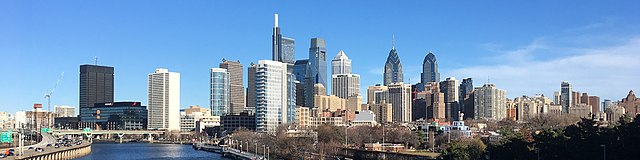
English: The skyline of Philadelphia, Pennsylvania viewed from the South Street Bridge over the Schuylkill River. If on Wikipedia, see the fully annotated version on the Wikimedia page.
|
||
| ڕێکەوت | |||
| سەرچاوە | File:Philadelphia_skyline_from_South_Street_Bridge_January_2020.jpeg | ||
| بەرھەمھێنەر | Dough4872; modifications and annotations by Maps and stuff (Brian W. Schaller) | ||
| وەشانەکانی تر |
|

.jpg)
| Camera location | | View this and other nearby images on: OpenStreetMap |
|---|
.jpg¶ms=039.946975_N_-075.186797_E_globe:Earth_type:camera_heading:69.51&language=ckb)
مۆڵەتنامە
This file is licensed under the Creative Commons Attribution-Share Alike 4.0 International license.
- تۆ ئازادی:
- بۆ بڵاکردنەوە – بۆ کۆپی کردن، دابەشکردن و دەستبەدەست ناردنی
- بۆ تێکەڵکردنەوە – بۆ سازاندنی کارەکە
- بەم مەرجانەی خوارەوە:
- دانەپاڵ – پێویستە باوەڕی گونجاو بدەیت، بەستەرێک بۆ مۆڵەتەکە دابین بکەیت و ئاماژە بەوە بکەیت کە ئایا گۆڕانکاری کراوە یان نا. دەتوانیت بە هەر شێوەیەکی گونجاو ئەوە بکەیت، بەڵام بە شێوەیەک نا کە وا دەربکەوێت کە مۆڵەتدەر پشتگیری تۆ یان بەکارهێنانەکەت بکات.
- بڵاوکردنەوەی گونجاو – ئەگەر لەسەر بنەمای ئەم کارە تێکەڵ، گۆڕان، یان ساز بکەی، پێویستە بەشدارییەکانت بە هەمان مۆڵەت یان هاوشێوەی مۆڵەتی ئەسڵی دابەش بکەی.
| Annotations | This image is annotated: View the annotations at Commons |
مێژووی پەڕگە
کرتە بکە لەسەر یەکێک لە ڕێکەوت/کاتەکان بۆ بینینی پەڕگەکە بەو شێوەی لەو کاتەدا بووە.
| ڕێکەوت/کات | ھێما | ئەندازە | بەکارھێنەر | تێبینی | |
|---|---|---|---|---|---|
| هەنووکە | ١٤:٢٢، ٢٧ی کانوونی دووەمی ٢٠٢٠ | ٣٬٨١٦ لە ٩٥٤ (١٫٤٢ مێگابایت) | Maps and stuff | User created page with UploadWizard |
بەکارھێنانی پەڕگە
ئەم پەڕەیە ئەم پەڕگەیە بەکار دەھێنێت:
بەکارھێنانی سەرانسەریی پەڕگە
ئەم ویکیانەی دیکەی خوارەوەش ئەم پەڕگە بەکاردێنن:
- بەکارھێنان لە ang.wikipedia.org
- بەکارھێنان لە ar.wikipedia.org
- بەکارھێنان لە arz.wikipedia.org
- بەکارھێنان لە ast.wikipedia.org
- بەکارھێنان لە br.wikipedia.org
- بەکارھێنان لە ca.wikipedia.org
- بەکارھێنان لە ce.wikipedia.org
- بەکارھێنان لە cy.wikipedia.org
- بەکارھێنان لە da.wikipedia.org
- بەکارھێنان لە de.wikivoyage.org
- بەکارھێنان لە diq.wikipedia.org
- بەکارھێنان لە en.wikipedia.org
- بەکارھێنان لە en.wikibooks.org
- بەکارھێنان لە en.wikivoyage.org
- بەکارھێنان لە eu.wikipedia.org
- بەکارھێنان لە fr.wikivoyage.org
- بەکارھێنان لە ga.wikipedia.org
- بەکارھێنان لە gl.wikipedia.org
- بەکارھێنان لە ha.wikipedia.org
- بەکارھێنان لە he.wikivoyage.org
- بەکارھێنان لە ht.wikipedia.org
- بەکارھێنان لە ia.wikipedia.org
- بەکارھێنان لە ilo.wikipedia.org
- بەکارھێنان لە incubator.wikimedia.org
- بەکارھێنان لە it.wikipedia.org
- بەکارھێنان لە it.wikivoyage.org
- بەکارھێنان لە ja.wikivoyage.org
- بەکارھێنان لە kab.wikipedia.org
- بەکارھێنان لە lb.wikipedia.org
- بەکارھێنان لە lld.wikipedia.org
- بەکارھێنان لە mhr.wikipedia.org
- بەکارھێنان لە no.wikipedia.org
- بەکارھێنان لە ru.wikipedia.org
- بەکارھێنان لە ru.wikinews.org
- بەکارھێنان لە simple.wikipedia.org
- بەکارھێنان لە sr.wikipedia.org
بینینی بەکارھێنانی گشتی زیاتری ئەم پەڕگەیە.
.jpg)
.jpg)