
پەڕگە:Karte Adelaide MKL1888.png
رەزۆلوشنی سەرتر لەمە لە بەردەست دا نیە.
Karte_Adelaide_MKL1888.png (٣٦٥ × ٥٣٩ پیکسڵ، قەبارەی پەڕگە: ٥١ کیلۆبایت، جۆری ئێم ئای ئێم ئی: image/png)
کورتە
| وەسف |
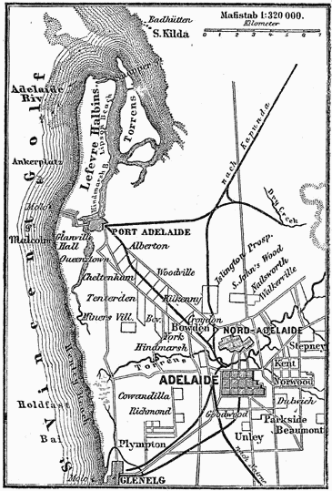
Deutsch: Plan von Adelaide (1 : 320.000)
English: Map of Adelaide (1:320,000 scale) |
| ڕێکەوت | بەنزیکی ١٨٨٥ |
| سەرچاوە | |
| بەرھەمھێنەر | Unknown author |

مۆڵەتنامە
| This image comes from the 4th edition of Meyers Konversationslexikon (1885–90). The copyrights have expired and this image is in the public domain. |
|
This work is in the public domain in its country of origin and other countries and areas where the copyright term is the author's life plus 100 years or fewer. This work is in the public domain in the United States because it was published (or registered with the U.S. Copyright Office) before January 1, 1929. | |
| This file has been identified as being free of known restrictions under copyright law, including all related and neighboring rights. | |
مێژووی پەڕگە
کرتە بکە لەسەر یەکێک لە ڕێکەوت/کاتەکان بۆ بینینی پەڕگەکە بەو شێوەی لەو کاتەدا بووە.
| ڕێکەوت/کات | ھێما | ئەندازە | بەکارھێنەر | تێبینی | |
|---|---|---|---|---|---|
| هەنووکە | ١٧:٣٣، ١١ی کانوونی یەکەمی ٢٠٠٤ | | ٣٦٥ لە ٥٣٩ (٥١ کیلۆبایت) | ¡0-8-15! | {{Template:PD-Meyers}} |
بەکارھێنانی پەڕگە
ئەم پەڕەیە ئەم پەڕگەیە بەکار دەھێنێت:
بەکارھێنانی سەرانسەریی پەڕگە
ئەم ویکیانەی دیکەی خوارەوەش ئەم پەڕگە بەکاردێنن:
- بەکارھێنان لە da.wikipedia.org
- بەکارھێنان لە de.wikipedia.org
- بەکارھێنان لە de.wikisource.org
- بەکارھێنان لە en.wikipedia.org
- بەکارھێنان لە fa.wikipedia.org
- بەکارھێنان لە fi.wikipedia.org
- بەکارھێنان لە lb.wikipedia.org
- بەکارھێنان لە ms.wikipedia.org
- بەکارھێنان لە zh.wikipedia.org