
پەڕگە:Finland location map.svg

Size of this PNG preview of this SVG file: ٣٠٤ لە ٥٩٩ پیکسەڵ. ڕێزەلووشنەکانی تر: ١٢٢ لە ٢٤٠ پیکسەڵ | ٢٤٣ لە ٤٨٠ پیکسەڵ | ٣٩٠ لە ٧٦٨ پیکسەڵ | ٥٢٠ لە ١٬٠٢٤ پیکسەڵ | ١٬٠٣٩ لە ٢٬٠٤٨ پیکسەڵ | ٨٧٢ لە ١٬٧١٨ پیکسەڵ.
پەڕگەی سەرەکی (پەڕگەی SVG، بە ناو ٨٧٢ × ١٬٧١٨ پیکسەڵ، قەبارەی پەڕگە: ١٫١ مێگابایت)
کورتە
| وەسف |
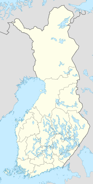
Deutsch: Positionskarte von Finnland
Quadratische Plattkarte, N-S-Streckung 235 %. Geographische Begrenzung der Karte:
English: Location map of Finland
Equirectangular projection, N/S stretching 235 %. Geographic limits of the map:
|
| ڕێکەوت | |
| سەرچاوە | own work, using United States National Imagery and Mapping Agency data |
| بەرھەمھێنەر | NordNordWest |

|
This map has been made or improved in the German Kartenwerkstatt (Map Lab). You can propose maps to improve as well.
|
مۆڵەتنامە
من، ھەڵگری مافی لەبەرگرتنەوەی ئەم بەرھەمە، لەژێر ئەم مۆڵەتنامەیانەدا بڵاوی دەکەمەوە:

|
ڕێگەدراوە بە لەبەرگرتنەوە، دابەشکردن ھەروەھا/یان سازاندنی ئەم بەڵگەنامەیە لەژێر مەرجی مۆڵەتی GNU بۆ بەڵگەنامەی ئازاد، وەشانی ١.٢ یان ھەر وەشانێکی تری دواتر کە بڵاوکراوەتەوە لەلایەن دامەزراوەی بەرنامەی ئازاد، بەبێ ھیچ بەشێکی جیاواز، بەبێ نووسین لەسەر بەرگی پێشەوە و دواوەی. وێنەیەک لەمۆڵەتەکە لە بەشێکدا ھەیە کە ناوی مۆڵەتی GNU بۆ بەڵگەنامەی ئازادە. |
ئەم پەڕگەیە لە ژێر مۆڵەتنامەی
Creative Commons Attribution-Share Alike 3.0 Unported دایە.
- تۆ ئازادی:
- بۆ بڵاکردنەوە – بۆ کۆپی کردن، دابەشکردن و دەستبەدەست ناردنی
- بۆ تێکەڵکردنەوە – بۆ سازاندنی کارەکە
- بەم مەرجانەی خوارەوە:
- دانەپاڵ – پێویستە باوەڕی گونجاو بدەیت، بەستەرێک بۆ مۆڵەتەکە دابین بکەیت و ئاماژە بەوە بکەیت کە ئایا گۆڕانکاری کراوە یان نا. دەتوانیت بە هەر شێوەیەکی گونجاو ئەوە بکەیت، بەڵام بە شێوەیەک نا کە وا دەربکەوێت کە مۆڵەتدەر پشتگیری تۆ یان بەکارهێنانەکەت بکات.
- بڵاوکردنەوەی گونجاو – ئەگەر لەسەر بنەمای ئەم کارە تێکەڵ، گۆڕان، یان ساز بکەی، پێویستە بەشدارییەکانت بە هەمان مۆڵەت یان هاوشێوەی مۆڵەتی ئەسڵی دابەش بکەی.
دەتوانی مۆڵەتنامەی دڵخوازت ھەڵبژێریت.
مێژووی پەڕگە
کرتە بکە لەسەر یەکێک لە ڕێکەوت/کاتەکان بۆ بینینی پەڕگەکە بەو شێوەی لەو کاتەدا بووە.
| ڕێکەوت/کات | ھێما | ئەندازە | بەکارھێنەر | تێبینی | |
|---|---|---|---|---|---|
| هەنووکە | ١٢:٠٦، ٢٦ی کانوونی دووەمی ٢٠٢١ | | ٨٧٢ لە ١٬٧١٨ (١٫١ مێگابایت) | Fenn-O-maniC | Updated regional borders as per https://asiointi.maanmittauslaitos.fi/karttapaikka/ |
| ١٠:٥٠، ٩ی ئازاری ٢٠١١ |  | ٨٧٢ لە ١٬٧١٨ (١٫٠٧ مێگابایت) | NordNordWest | upd | |
| ٢٠:٤١، ٢٠ی کانوونی دووەمی ٢٠١٠ |  | ٨٧٢ لە ١٬٥٣٦ (١٫٢ مێگابایت) | NordNordWest | update | |
| ١٨:١٢، ٥ی ئابی ٢٠٠٨ |  | ٨٧٣ لە ١٬٥٣٦ (١٫٠٧ مێگابایت) | NordNordWest | ||
| ١١:٥٤، ٣٠ی تەممووزی ٢٠٠٨ |  | ٨٧٣ لە ١٬٥٣٦ (١٫٠١ مێگابایت) | NordNordWest | optimized | |
| ١٨:٥٥، ٨ی تەممووزی ٢٠٠٨ |  | ٨٧٣ لە ١٬٥٣٦ (١٫٣٣ مێگابایت) | NordNordWest | ||
| ١٤:٠٥، ٧ی تەممووزی ٢٠٠٨ |  | ٨٧٣ لە ١٬٥٣٦ (١٫٢٨ مێگابایت) | NordNordWest | ||
| ١٩:٣١، ٣٠ی حوزەیرانی ٢٠٠٨ |  | ٨٧٣ لە ١٬٥٣٦ (١٫٣٨ مێگابایت) | NordNordWest | ||
| ٢٠:٣٥، ٢٩ی حوزەیرانی ٢٠٠٨ |  | ٨٧٣ لە ١٬٥٣٦ (١٫٣٨ مێگابایت) | NordNordWest | {{Information |Description= {{de|Positionskarte von Finnland}} Quadratische Plattkarte, N-S-Streckung 210 %. Geographische Begrenzung der Karte: * N: 70.4° N * S: 59.5° N * W: 19° W * O: 32° W {{en|Location map of [[:en:Finland|Finlan |
بەکارھێنانی پەڕگە
ئەم پەڕەیە ئەم پەڕگەیە بەکار دەھێنێت:
بەکارھێنانی سەرانسەریی پەڕگە
ئەم ویکیانەی دیکەی خوارەوەش ئەم پەڕگە بەکاردێنن:
- بەکارھێنان لە am.wikipedia.org
- بەکارھێنان لە an.wikipedia.org
- بەکارھێنان لە arz.wikipedia.org
- بەکارھێنان لە av.wikipedia.org
- بەکارھێنان لە bg.wikipedia.org
- بەکارھێنان لە bs.wikipedia.org
- بەکارھێنان لە ca.wikipedia.org
- بەکارھێنان لە ceb.wikipedia.org
بینینی بەکارھێنانی گشتی زیاتری ئەم پەڕگەیە.