
پەڕگە:Dominican Republic location map.svg

Size of this PNG preview of this SVG file: ٧٣٧ لە ٦٠٠ پیکسەڵ. ڕێزەلووشنەکانی تر: ٢٩٥ لە ٢٤٠ پیکسەڵ | ٥٩٠ لە ٤٨٠ پیکسەڵ | ٩٤٤ لە ٧٦٨ پیکسەڵ | ١٬٢٥٩ لە ١٬٠٢٤ پیکسەڵ | ٢٬٥١٧ لە ٢٬٠٤٨ پیکسەڵ | ١٬٤٠٠ لە ١٬١٣٩ پیکسەڵ.
پەڕگەی سەرەکی (پەڕگەی SVG، بە ناو ١٬٤٠٠ × ١٬١٣٩ پیکسەڵ، قەبارەی پەڕگە: ١٨٢ کیلۆبایت)
queretaro
کورتە
| وەسف |
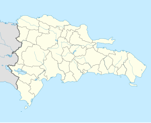
Deutsch: Positionskarte Dominikanische Republik mit Provinzen, Quadratische Plattkarte, N-S-Streckung 105 %. Geographische Begrenzung der Karte:
English: Location map Dominican Republic with Provinces, Equirectangular projection, N/S stretching 105 %. Geographic limits of the map:
|
||
| ڕێکەوت | |||
| سەرچاوە |
بەرھەمی خۆم,VMAP0, http://www.one.gob.do, http://lib.utexas.edu/maps/dominican_republic.html
|
||
| بەرھەمھێنەر | Alexrk2 | ||
| وەشانەکانی تر |
|
||
| SVG genesis |
|


مۆڵەتنامە
من، ھەڵگری مافی لەبەرگرتنەوەی ئەم بەرھەمە، لەژێر ئەم مۆڵەتنامەیەدا بڵاوی دەکەمەوە:
ئەم پەڕگەیە لە ژێر مۆڵەتنامەی
Creative Commons Attribution-Share Alike 3.0 Unported دایە.
- تۆ ئازادی:
- بۆ بڵاکردنەوە – بۆ کۆپی کردن، دابەشکردن و دەستبەدەست ناردنی
- بۆ تێکەڵکردنەوە – بۆ سازاندنی کارەکە
- بەم مەرجانەی خوارەوە:
- دانەپاڵ – پێویستە باوەڕی گونجاو بدەیت، بەستەرێک بۆ مۆڵەتەکە دابین بکەیت و ئاماژە بەوە بکەیت کە ئایا گۆڕانکاری کراوە یان نا. دەتوانیت بە هەر شێوەیەکی گونجاو ئەوە بکەیت، بەڵام بە شێوەیەک نا کە وا دەربکەوێت کە مۆڵەتدەر پشتگیری تۆ یان بەکارهێنانەکەت بکات.
- بڵاوکردنەوەی گونجاو – ئەگەر لەسەر بنەمای ئەم کارە تێکەڵ، گۆڕان، یان ساز بکەی، پێویستە بەشدارییەکانت بە هەمان مۆڵەت یان هاوشێوەی مۆڵەتی ئەسڵی دابەش بکەی.
مێژووی پەڕگە
کرتە بکە لەسەر یەکێک لە ڕێکەوت/کاتەکان بۆ بینینی پەڕگەکە بەو شێوەی لەو کاتەدا بووە.
| ڕێکەوت/کات | ھێما | ئەندازە | بەکارھێنەر | تێبینی | |
|---|---|---|---|---|---|
| هەنووکە | ١٨:٣٩، ١٠ی شوباتی ٢٠١٠ | | ١٬٤٠٠ لە ١٬١٣٩ (١٨٢ کیلۆبایت) | Alexrk2 | fixed boundary style |
| ١٣:١٧، ٧ی شوباتی ٢٠١٠ |  | ١٬٤٠٠ لە ١٬١٣٩ (١٨١ کیلۆبایت) | Alexrk2 | == Summary == {{Information |Description= {{de|Positionskarte Dominikanische Republik mit Provinzen, Quadratische Plattkarte, N-S-Streckung 105 %. Geographische Begrenzung der Karte:}} {{en|Location map [[:en:Dominican Repu |
بەکارھێنانی پەڕگە
ئەم پەڕەیە ئەم پەڕگەیە بەکار دەھێنێت:
بەکارھێنانی سەرانسەریی پەڕگە
ئەم ویکیانەی دیکەی خوارەوەش ئەم پەڕگە بەکاردێنن:
- بەکارھێنان لە af.wikipedia.org
- بەکارھێنان لە an.wikipedia.org
- بەکارھێنان لە ar.wikipedia.org
- بەکارھێنان لە ast.wikipedia.org
- La Barraquera (San José de Ocoa)
- Oviedo (República Dominicana)
- Santu Domingu
- Módulu:Mapa de llocalización/datos/República Dominicana
- Bancu Central de la República Dominicana
- Módulu:Mapa de llocalización/datos/República Dominicana/usu
- Copa Panamericana de Voleibol Femenín de 2018
- Aeródromu de Cabo Rojo
- Aeropuertu Domésticu de Constanza
- Aeropuertu Osvaldo Virgil
- Aeródromu de Portillo
- Puertu de Puerto Plata
- Puertu de San Pedro de Macorís
- Puertu de Santu Domingu
- Ríu Ozama
- بەکارھێنان لە az.wikipedia.org
- بەکارھێنان لە ba.wikipedia.org
- بەکارھێنان لە be-tarask.wikipedia.org
- بەکارھێنان لە be.wikipedia.org
- بەکارھێنان لە bg.wikipedia.org
- بەکارھێنان لە bn.wikipedia.org
- بەکارھێنان لە bs.wikipedia.org
- بەکارھێنان لە ca.wikipedia.org
- بەکارھێنان لە ceb.wikipedia.org
بینینی بەکارھێنانی گشتی زیاتری ئەم پەڕگەیە.