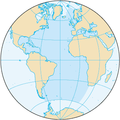
پەڕگە:Atlantic Ocean.png
Atlantic_Ocean.png (٣٣٠ × ٣٣٠ پیکسڵ، قەبارەی پەڕگە: ٢٦ کیلۆبایت، جۆری ئێم ئای ئێم ئی: image/png)
مێژووی پەڕگە
کرتە بکە لەسەر یەکێک لە ڕێکەوت/کاتەکان بۆ بینینی پەڕگەکە بەو شێوەی لەو کاتەدا بووە.
| ڕێکەوت/کات | ھێما | ئەندازە | بەکارھێنەر | تێبینی | |
|---|---|---|---|---|---|
| هەنووکە | ٢٠:١١، ٢٧ی ئابی ٢٠١٩ |  | ٣٣٠ لە ٣٣٠ (٢٦ کیلۆبایت) | Kaldari | same dimensions as other ocean images |
| ٢٠:٢٠، ٢٢ی ئابی ٢٠٠٩ |  | ٣٢٨ لە ٣٢٨ (١٢ کیلۆبایت) | Serg!o | ups | |
| ٢٠:١٦، ٢٢ی ئابی ٢٠٠٩ |  | ٣٢٩ لە ٣٣٠ (١٤ کیلۆبایت) | Serg!o | language neutral map | |
| ١٠:١٣، ٣ی تشرینی دووەمی ٢٠٠٤ |  | ٣٢٨ لە ٣٢٨ (١٢ کیلۆبایت) | Maximaximax | North and South Atlantic Ocean from [http://www.cia.gov/cia/publications/factbook/geos/zh.html CIA World Factbook - Atlantic Ocean] (picture URL is [http://www.cia.gov/cia/publications/factbook/maps/zh-map.gif]). {{PD-USGov}} Category:Oceans |
بەکارھێنانی پەڕگە
ئەم پەڕەیە ئەم پەڕگەیە بەکار دەھێنێت:
بەکارھێنانی سەرانسەریی پەڕگە
ئەم ویکیانەی دیکەی خوارەوەش ئەم پەڕگە بەکاردێنن:
- بەکارھێنان لە ab.wikipedia.org
- بەکارھێنان لە als.wikipedia.org
- بەکارھێنان لە an.wikipedia.org
- بەکارھێنان لە arc.wikipedia.org
- بەکارھێنان لە ar.wikipedia.org
- بەکارھێنان لە arz.wikipedia.org
- بەکارھێنان لە ast.wikipedia.org
- بەکارھێنان لە ast.wiktionary.org
- بەکارھێنان لە as.wikipedia.org
- بەکارھێنان لە av.wikipedia.org
- بەکارھێنان لە az.wikipedia.org
- بەکارھێنان لە ba.wikipedia.org
- بەکارھێنان لە be-tarask.wikipedia.org
- بەکارھێنان لە be.wikipedia.org
- بەکارھێنان لە bg.wikipedia.org
- بەکارھێنان لە bjn.wikipedia.org
- بەکارھێنان لە bo.wikipedia.org
- بەکارھێنان لە br.wikipedia.org
- بەکارھێنان لە bs.wikipedia.org
- بەکارھێنان لە bxr.wikipedia.org
- بەکارھێنان لە ceb.wikipedia.org
- بەکارھێنان لە ce.wikipedia.org
- بەکارھێنان لە cs.wikipedia.org
بینینی بەکارھێنانی گشتی زیاتری ئەم پەڕگەیە.


