بۆ ناوەڕۆک بازبدە

پەڕگە:BlankMap-World-1985.png
ناوەڕۆکی پەڕە بە زمانەکانی تر پشتگیریی لێ ناکرێت.
لە ئینسایکڵۆپیدیای ئازادی ویکیپیدیاوە

پەڕگەی سەرەکی(١٬٥٠٠ × ٧٤٠ پیکسڵ، قەبارەی پەڕگە: ٩٠ کیلۆبایت، جۆری ئێم ئای ئێم ئی: image/png)

ئەم پەڕگە لە Wikimedia Commonsەوەیە و لەوانەیە لە پڕۆژەکانی دیکەش بەکار ھاتبێت. پێناسەکەی لەسەر پەڕەی وەسفی پەڕگەکە لە خوارەوە نیشان دراوە.

کورتە

وەسف

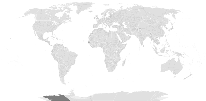
Blank political map of the world c.1985.

This is also officially accurate for the period between 1977 (South Africa imposes direct rule on Walvis Bay) - May 22 1990 (Unification of North and South Yemen). Unofficial border changes occurred between 1977 and 1990 which include in 1979 the US de facto hand over of the Panama Canal Zone to Panama (made official in December 1999) and in December 26, 1981 when the Iraq-Saudi Arabia Neutral Zone was partitioned between Iraq and Saudi Arabia but was only officially accepted in 1991.

Blank maps of the world for historical use
pre-1800

1 · 820 · 1500 · 1710


19th century

1840 · 1861 · 1866 · 1872 · 1898


20th century

1902 · 1912 · 1914 · WWI · Aug 1918 · 1920 · 1921 · 1924 · 1926 · 1935 · 1937 · Mar 1938 · Oct 1938 · Mar 1939 · Oct 1939 · WWII · Nov 1942 · May 1945 · 1957 · 1959 · 1962 · 1968 · 1970 · 1985 · 1990 · 1993


21st century

2000 · 2005 · 2007 · 2009 · Current

(this template: · view · discuss )
ڕێکەوت originally created پێش ١٣ی ئایاری ٢٠٠٥
date QS:P,+2005-05-13T00:00:00Z/7,P1326,+2005-05-13T00:00:00Z/11
سەرچاوە from wikipedia
بەرھەمھێنەر several/unknown authors from Wikipedia/Commons; see Original upload log and file upload log below for the latest
وەشانەکانی تر

Derivative works of this file:

مۆڵەتنامە

w:en:Creative Commons
دانەپاڵ بڵاوکردنەوەی گونجاو
ئەم پەڕگەیە لە ژێر مۆڵەتنامەی

Creative Commons Attribution-Share Alike 3.0 Unported دایە. Subject to disclaimers.

تۆ ئازادی:
  • بۆ بڵاکردنەوە – بۆ کۆپی کردن، دابەشکردن و دەستبەدەست ناردنی
  • بۆ تێکەڵکردنەوە – بۆ سازاندنی کارەکە
بەم مەرجانەی خوارەوە:
  • دانەپاڵ – پێویستە باوەڕی گونجاو بدەیت، بەستەرێک بۆ مۆڵەتەکە دابین بکەیت و ئاماژە بەوە بکەیت کە ئایا گۆڕانکاری کراوە یان نا. دەتوانیت بە هەر شێوەیەکی گونجاو ئەوە بکەیت، بەڵام بە شێوەیەک نا کە وا دەربکەوێت کە مۆڵەتدەر پشتگیری تۆ یان بەکارهێنانەکەت بکات.
  • بڵاوکردنەوەی گونجاو – ئەگەر لەسەر بنەمای ئەم کارە تێکەڵ، گۆڕان، یان ساز بکەی، پێویستە بەشدارییەکانت بە هەمان مۆڵەت یان هاوشێوەی مۆڵەتی ئەسڵی دابەش بکەی.
This licensing tag was added to this file as part of the GFDL licensing update.
GNU head ڕێگەدراوە بە لەبەرگرتنەوە، دابەشکردن ھەروەھا/یان سازاندنی ئەم بەڵگەنامەیە لەژێر مەرجی مۆڵەتی GNU بۆ بەڵگەنامەی ئازاد، وەشانی ١.٢ یان ھەر وەشانێکی تری دواتر کە بڵاوکراوەتەوە لەلایەن دامەزراوەی بەرنامەی ئازاد، بەبێ ھیچ بەشێکی جیاواز، بەبێ نووسین لەسەر بەرگی پێشەوە و دواوەی. وێنەیەک لەمۆڵەتەکە لە بەشێکدا ھەیە کە ناوی مۆڵەتی GNU بۆ بەڵگەنامەی ئازادە. Subject to disclaimers.

Original upload log

From enwp File:BlankMap-World-1985.png:

  • 2006-07-01T03:50:46 Hoshie (talk | contribs) uploaded "File:BlankMap-World-1985.png" (Added Walvis Bay and the Trust Territory of the Pacific Islands. See talk.)
  • 2006-03-28T03:55:33 E Pluribus Anthony (talk | contribs) uploaded "File:BlankMap-World-1985.png" (World map: blank, with borders (1985))
  • 2006-03-26T17:41:59 E Pluribus Anthony (talk | contribs) uploaded "File:BlankMap-World-1985.png" (World map: blank, with borders (1985))
  • 2006-01-04T09:34:07 E Pluribus Anthony (talk | contribs) uploaded "File:BlankMap-World-1985.png" (World map: blank, with borders (1985))
  • 2005-09-19T13:49:05 E Pluribus Anthony (talk | contribs) uploaded "File:BlankMap-World-1985.png" (World map: blank, with borders (1985))
  • 2005-09-19T08:06:52 E Pluribus Anthony (talk | contribs) uploaded "File:BlankMap-World-1985.png" (World map: blank, with borders (1985))
  • 2005-09-19T02:56:16 E Pluribus Anthony (talk | contribs) uploaded "File:BlankMap-World-1985.png" (World map: blank, with borders (1985))
  • 2005-09-19T01:09:58 E Pluribus Anthony (talk | contribs) uploaded "File:BlankMap-World-1985.png" (World map: blank, with borders (1985))
  • 2005-05-12T23:25:33 Stern (talk | contribs) uploaded "File:BlankMap-World-1985.png" (minor changes (Denmark, Berlin, Caribbean))
  • other uploads which were not logged

لێدوانەکان

Add a one-line explanation of what this file represents

بەندەکانی لەم پەڕگەیەدا دەردەکەون

depicts ئینگلیزی

media type ئینگلیزی

image/png

checksum ئینگلیزی

d6bb7eef1d4554d5327a28d84023923685565f0d

determination method ئینگلیزی: SHA-1 ئینگلیزی

data size ئینگلیزی

٩٢٬٣٠٤ بایت

٧٤٠ پیکسڵ

width ئینگلیزی

١٬٥٠٠ پیکسڵ

مێژووی پەڕگە

کرتە بکە لەسەر یەکێک لە ڕێکەوت/کاتەکان بۆ بینینی پەڕگەکە بەو شێوەی لەو کاتەدا بووە.

(نوێترین | کۆنترین) (١٠ی نوێتر | ) (١٠ | ٢٠ | ٥٠ | ١٠٠ | ٢٥٠ | ٥٠٠) ببینە
ڕێکەوت/کاتھێمائەندازەبەکارھێنەرتێبینی
هەنووکە‏١٤:٥٦، ١٠ی کانوونی یەکەمی ٢٠١٩ھێما بۆ وەشانی  ‏١٤:٥٦، ١٠ی کانوونی یەکەمی ٢٠١٩١٬٥٠٠ لە ٧٤٠ (٩٠ کیلۆبایت)AKS471883Senegambia
‏١١:٠٤، ١٠ی تشرینی یەکەمی ٢٠١٧ھێما بۆ وەشانی  ‏١١:٠٤، ١٠ی تشرینی یەکەمی ٢٠١٧١٬٥٠٠ لە ٧٤٠ (١٠٤ کیلۆبایت)Expertseeker90Major edits and overhall! Continents, coastlines, lakes, rivers, islands, atolls and reefs added or fixed. National and internal boundaries re positioned and adjusted.
‏٢٣:١٣، ٧ی کانوونی دووەمی ٢٠١٣ھێما بۆ وەشانی  ‏٢٣:١٣، ٧ی کانوونی دووەمی ٢٠١٣١٬٤٢٥ لە ٦٢٥ (٤٩ کیلۆبایت)CriostóirThese are the internationally recognised borders of Morocco (and as recognised by the UN)
‏٢٠:٤٠، ٢٨ی تشرینی یەکەمی ٢٠١٢ھێما بۆ وەشانی  ‏٢٠:٤٠، ٢٨ی تشرینی یەکەمی ٢٠١٢١٬٤٢٥ لە ٦٢٥ (٢٨ کیلۆبایت)ApolikamixitosFixing Morocco borders.
‏١٣:٠٨، ١٣ی حوزەیرانی ٢٠٠٩ھێما بۆ وەشانی  ‏١٣:٠٨، ١٣ی حوزەیرانی ٢٠٠٩١٬٤٢٥ لە ٦٢٥ (٤٩ کیلۆبایت)HoshieAdded a pixel around Timor island, fixed Cabinda (Angola), fixed the border of the Yemens and Saudi Arabia to where it was before the 2000 treaty based on this 1976 map [http://www.lib.utexas.edu/maps/middle_east_and_asia/middle_east_pol_1976.jpg http://w
‏٠١:٢١، ٤ی تشرینی یەکەمی ٢٠٠٧ھێما بۆ وەشانی  ‏٠١:٢١، ٤ی تشرینی یەکەمی ٢٠٠٧١٬٤٢٥ لە ٦٢٥ (٣٠ کیلۆبایت)R-41~commonswikiRedone version
‏٠٢:٥٢، ٢٤ی ئەیلوولی ٢٠٠٧ھێما بۆ وەشانی  ‏٠٢:٥٢، ٢٤ی ئەیلوولی ٢٠٠٧١٬٣٥٧ لە ٦٢٨ (٤٥ کیلۆبایت)Hoshieput the (N/S) Yemen boundary in white due to the fact the boundaries in southern Saudi Arabia have been disputed, undemarcated, or undisclosed over the years.
‏٠٠:٤٧، ٦ی ئابی ٢٠٠٧ھێما بۆ وەشانی  ‏٠٠:٤٧، ٦ی ئابی ٢٠٠٧١٬٣٥٧ لە ٦٢٨ (٤٥ کیلۆبایت)Hoshieadded Cabinda, under same license as original.
‏١٠:٥٣، ٢٤ی کانوونی دووەمی ٢٠٠٧ھێما بۆ وەشانی  ‏١٠:٥٣، ٢٤ی کانوونی دووەمی ٢٠٠٧١٬٣٥٧ لە ٦٢٨ (٤٥ کیلۆبایت)HoshieThe Yemen boundry with Saudi Arabia did not exist until 2000.
‏٠٤:٠٧، ١٢ی ئابی ٢٠٠٦ھێما بۆ وەشانی  ‏٠٤:٠٧، ١٢ی ئابی ٢٠٠٦١٬٣٥٧ لە ٦٢٨ (٤٥ کیلۆبایت)HoshieI have removed the outline of the Trust Territory of the Pacific Islands and moved Walvis Bay down the coast of Namibia.
(نوێترین | کۆنترین) (١٠ی نوێتر | ) (١٠ | ٢٠ | ٥٠ | ١٠٠ | ٢٥٠ | ٥٠٠) ببینە

ھیچ پەڕەیەک نییە کە ئەم پەڕگەیە بەکاربھێنێت.

بەکارھێنانی سەرانسەریی پەڕگە

دراوی مێتا