
پەڕگە:United Kingdom NUTS location map.svg

Size of this PNG preview of this SVG file: ٣٨٨ لە ٦٠٠ پیکسەڵ. ڕێزەلووشنەکانی تر: ١٥٥ لە ٢٤٠ پیکسەڵ | ٣١٠ لە ٤٨٠ پیکسەڵ | ٤٩٧ لە ٧٦٨ پیکسەڵ | ٦٦٣ لە ١٬٠٢٤ پیکسەڵ | ١٬٣٢٥ لە ٢٬٠٤٨ پیکسەڵ | ٨٨٦ لە ١٬٣٦٩ پیکسەڵ.
پەڕگەی سەرەکی (پەڕگەی SVG، بە ناو ٨٨٦ × ١٬٣٦٩ پیکسەڵ، قەبارەی پەڕگە: ٨٧٣ کیلۆبایت)
| وەسف |
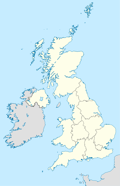
Deutsch: Positionskarte des Vereinigten Königreichs mit NUTS-1-Gebieten
Quadratische Plattkarte, N-S-Streckung 170 %. Geographische Begrenzung der Karte:
English: Location map of the United Kingdom with NUTS 1 areas
Equirectangular projection, N/S stretching 170 %. Geographic limits of the map:
|
| ڕێکەوت | (UTC) |
| سەرچاوە | |
| بەرھەمھێنەر |
|
| وەشانەکانی تر |
|


ئەم پەڕگەیە لە ژێر مۆڵەتنامەی
Creative Commons Attribution-Share Alike 3.0 Unported دایە.
- تۆ ئازادی:
- بۆ بڵاکردنەوە – بۆ کۆپی کردن، دابەشکردن و دەستبەدەست ناردنی
- بۆ تێکەڵکردنەوە – بۆ سازاندنی کارەکە
- بەم مەرجانەی خوارەوە:
- دانەپاڵ – پێویستە باوەڕی گونجاو بدەیت، بەستەرێک بۆ مۆڵەتەکە دابین بکەیت و ئاماژە بەوە بکەیت کە ئایا گۆڕانکاری کراوە یان نا. دەتوانیت بە هەر شێوەیەکی گونجاو ئەوە بکەیت، بەڵام بە شێوەیەک نا کە وا دەربکەوێت کە مۆڵەتدەر پشتگیری تۆ یان بەکارهێنانەکەت بکات.
- بڵاوکردنەوەی گونجاو – ئەگەر لەسەر بنەمای ئەم کارە تێکەڵ، گۆڕان، یان ساز بکەی، پێویستە بەشدارییەکانت بە هەمان مۆڵەت یان هاوشێوەی مۆڵەتی ئەسڵی دابەش بکەی.
Original upload log
This image is a derivative work of the following images:
- File:United_Kingdom_location_map.svg licensed with Cc-by-sa-3.0, GFDL
- 2011-01-11T22:14:29Z NordNordWest 886x1369 (660787 Bytes) upd
- 2008-07-19T21:44:02Z NordNordWest 886x1369 (1484834 Bytes) '
- 2008-07-07T14:29:12Z NordNordWest 886x1369 (1484834 Bytes) '
- 2008-07-01T16:17:52Z NordNordWest 886x1369 (1547699 Bytes) '
- 2008-07-01T16:05:12Z NordNordWest 886x1369 (1546376 Bytes) {{Information |Description= {{de|Positionskarte des [[:de:Vereinigtes Königreich|Vereinigten Königreichs]]}} Quadratische Plattkarte, N-S-Streckung 170 %. Geographische Begrenzung der Karte: * N: 61.0° N * S: 49.0° N * W:
- File:England_location_map.svg licensed with Cc-by-sa-3.0
- 2010-03-12T22:58:19Z Spischot 816x991 (468569 Bytes) {{Information |Description= {{de|Positionskarte von [[:de:England|]]}} Quadratische Plattkarte, N-S-Streckung 170 %. Geographische Begrenzung der Karte: * N: 56.0° N * S: 49.75° N * W: 6.75° W * O: 2.0° O {{en|Location
Uploaded with derivativeFX
مێژووی پەڕگە
کرتە بکە لەسەر یەکێک لە ڕێکەوت/کاتەکان بۆ بینینی پەڕگەکە بەو شێوەی لەو کاتەدا بووە.
| ڕێکەوت/کات | ھێما | ئەندازە | بەکارھێنەر | تێبینی | |
|---|---|---|---|---|---|
| هەنووکە | ١٤:١٢، ٢٢ی کانوونی دووەمی ٢٠١١ | | ٨٨٦ لە ١٬٣٦٩ (٨٧٣ کیلۆبایت) | NordNordWest | {{Information |Description={{de|Positionskarte des Vereinigten Königreichs mit NUTS-1-Gebieten}} Quadratische Plattkarte, N-S-Streckung 170 %. Geographische Begrenzung der Karte: * N: 61.0° N * S: 49.0° N * W: 11.0° |
بەکارھێنانی پەڕگە
ئەم پەڕەیە ئەم پەڕگەیە بەکار دەھێنێت:
بەکارھێنانی سەرانسەریی پەڕگە
ئەم ویکیانەی دیکەی خوارەوەش ئەم پەڕگە بەکاردێنن:
- بەکارھێنان لە als.wikipedia.org
- بەکارھێنان لە ast.wikipedia.org
- بەکارھێنان لە ce.wikipedia.org
- بەکارھێنان لە de.wikipedia.org
- بەکارھێنان لە diq.wikipedia.org
- بەکارھێنان لە en.wikipedia.org
- بەکارھێنان لە es.wikipedia.org
- بەکارھێنان لە frr.wikipedia.org
- بەکارھێنان لە hy.wikipedia.org
- بەکارھێنان لە io.wikipedia.org
- بەکارھێنان لە kaa.wikipedia.org
- بەکارھێنان لە ka.wikipedia.org
- بەکارھێنان لە kbd.wikipedia.org
- بەکارھێنان لە ky.wikipedia.org
- بەکارھێنان لە lez.wikipedia.org
- بەکارھێنان لە mn.wikipedia.org
- بەکارھێنان لە myv.wikipedia.org
- بەکارھێنان لە nap.wikipedia.org
- بەکارھێنان لە ne.wikipedia.org
بینینی بەکارھێنانی گشتی زیاتری ئەم پەڕگەیە.