
پەڕگە:Sweden location map.svg

Size of this PNG preview of this SVG file: ٣١١ لە ٥٩٩ پیکسەڵ. ڕێزەلووشنەکانی تر: ١٢٤ لە ٢٤٠ پیکسەڵ | ٢٤٩ لە ٤٨٠ پیکسەڵ | ٣٩٩ لە ٧٦٨ پیکسەڵ | ٥٣٢ لە ١٬٠٢٤ پیکسەڵ | ١٬٠٦٤ لە ٢٬٠٤٨ پیکسەڵ | ٩٥٤ لە ١٬٨٣٦ پیکسەڵ.
پەڕگەی سەرەکی (پەڕگەی SVG، بە ناو ٩٥٤ × ١٬٨٣٦ پیکسەڵ، قەبارەی پەڕگە: ٢٫٠٣ مێگابایت)
کورتە
| وەسف |
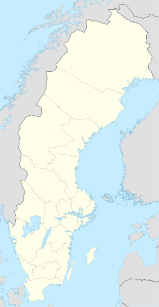
Deutsch: Positionskarte von Schweden
Quadratische Plattkarte, N-S-Streckung 214,7895 %. Geographische Begrenzung der Karte:
English: Location map of Sweden
Equirectangular projection, N/S stretching 214,7895 %. Geographic limits of the map:
|
||
| ڕێکەوت | |||
| سەرچاوە | own work, using United States National Imagery and Mapping Agency data | ||
| بەرھەمھێنەر | NordNordWest | ||
| وەشانەکانی تر |
Derivative works of this file:
|
||
| SVG genesis |
|


مۆڵەتنامە
من، ھەڵگری مافی لەبەرگرتنەوەی ئەم بەرھەمە، لەژێر ئەم مۆڵەتنامەیانەدا بڵاوی دەکەمەوە:

|
ڕێگەدراوە بە لەبەرگرتنەوە، دابەشکردن ھەروەھا/یان سازاندنی ئەم بەڵگەنامەیە لەژێر مەرجی مۆڵەتی GNU بۆ بەڵگەنامەی ئازاد، وەشانی ١.٢ یان ھەر وەشانێکی تری دواتر کە بڵاوکراوەتەوە لەلایەن دامەزراوەی بەرنامەی ئازاد، بەبێ ھیچ بەشێکی جیاواز، بەبێ نووسین لەسەر بەرگی پێشەوە و دواوەی. وێنەیەک لەمۆڵەتەکە لە بەشێکدا ھەیە کە ناوی مۆڵەتی GNU بۆ بەڵگەنامەی ئازادە. |
ئەم پەڕگەیە لە ژێر مۆڵەتنامەی
Creative Commons Attribution-Share Alike 3.0 Unported دایە.
- تۆ ئازادی:
- بۆ بڵاکردنەوە – بۆ کۆپی کردن، دابەشکردن و دەستبەدەست ناردنی
- بۆ تێکەڵکردنەوە – بۆ سازاندنی کارەکە
- بەم مەرجانەی خوارەوە:
- دانەپاڵ – پێویستە باوەڕی گونجاو بدەیت، بەستەرێک بۆ مۆڵەتەکە دابین بکەیت و ئاماژە بەوە بکەیت کە ئایا گۆڕانکاری کراوە یان نا. دەتوانیت بە هەر شێوەیەکی گونجاو ئەوە بکەیت، بەڵام بە شێوەیەک نا کە وا دەربکەوێت کە مۆڵەتدەر پشتگیری تۆ یان بەکارهێنانەکەت بکات.
- بڵاوکردنەوەی گونجاو – ئەگەر لەسەر بنەمای ئەم کارە تێکەڵ، گۆڕان، یان ساز بکەی، پێویستە بەشدارییەکانت بە هەمان مۆڵەت یان هاوشێوەی مۆڵەتی ئەسڵی دابەش بکەی.
دەتوانی مۆڵەتنامەی دڵخوازت ھەڵبژێریت.
مێژووی پەڕگە
کرتە بکە لەسەر یەکێک لە ڕێکەوت/کاتەکان بۆ بینینی پەڕگەکە بەو شێوەی لەو کاتەدا بووە.
| ڕێکەوت/کات | ھێما | ئەندازە | بەکارھێنەر | تێبینی | |
|---|---|---|---|---|---|
| هەنووکە | ٢٣:٢٦، ٢٠ی ئازاری ٢٠٢٣ | | ٩٥٤ لە ١٬٨٣٦ (٢٫٠٣ مێگابایت) | HCa | Reverted to version as of 18:28, 15 July 2008 (UTC) |
| ٠٦:٤٥، ١ی تشرینی دووەمی ٢٠١٥ |  | ٨٤٢ لە ١٬٨٣٧ (١٫٠١ مێگابایت) | Larske | Correction of border between Västra Götalands län and Jönköpings län. Habo municipality and Mullsjö municipality belong to Jönköpings län. | |
| ١٧:١١، ٤ی ئابی ٢٠١١ |  | ٨٤٢ لە ١٬٨٣٧ (٩٨١ کیلۆبایت) | NordNordWest | upd | |
| ٠٩:٢٤، ٢٧ی کانوونی دووەمی ٢٠٠٩ |  | ٩٥٤ لە ١٬٨٣٧ (٢٫٧٤ مێگابایت) | Erik Frohne | Added missing border Scania-Blekinge Category:Location maps of Sweden | |
| ٠٨:٢٢، ٢٩ی ئابی ٢٠٠٨ |  | ٩٥٤ لە ١٬٨٣٧ (٢٫٧٤ مێگابایت) | NordNordWest | ||
| ٠٨:١٨، ٢٩ی ئابی ٢٠٠٨ |  | ٩٥٤ لە ١٬٨٣٧ (١٫٤٦ مێگابایت) | NordNordWest | ||
| ١١:٣٢، ٣٠ی تەممووزی ٢٠٠٨ |  | ٩٥٤ لە ١٬٨٣٦ (١٫٤٦ مێگابایت) | NordNordWest | optimized | |
| ١٨:٢٨، ١٥ی تەممووزی ٢٠٠٨ |  | ٩٥٤ لە ١٬٨٣٦ (٢٫٠٣ مێگابایت) | NordNordWest | {{Information |Description= {{de|Positionskarte von Schweden}} Quadratische Plattkarte, N-S-Streckung 190 %. Geographische Begrenzung der Karte: * N: 69.5° N * S: 55.1° N * W: 10.4° O * O: 24.6° O {{en|Location map of [[:en:Sweden|Swe |
بەکارھێنانی پەڕگە
ئەم پەڕەیە ئەم پەڕگەیە بەکار دەھێنێت:
بەکارھێنانی سەرانسەریی پەڕگە
ئەم ویکیانەی دیکەی خوارەوەش ئەم پەڕگە بەکاردێنن:
- بەکارھێنان لە af.wikipedia.org
- بەکارھێنان لە als.wikipedia.org
- بەکارھێنان لە am.wikipedia.org
- بەکارھێنان لە an.wikipedia.org
- بەکارھێنان لە ar.wikipedia.org
- بەکارھێنان لە arz.wikipedia.org
- بەکارھێنان لە ast.wikipedia.org
بینینی بەکارھێنانی گشتی زیاتری ئەم پەڕگەیە.