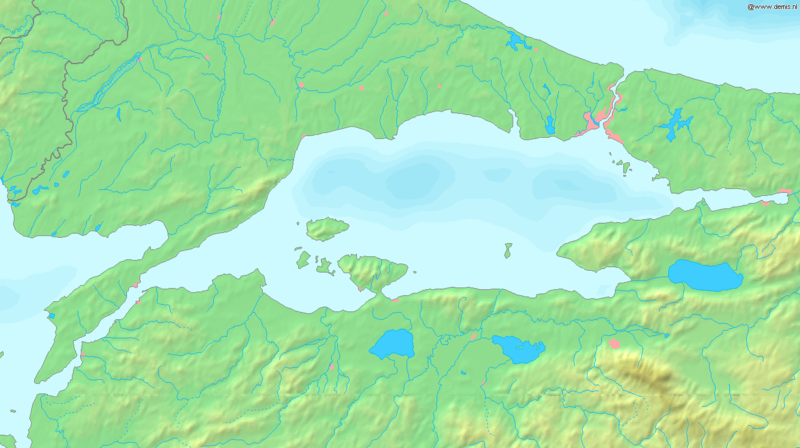
پەڕگە:Sea of Marmara map.png

قەبارەی ئەم پێشبینینە: ٨٠٠ لە ٤٤٨ پیکسەڵ. ڕێزەلووشنەکانی تر: ٣٢٠ لە ١٧٩ پیکسەڵ | ٦٤٠ لە ٣٥٨ پیکسەڵ | ١٬٣٣٦ لە ٧٤٨ پیکسەڵ.
پەڕگەی سەرەکی (١٬٣٣٦ × ٧٤٨ پیکسڵ، قەبارەی پەڕگە: ٣٣٤ کیلۆبایت، جۆری ئێم ئای ئێم ئی: image/png)
مێژووی پەڕگە
کرتە بکە لەسەر یەکێک لە ڕێکەوت/کاتەکان بۆ بینینی پەڕگەکە بەو شێوەی لەو کاتەدا بووە.
| ڕێکەوت/کات | ھێما | ئەندازە | بەکارھێنەر | تێبینی | |
|---|---|---|---|---|---|
| هەنووکە | ١٧:٣٧، ٦ی ئەیلوولی ٢٠٠٥ |  | ١٬٣٣٦ لە ٧٤٨ (٣٣٤ کیلۆبایت) | Mats Halldin~commonswiki | Map of the Sea of Marmara Bounding box West 26°, South 39.8°, East 30°, North 41.5°. {{demis-pd}} Category:Maps of Turkey |
بەکارھێنانی پەڕگە
ئەم پەڕەیە ئەم پەڕگەیە بەکار دەھێنێت:
بەکارھێنانی سەرانسەریی پەڕگە
ئەم ویکیانەی دیکەی خوارەوەش ئەم پەڕگە بەکاردێنن:
- بەکارھێنان لە af.wikipedia.org
- بەکارھێنان لە am.wikipedia.org
- بەکارھێنان لە ang.wikipedia.org
- بەکارھێنان لە ar.wikipedia.org
- بەکارھێنان لە azb.wikipedia.org
- بەکارھێنان لە az.wikipedia.org
- بەکارھێنان لە ba.wikipedia.org
- بەکارھێنان لە br.wikipedia.org
- بەکارھێنان لە bs.wikipedia.org
- بەکارھێنان لە ca.wikipedia.org
- بەکارھێنان لە ce.wikipedia.org
- بەکارھێنان لە cs.wikipedia.org
- بەکارھێنان لە cv.wikipedia.org
- بەکارھێنان لە cy.wikipedia.org
- بەکارھێنان لە da.wikipedia.org
- بەکارھێنان لە de.wikipedia.org
- بەکارھێنان لە diq.wikipedia.org
- بەکارھێنان لە dsb.wikipedia.org
- بەکارھێنان لە el.wikipedia.org
- بەکارھێنان لە el.wiktionary.org
- بەکارھێنان لە en.wikipedia.org
- بەکارھێنان لە en.wiktionary.org
- بەکارھێنان لە eo.wikipedia.org
- بەکارھێنان لە es.wikipedia.org
- بەکارھێنان لە et.wikipedia.org
- بەکارھێنان لە fa.wikipedia.org
- بەکارھێنان لە fi.wikipedia.org
- بەکارھێنان لە fr.wikipedia.org
بینینی بەکارھێنانی گشتی زیاتری ئەم پەڕگەیە.
