
پەڕگە:Continental-Europe-map.png
رەزۆلوشنی سەرتر لەمە لە بەردەست دا نیە.
Continental-Europe-map.png (٤١٥ × ٤٢٢ پیکسڵ، قەبارەی پەڕگە: ١٢ کیلۆبایت، جۆری ئێم ئای ئێم ئی: image/png)
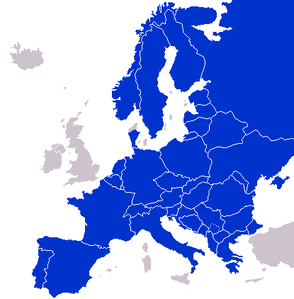
A map of Continental Europe.
| من، هەڵگری مافی لەبەرگرتنەوەی ئەم بەرھەمە، ئەم بەرھەمە بڵاودەکەمەوە بۆ پاوانی گشتی (public domain). ئەم مافە بۆ سەرانسەری جیھانە. لە ھەندێ وڵاتدا لەوانەیە یاسا، ڕێگە بەمە نەدات؛ لەو کاتەدا: من مافی بەکارھێنانی ئەم بەرھەمە بۆ ھەر مەبەستێک دەبەخشم بە ھەموو کەسێک، بێ ھیچ مەرجێک، مەگەر ئەو چەشنە مەرجانە کە یاسا ھەبوونیانی بە پێویستی بزانێت. |
derivative works
Derivative works of this file: Kontinentet.png

|
This locator map image could be re-created using vector graphics as an SVG file. This has several advantages; see Commons:Media for cleanup for more information. If an SVG form of this image is available, please upload it and afterwards replace this template with
{{vector version available|new image name}}.
It is recommended to name the SVG file “Continental-Europe-map.svg”—then the template Vector version available (or Vva) does not need the new image name parameter. |
مێژووی پەڕگە
کرتە بکە لەسەر یەکێک لە ڕێکەوت/کاتەکان بۆ بینینی پەڕگەکە بەو شێوەی لەو کاتەدا بووە.
| ڕێکەوت/کات | ھێما | ئەندازە | بەکارھێنەر | تێبینی | |
|---|---|---|---|---|---|
| هەنووکە | ٠١:٤٧، ٨ی ئەیلوولی ٢٠٢٣ | | ٤١٥ لە ٤٢٢ (١٢ کیلۆبایت) | Sariyr | Exit Vendsyssel-Thy (Denmark) |
| ٠٨:٠٦، ١٨ی تەممووزی ٢٠٠٩ |  | ٤١٥ لە ٤٢٢ (١٤ کیلۆبایت) | Hoshie | redid Kosovo/Montenegro borders based on Cradel's older map; anti-alasing has been removed. | |
| ١٠:١٨، ٢٧ی ئەیلوولی ٢٠٠٨ |  | ٤١٥ لە ٤٢٢ (١٤ کیلۆبایت) | Hoshie | readded Kosovo in a different way. See talk. | |
| ٠٣:١٨، ٢٥ی ئەیلوولی ٢٠٠٨ |  | ٤١٥ لە ٤٢٢ (١٤ کیلۆبایت) | Hoshie | added Montenegro and fix the tripoint between Albania, Serbia/Kosovo and Montenegro | |
| ١٥:٤٠، ١٦ی ئەیلوولی ٢٠٠٨ |  | ٤١٥ لە ٤٢٢ (١٠ کیلۆبایت) | Tocino | Reverted to version as of 00:00, 16 September 2008 | |
| ١٠:٠٦، ١٦ی ئەیلوولی ٢٠٠٨ |  | ٤١٥ لە ٤٢٢ (١٠ کیلۆبایت) | Cradel | Reverted to version as of 20:45, 15 September 2008 | |
| ٠٠:٠٠، ١٦ی ئەیلوولی ٢٠٠٨ |  | ٤١٥ لە ٤٢٢ (١٠ کیلۆبایت) | Tocino | Reverted to version as of 17:25, 15 September 2008 | |
| ٢٠:٤٥، ١٥ی ئەیلوولی ٢٠٠٨ |  | ٤١٥ لە ٤٢٢ (١٠ کیلۆبایت) | Cradel | Reverted to version as of 11:56, 14 September 2008 | |
| ١٧:٢٥، ١٥ی ئەیلوولی ٢٠٠٨ |  | ٤١٥ لە ٤٢٢ (١٠ کیلۆبایت) | Tocino | Reverted to version as of 14:24, 12 January 2008 | |
| ١١:٥٦، ١٤ی ئەیلوولی ٢٠٠٨ |  | ٤١٥ لە ٤٢٢ (١٠ کیلۆبایت) | Cradel | fix |
بەکارھێنانی پەڕگە
ئەم پەڕەیە ئەم پەڕگەیە بەکار دەھێنێت:
بەکارھێنانی سەرانسەریی پەڕگە
ئەم ویکیانەی دیکەی خوارەوەش ئەم پەڕگە بەکاردێنن:
- بەکارھێنان لە ar.wikipedia.org
- بەکارھێنان لە az.wikipedia.org
- بەکارھێنان لە bs.wikipedia.org
- بەکارھێنان لە ca.wikipedia.org
- بەکارھێنان لە da.wikipedia.org
- بەکارھێنان لە de.wikipedia.org
- بەکارھێنان لە en.wikipedia.org
- بەکارھێنان لە eo.wikipedia.org
- بەکارھێنان لە es.wikipedia.org
- بەکارھێنان لە eu.wikipedia.org
- بەکارھێنان لە fa.wikipedia.org
- بەکارھێنان لە fi.wikipedia.org
- بەکارھێنان لە fo.wikipedia.org
- بەکارھێنان لە gl.wikipedia.org
- بەکارھێنان لە hy.wikipedia.org
- بەکارھێنان لە id.wikipedia.org
- بەکارھێنان لە is.wikipedia.org
- بەکارھێنان لە it.wikipedia.org
- بەکارھێنان لە ja.wikipedia.org
- بەکارھێنان لە kk.wikipedia.org
- بەکارھێنان لە ko.wikipedia.org
- بەکارھێنان لە nl.wikipedia.org
- بەکارھێنان لە nn.wikipedia.org
- بەکارھێنان لە pl.wikipedia.org
- بەکارھێنان لە pt.wikipedia.org
- بەکارھێنان لە ro.wikipedia.org
- بەکارھێنان لە ru.wikipedia.org
- بەکارھێنان لە sco.wikipedia.org
- بەکارھێنان لە sv.wikipedia.org
- بەکارھێنان لە th.wikipedia.org
- بەکارھێنان لە tr.wikipedia.org
- بەکارھێنان لە uk.wikipedia.org
- بەکارھێنان لە www.wikidata.org